The Ascent

No matter how early one goes to bed, one can never get enough sleep in Laban Rata

(
elevation : 3272 m). 'Supper', which is a simple and light meal of bread, rice or noodles, is served at 02:00, and the hike to the summit starts in darkness not too long after. I joined a long procession of hikers that were armed with headlamps and bundled in jackets, that made their way up the trail, all of them eager to make the 1.5 kilometres to 'Sayat Sayat Hut'
(
elevation : 3668 m) before the 05:00 cut-off time.
The trail was relatively narrow, with scarcely two being able to hike abreast. The slow trudging of the sleepy hikers caused bottlenecks to form, and all we could do was to watch our footing in the narrow cone that was created by the light from our headlamps, and to just shuffle on and fill each space that opened up right in front of us.
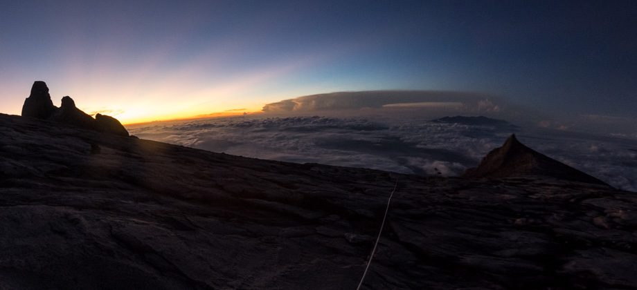
The foliage eventually gave way to barren rocks, and as I looked back, the long train of hikers and the light from their headlamps brought back memories of the
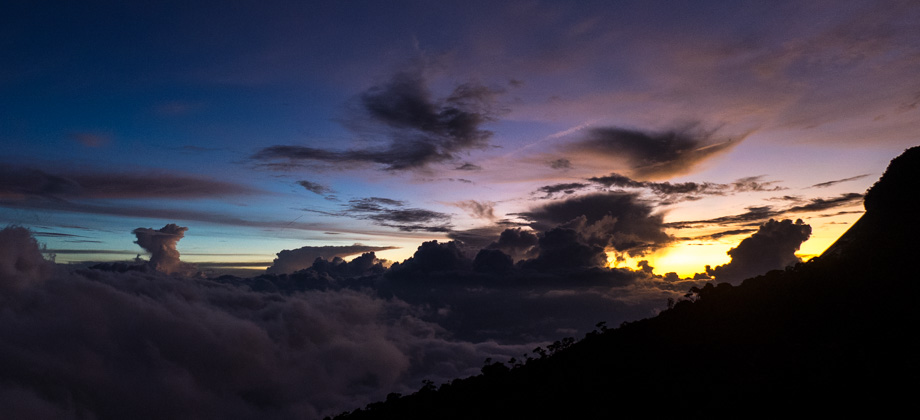
Poon Hill hike that I had done earlier in the year. The stars were out and would have been brilliant if not for the blazing light from the full moon above us. The constellation Orion was almost at the zenith and the three stars that made up the Winter Triangle lay right next to it. One of those stars, the red supergiant Betelgeuse, is the ninth-brightest star in the sky, but would be the brightest if only we could perceive all the wavelengths of radiation. Lightning flashed in the distance over the town of Kundasang behind us, and those who noticed began to hope that the skies would remain clear... at least until sunrise.
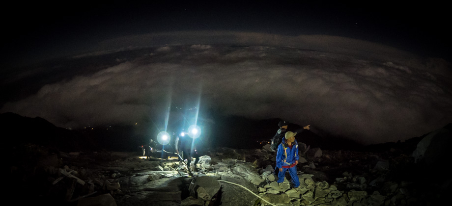
 Summit push n the darkness
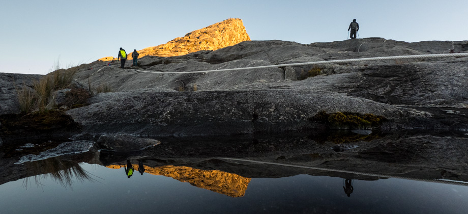
A thick white rope that was laid out on the rocky slopes eventually took the place of the stairwell. It disappeared into the inky darkness, yet we continued to follow it, with some hikers occasionally holding on to it for some extra support. The rope was also tied to strung-out anchor points which greatly assisted our ascent on the sections of the rock that were near vertical. The sea of clouds behind us could be seen due to the ambient light from the full moon, and the fact that we were relentlessly ascending gave me the impression that the clouds were 'settling' onto the ground beneath them.
Approximately 750 metres along, the trail veered to the left and we began to head west towards the dim lights of 'Sayat Sayat Hut'
(
elevation : 3668 m) in the distance. The moon now lay right in front of us and it slowly crept towards the horizon as we made our way forward, and in my sleepy stupor, I began to entertain impossible notions of trying to 'beat it' to the summit.
The Sunrise
Despite the slow pace of the hiker train, we reached the Sayat Sayat checkpoint
(
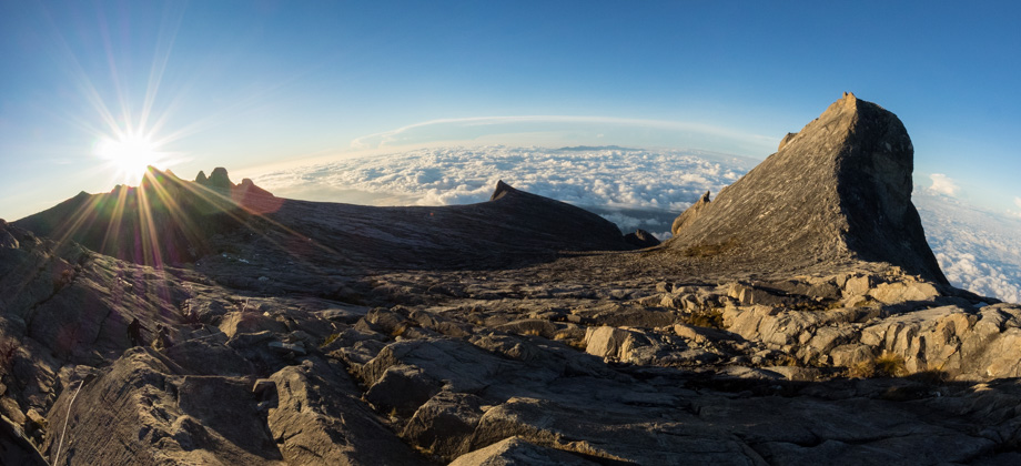
elevation : 3668 m) after an hour and a half of walking, which was well before the 05:00 cut-off. Our permits were checked once again here, and our names were ticked off from the list. The expansive granite plateau lay right in front of us, which would take an hour or two to cross depending on one's pace. After a while, the sky began to lighten and the inky darkness began to melt away, and the sharp shape of South Peak (
elevation : 3921 m), which was the same iconic peak that can be seen on the back of
MYR1 & MYR100 notes, could be seen piercing the sky to our left; and the stubby towers of Donkey Ear's Peak (
elevation : 4048 m) could be seen on our right.
The trail began to veer right to head northwards instead, and as it did the pyramid-shape of Low's Peak
(
elevation : 4095 m) made its appearance in the distance ahead of us. There was no rush whatsoever to reach the summit, and since the weather was absolutely perfect and it was not too cold, we took our sweet time to appreciate the breath-taking yet eerie moonscape that surrounded us. As the sun rose and its light fell upon the mountain, the bleak grey of the rocky tips of the peaks morphed into a golden yellow, and transformed them right in front of our very eyes.
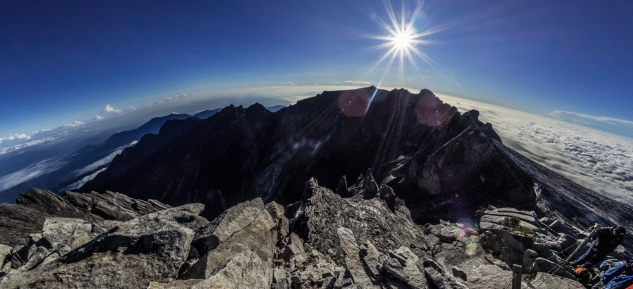
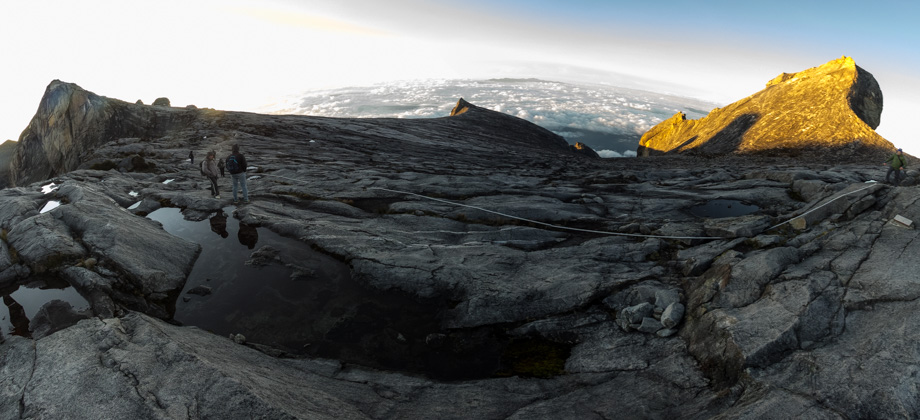
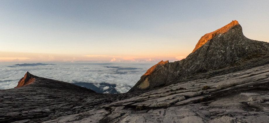
 The early morning sun lighting up South Peak (elevation : 3921 m) on the left and St. John's Peak (elevation : 4091 m) on the right
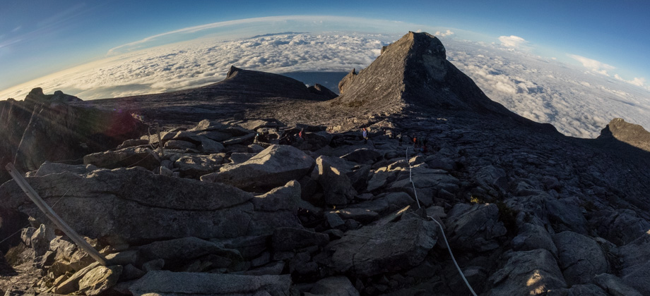
 St. John's Peak (elevation : 4091 m) on the left and Low's Peak (elevation : 4095 m) on the right