


March 6, 2020
Posted by Ramon Fadli in Diving, Glaciers, Iceland, IUCN Protected Category 2, National Parks, Southern Region, Taiga & Boreal Forests, Tundra, UNESCO
Silfra Fissure
The Fissure
Silfra Fissure was formed within the divergent tectonic boundary between the North American and Eurasian plates. This 'fissure zone' runs across the middle of Iceland and makes up a small portion of the Mid-Atlantic Ridge. The Mid-Atlantic Ridge, on the other hand, runs from the Mid-Arctic Ridge, which is located north-east of Greenland, right through the Atlantic Ocean until it meets the Antarctic Plate. This not only makes Iceland one of the few places in the world (including Jan Mayen, the Azores and Tristan da Cunha) where volcanoes on the Mid-Atlantic Ridge are visible above sea level, but also the only place in the world where the axis of the ridge can actually be observed.
 The Silfra Fissure, although located inside a large rift valley, lies much closer to the west edge of this valley--the edge marked by the 7.7 kilometre-long Almannagjá gorge. The eastern edge of the valley, in turn, is marked by the Heiðagjá gorge. When the tension that builds up over decades is released and causes the plates to split apart, the rift valley ends up sinking between these two gorges--sinking valleys like this are known as 'grabens'. During the earthquakes that struck the area in 1789, the valley floor of Þingvellir sank by almost two metres.
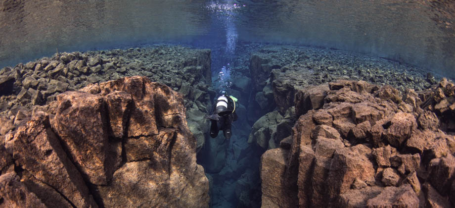
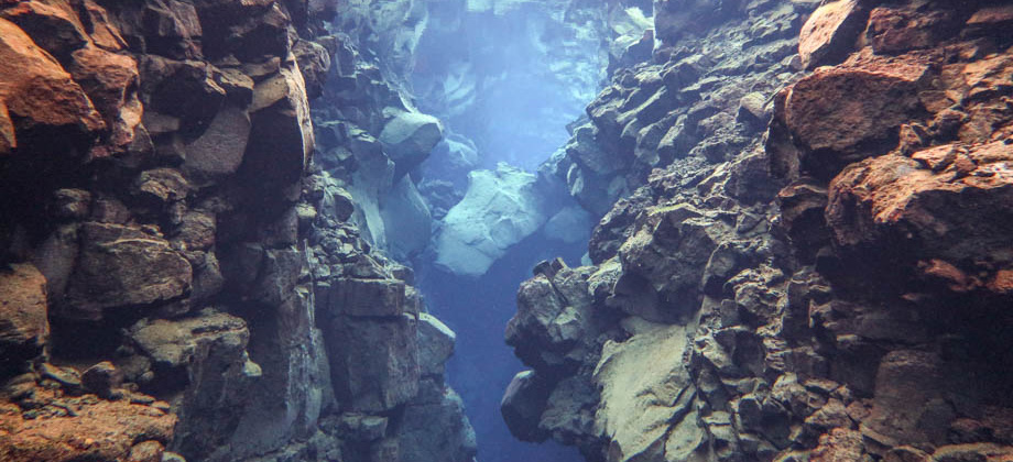
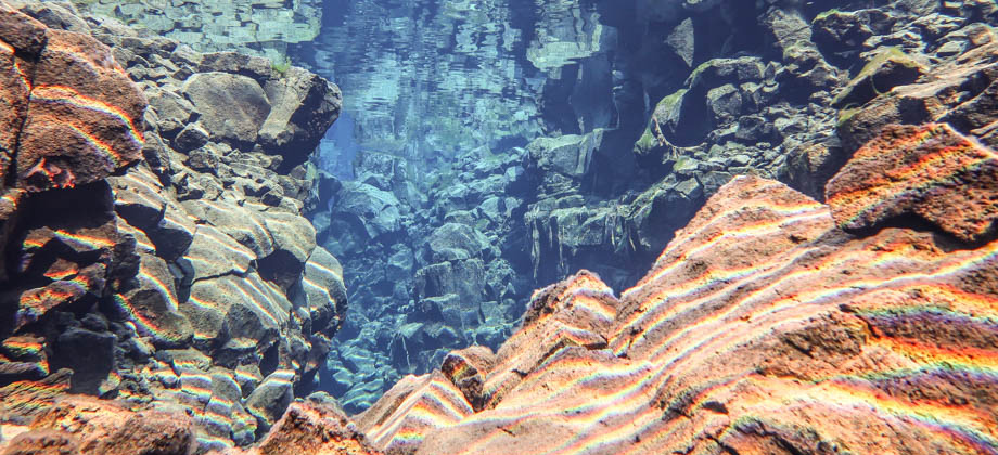
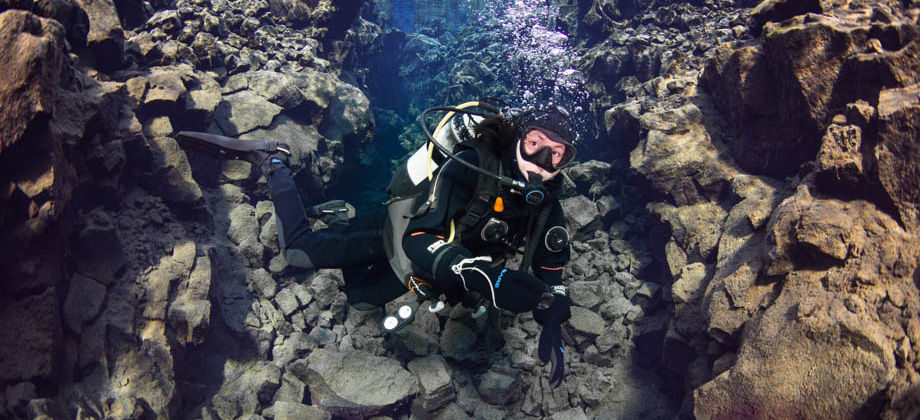
This slow remodelling of the land creates all sorts of cracks and fissures, but what makes Silfra unique is that when it was created, an underwater spring was cracked open in the process, and it flooded the fissure with crystal clear water. From the surface, this narrow channel of water really does not look like much, but when you are diving inside it, in-between two tectonic plates, and when the enormous geological power that is slowly splitting the land apart dawns on you, the experience becomes incredibly surreal.
The Silfra Fissure, although located inside a large rift valley, lies much closer to the west edge of this valley--the edge marked by the 7.7 kilometre-long Almannagjá gorge. The eastern edge of the valley, in turn, is marked by the Heiðagjá gorge. When the tension that builds up over decades is released and causes the plates to split apart, the rift valley ends up sinking between these two gorges--sinking valleys like this are known as 'grabens'. During the earthquakes that struck the area in 1789, the valley floor of Þingvellir sank by almost two metres.
This slow remodelling of the land creates all sorts of cracks and fissures, but what makes Silfra unique is that when it was created, an underwater spring was cracked open in the process, and it flooded the fissure with crystal clear water. From the surface, this narrow channel of water really does not look like much, but when you are diving inside it, in-between two tectonic plates, and when the enormous geological power that is slowly splitting the land apart dawns on you, the experience becomes incredibly surreal.


Glacial Meltwater
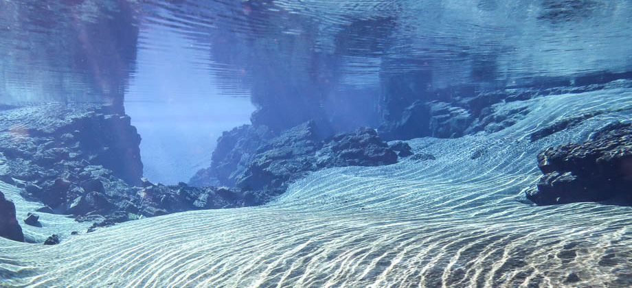
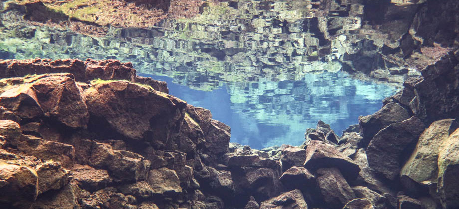
One thing that immediately strikes divers is the unbelievable visibility of Silfra Fissure, which can be in excess of a hundred metres. The water is so clear, in fact, that I found the reflections of the rocks on the surface of the water to be somewhat disorientating. The water originates from the Langjökull glacier


