


October 25, 2018
Posted by Ramon Fadli in Alpine, Arctic & Antarctic Tundra, Broadleaf Rainforests, Class 6, Forests, Guided Hike, Hiking, IUCN Protected Category 2, Malaysia, Mountains, Multiday Hike, National Parks, Peak Labels, Sabah, Tropical Rainforest, UNESCO
Mount Kinabalu
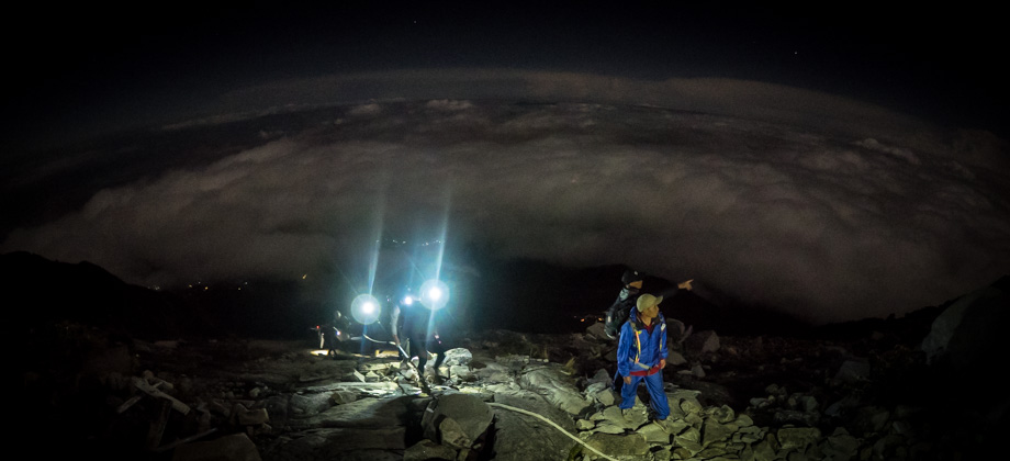
Kinabalu Day 1 : Timpohon Gate to Laban Rata
Kinabalu Day 2 : Laban Rata to Low's Peak
Mount Kinabalu
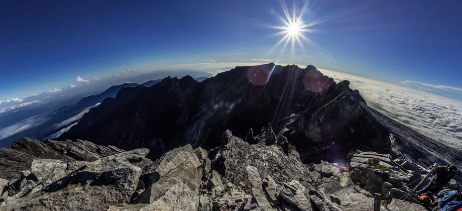
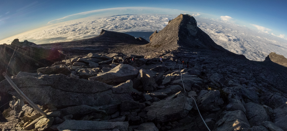
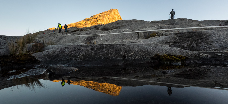
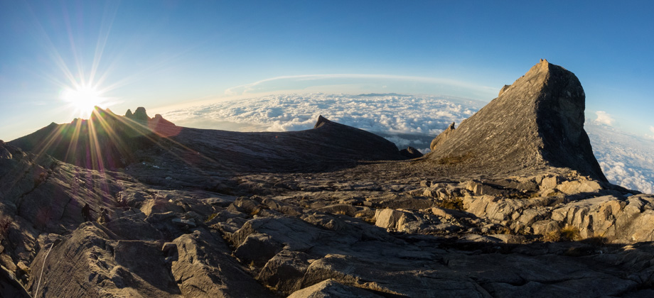
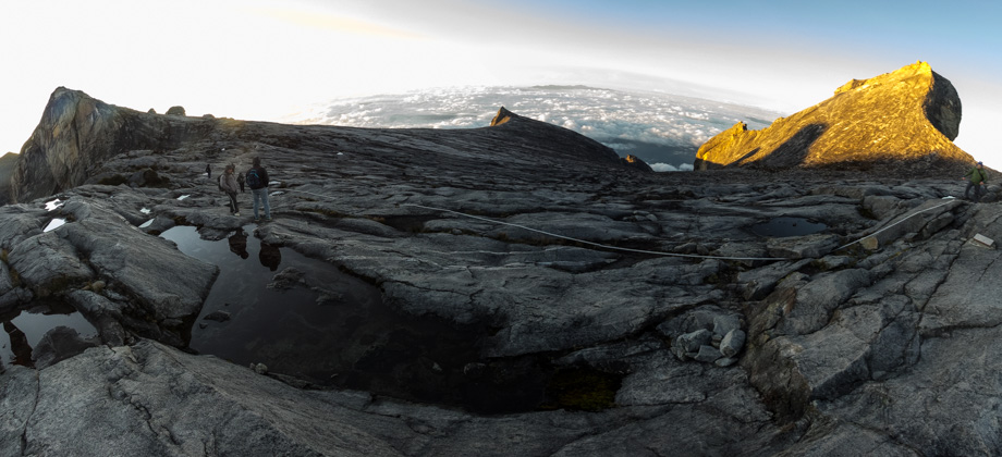
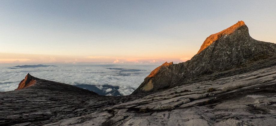
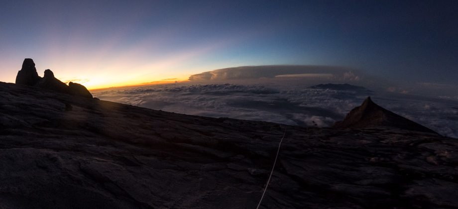
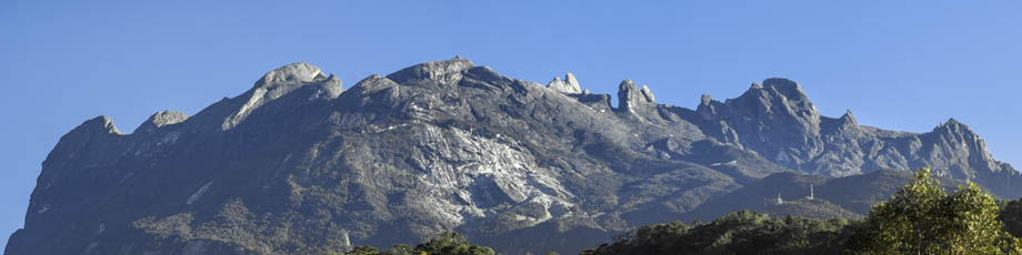
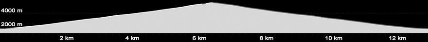
 Mount Kinabalu (elevation : 4095 m) is the highest mountain in Malaysia (both by prominence as well as sheer elevation), and is also the highest mountain between the Himalayas and the island of New Guinea. Based on topographic prominence, Mount Kinabalu also happens to be the 20th highest mountain in the world, but only the second highest mountain in South-East Asia behind Puncak Jaya (elevation : 4884 m), also known as Carstensz Pyramid, in Indonesia. When one discounts the prominence and looks only at elevation, however, there are a number of mountains that are taller in both Myanmar and Indonesia--the most notable of these being Hkakabo Razi (elevation : 5881 m) in Myanmar.
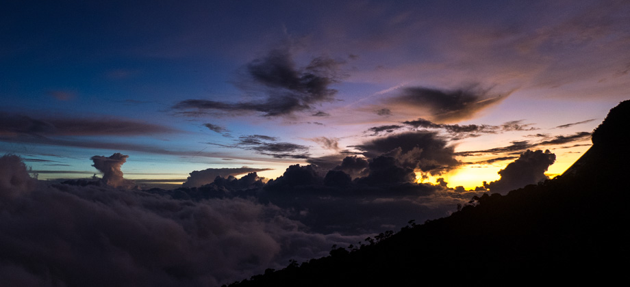
Mount Kinabalu is basically a massive granite intrusion (or a pluton to be precise) that was formed when magma solidified underground before being thrust upwards through the Earth's crust by tectonic movements millions of years ago. Approximately 100,000 years ago, this granite intrusion was completely covered by glaciers. As the glaciers flowed down the mountain's sides, they scoured the granite surface below and left smooth slopes that were surrounded by craggy spires in their wake. The glaciers also created the 1800 metres-deep Low's Gully, which is considered one of the least explored and most inhospitable places on earth. The gully begins with a sheer drop down the northern slopes of Low's Peak (elevation : 4095 m), the highest point of Mount Kinabalu.
Mount Kinabalu (elevation : 4095 m) is the highest mountain in Malaysia (both by prominence as well as sheer elevation), and is also the highest mountain between the Himalayas and the island of New Guinea. Based on topographic prominence, Mount Kinabalu also happens to be the 20th highest mountain in the world, but only the second highest mountain in South-East Asia behind Puncak Jaya (elevation : 4884 m), also known as Carstensz Pyramid, in Indonesia. When one discounts the prominence and looks only at elevation, however, there are a number of mountains that are taller in both Myanmar and Indonesia--the most notable of these being Hkakabo Razi (elevation : 5881 m) in Myanmar.
Mount Kinabalu is basically a massive granite intrusion (or a pluton to be precise) that was formed when magma solidified underground before being thrust upwards through the Earth's crust by tectonic movements millions of years ago. Approximately 100,000 years ago, this granite intrusion was completely covered by glaciers. As the glaciers flowed down the mountain's sides, they scoured the granite surface below and left smooth slopes that were surrounded by craggy spires in their wake. The glaciers also created the 1800 metres-deep Low's Gully, which is considered one of the least explored and most inhospitable places on earth. The gully begins with a sheer drop down the northern slopes of Low's Peak (elevation : 4095 m), the highest point of Mount Kinabalu.
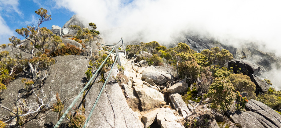
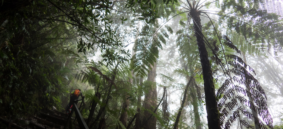
The Hike via Timpohon Gate
There used to be two one-day climbing options, one of which was a one-day hike but since the end of 2015 the permit has been suspended due to safety issues. The other option is the Kinabalu Climbathon (which I participated in back in 2011), which has now become a biennial event and will next be held in 2019. The normal hike however, begins from Timpohon Gate
Disclaimer
This hike is one of five entries on this website (out of more than a hundred) that made use of a guide. I personally am a big advocate of independent travel and self-guided hiking that does not require guides or porters. My reasoning is as follows (in no particular order): Less costly: Aside from the cost of permits, self-guided hiking has no guide expenses that need to be covered, and hikers also have full control over the cost of their meals. Guide expenses tend to normally be shared out amongst the group, which means that the larger the group, the less each hiker will have to pay. Less environmental impact: Without the burden of guide expenses, group sizes can be kept much lower. Small groups tend to be far more mobile and significantly reduce their impact to trails and campsites. Large groups also have a profound impact on other groups that are sharing the trail. I personally feel that groups of more than 4 or 5 people tend to be too large. Read up on Leave No Trace (LNT) principles for more info. More independence: Self-guided hiking requires hikers to be knowledgeable in multiple skills--navigation and route-finding, survival techniques, and wilderness medical skills just to name a few. It requires a level of fitness that allows hikers to be fully independent and to be able to carry all the gear that they will need without requiring the services of porters. Hikers that are unprepared should simply not be allowed on the trails. The trails are currently overloaded with hikers who should not be there in the first place. High customisability: One of the best things about independent travel is researching the location prior to the trip. This inevitably means that you will know far more about the area that is traveled through compared to someone who just goes in blindly expecting the guide to handle everything. You get full control over the planning of the route as well as developing contingency plans in situations such as inclement weather or medical emergencies. You also get to determine your own pace and can choose to stop if you need a moment of peaceful reflection. Who wouldn't want to enjoy nature on their own terms?"The Wildlife Crime Hotline, managed by the Malaysian Conservation Alliance for Tigers (MYCAT), provides YOU an avenue to report offences involving endangered wildlife in Malaysia. We protect the identity of all informants, only key info of the reports are forwarded to the authorities."
Emergency Numbers
Kinabalu Park Counter 088-889095 Park Manager 019-862 0707 / 088-889888 Protection & Enforcement 019-956 0884 / 088-888627 Mountain Rescue 014-874 3000 / 019-802 4110 Wildlife Crime Hotline 019-356 4194Difficulty Rating : 4.8 / 10.0
(Class 6 - Fairly Challenging)
*Click here to learn more about the difficulty rating.
**Please bear in mind that this rating is for those who do not employ the services of porters. A lighter load reduces the difficulty levels significantly and becomes more pronounced with high-altitude hikes. The rating for 'duration' has also been reduced from a six to a four as this hike does not require one to bring things like tents, sleeping bags, or food. As such, your backpack should be fairly light even if porters are not used.
Interactive Location Map
For those who also have a Suunto GPS device, the GPX file for eachsegment can be found at the end of each day's entry. The entireroute can also be downloaded here (right click and save link as).
Next : Day 1 - Timpohon Gate to Laban Rata
Mountains of Malaysia
Malaysia Overview
Interactive Location Map
Next : Day 1 - Timpohon Gate to Laban Rata
Mountains of Malaysia
Malaysia Overview

