
Mount Nuang (Kuala Pangsoon)
Mount Nuang - Part 1 : Mount Nuang
Mount Nuang - Part 2 : Camp Lolo
Mount Nuang - Part 3 : Puncak Pengasih
Via Kuala Pangsoon - Via Janda Baik
Mount Nuang
The group rose bright and early for the long drive to Kuala Pangsoon in Ulu Langat which lay on the east side of the state of Selangor. The trail for the trek up to the summit of Mount Nuang, which is one of the highest mountains in Selangor, began just before the Sungai Langat Dam at GPS coordinates '3.217420, 101.883090'.
Before we go on, please jot down the numbers that are listed below. If you do see any suspicious behaviour when out hiking, encounter things like traps and snares, or even see protected animals or their parts that are sold as either collectibles, pets, or for (so-called) medicine, then please do not hesitate to contact the wildlife crime hotline. Be sure to try and document it as best you can with photos or video without putting yourself in danger, and take note of the details: descriptions of those who are involved, as well as when and where it took place."The Wildlife Crime Hotline, managed by the Malaysian Conservation Alliance for Tigers (MYCAT), provides YOU an avenue to report offences involving endangered wildlife in Malaysia. We protect the identity of all informants, only key info of the reports are forwarded to the authorities."
Emergency Numbers
Wildlife Crime Hotline 019-356 4194 Wildlife Department 1800 885 151 Selangor Forestry Department 03-9075 2885 Batu 18 Police Station 03-9021 1557 Ampang Bomba 03-4292 4444 Ampang Hospital 03-4289 6000 Medical Emergency Coordination Centre (MECC Ampang Hospital) 03-4289 6565Difficulty Rating : 4.6 / 10.0
(Class 6 - Fairly Challenging)
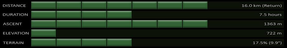
Nuang Elevation Profile

Getting There
At the end of the winding road that forks at a football field, take the left road that leads up to the dam and then make the sharp left turn at the Puncak Niaga gate that leads up to the parking lot.
The facilities that surrounded the trail entrance were surprisingly good, with large, clean public restrooms and shower rooms just nearby. The small hut where registration with the Park Ranger was to be done was just before the beginning of the trail. One had to write down their name as well as the number of trekkers in their party, and then pay the measly sum of RM1 for the park entrance fee. It is also advisable to take down the phone number of the ranger on duty just in case there are any unfortunate mishaps along the way.
The trail from Kuala Pangsoon is one of three that the Malaysian Department of Wildlife and National Parks established to the Nuang summit, with the other Selangor trail beginning from Kampung Kemensah in Gombak. I was fairly well prepared for this trek with sufficient water, a torch, pizza for lunch at the summit, as well as having plotted the trail up to the summit of Nuang for my Suunto Ambit :
Mount Nuang va Kuala Pangsoon Map
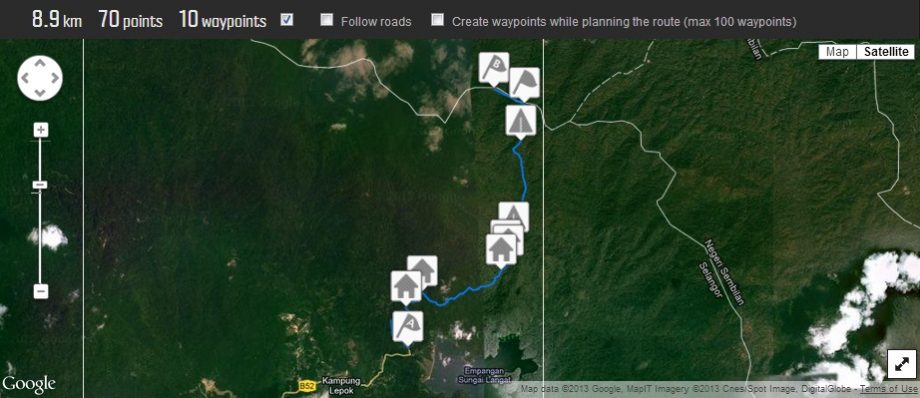
Nuang Trail
We set off at 07:50 which was considered early enough to do the trek in order to make it back before dark but the earlier you set off the better. The ranger that we spoke to told us that a Kenyan runner had ran to the summit and back in only two hours and 45 minutes, whereas the fastest Malaysian had only done it in around three hours. He then went on to say that if we were fast we may be able to do the whole trek in about five hours but that we would have to turn back wherever we were on the trail at 14:00 so that we would make it back to the entrance before nightfall.
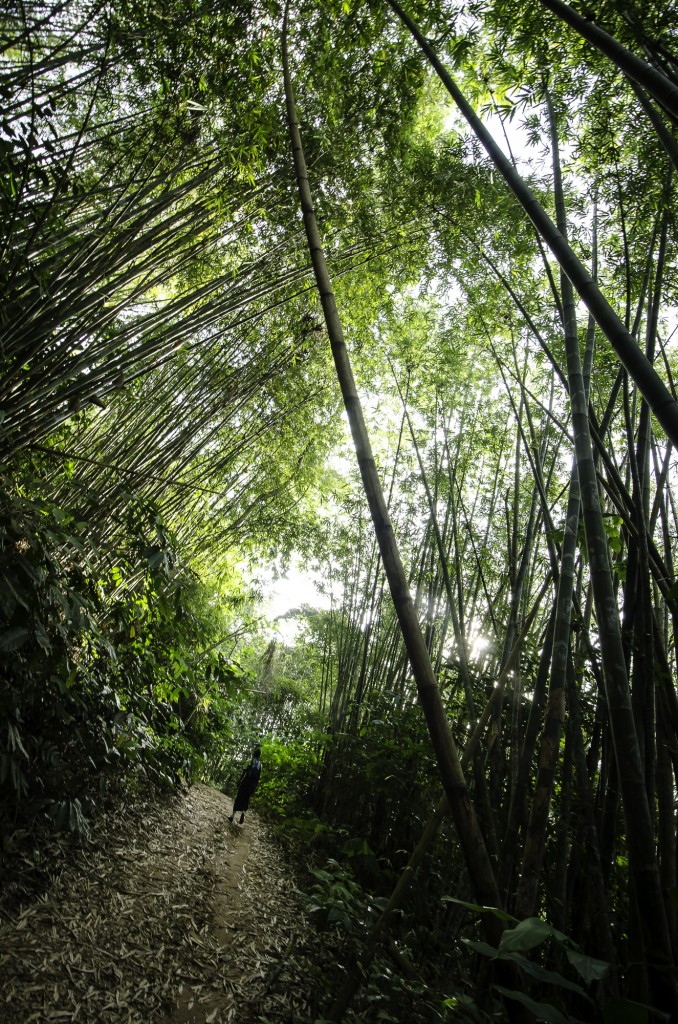
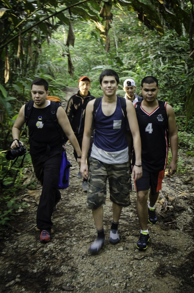
After passing through the archway stating 'Hutan Lipur Gunung Nuang', the trail followed a fairly wide dirt road which quickly reached a junction with the correct route veering right. The trail had a fairly consistent incline but a mild one at that which did not prove too strenuous. The trail wound its way up the mountain passing several cement rest stops along the way. This was where we encountered our first casualty, the sole of Edrie's shoe! It had began to peel off and my medic tape from my First Aid Kit was called upon in order to make the necessary repairs. By 08:45 we were back on our way.
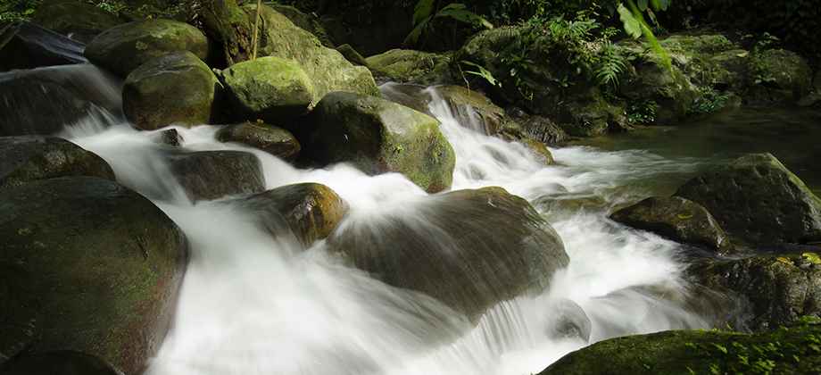
We reached the 'Buluh Minyak' rest stop (W6) shortly after and were greeted by the torrential sounds of a waterfall (the W5 rest stop was called 'Buluh Kasap' and W4 was called Buluh Tumpat'). I made a quick stop at the waterfall to take some slow shutter speed shots of the rapids before rejoining the group. The waterfall was decent and would have made for a nice place to take a dip and I actually contemplated lingering a little longer. The group however were keen to continue on.
")

I was with Ramon in the group that hiked Mount Nuang. Now, for someone like me, who have low stamina (literally), haven’t ever hiked in my life, bought my hiking shoes the day before, not too sure what to bring along for the trip and headed for the Nuang which is known as the most hardcore in the state, I could honestly say I did pretty well. Though it took me 12 hours (yes, you read it right) from start to finish, all I could say is just go on and don’t stop. We met a lot of people who turned back down due to the insufficient time and they didn’t want to risk getting caught with the dark, just bring a torchlight and you’ll be fine. Oh and make sure you have a guide if you’re gonna be as slow as I am, at least he’ll know the way 😉