
Mount Nuang (Janda Baik)
Via Kuala Pangsoon - Via Janda Baik
Mount Nuang
"The Wildlife Crime Hotline, managed by the Malaysian Conservation Alliance for Tigers (MYCAT), provides YOU an avenue to report offences involving endangered wildlife in Malaysia. We protect the identity of all informants, only key info of the reports are forwarded to the authorities."
Emergency Numbers
Wildlife Crime Hotline 019-356 4194 Wildlife Department 1800 885 151 Selangor Forestry Department 03-9075 2885 Batu 18 Police Station 03-9021 1557 Ampang Bomba 03-4292 4444 Ampang Hospital 03-4289 6000 Medical Emergency Coordination Centre (MECC Ampang Hospital) 03-4289 6565Difficulty Rating : 4.0 / 10.0
(Class 5 - Moderate)

Nuang Elevation Profile


Getting There
The trailhead was very easy to locate as all one needed to do was to head towards Kampung Janda Baik and to continue along the road until the 'ILMU' building was reached. From there, one would continue straight for a while until a gated carpark with a green fence along its perimeter (3.303979, 101.887121) was seen. I found the parking costs here to be very high though (at MYR7) but the cars were watched over and there were bathrooms and showers, so I suppose one could justify the cost to a certain degree.
 We came upon a gravel path within 10 minutes or so that lead straight to the gate of the 'Hutan simpan kekal'. The trail narrowed significantly from here, with tall reeds and grass lining the sides and the occasional burst of colour from a variety of flowers. The path lead on past an Orang Asli traditional house before skirting a dropoff on the left. After about half an hour, we reached the junction (1.4 km mark) with the marker-lined Nuang path continuing up straight on (the left path descending and the right with pipes disappearing into the dense undergrowth).
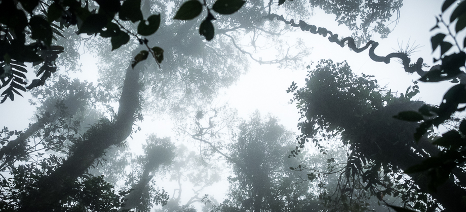
The canopy above was considerably thicker here and the forest floor was moist underfoot with fresh litterfall and an abundance of leeches (Haemadipsa sp.). Sounds of chirping birds accompanied the sounds of water from the rushing river down to our left and the occasional cracked pipe that ran parallel to the trail. Bamboo (Tribe : Bambuseae) shoots were ubiquitous here, with sections of the trail almost completely overgrown, reminding me of the beginning of the TNBYY hike.
We came upon a gravel path within 10 minutes or so that lead straight to the gate of the 'Hutan simpan kekal'. The trail narrowed significantly from here, with tall reeds and grass lining the sides and the occasional burst of colour from a variety of flowers. The path lead on past an Orang Asli traditional house before skirting a dropoff on the left. After about half an hour, we reached the junction (1.4 km mark) with the marker-lined Nuang path continuing up straight on (the left path descending and the right with pipes disappearing into the dense undergrowth).
The canopy above was considerably thicker here and the forest floor was moist underfoot with fresh litterfall and an abundance of leeches (Haemadipsa sp.). Sounds of chirping birds accompanied the sounds of water from the rushing river down to our left and the occasional cracked pipe that ran parallel to the trail. Bamboo (Tribe : Bambuseae) shoots were ubiquitous here, with sections of the trail almost completely overgrown, reminding me of the beginning of the TNBYY hike.
 Around 2.4 km in, the trail branched off to the left. We continued following the trail markers until the trail began to descend for approximately 100 metres before reaching the Cemperoh waterfall. We decided to continue on, so hopped across the river before meeting the trail once again as it swung around to the left.

Next : Mount Nuang (Part 2)
Malaysia Overview
")
