September 15, 2016
Posted by
Ramon Fadli in
Budget,
Chiang Mai,
Class 3,
Day Hike,
Dry Broadleaf Forests,
Forests,
Hiking,
IUCN Protected Category 2,
Mountains,
National Parks,
Thailand,
Tropical Savanna Doi Suthep
Chiang Mai Day 6
Doi Suthep
PROTECTED STATUS :
We began the day with plenty of food, ordering yellow curry
THB89/4 and red curry that we shared
THB89/4, and three plates of rice for myself
THB30). After settling the tab, we all grabbed our bags and jumped on the new van (get someone from Jira's homestay to call for the times beforehand) that went straight into the city of Chiang Mai for a mere
THB35, that ended up dropping us off at Tapae gate.
Once we arrived, we decided to have a quick look around the area for a lodge and eventually found a nice one called 'Siri'. We then jumped onto a songthaew
THB25 for the long ride to Chiang Mai University, which was the starting point of our hike up to the peak of Doi Suthep (ดอยสุเทพ),
elevation : 1676 m, following the route known as 'the monk's trail'.
*Click here to learn more about the difficulty rating.
Directions
Chiang Mai University lies directly to the west of Chiang Mai city, nestled right under the shadow of the mountains. Ensure that you head down Suthep road (ถนน สุเทพ), heading almost directly westward before leading to Suthep alley (ซอย สุเทพ), your last stop before hiking up the mountain. Bear in mind that Huaykaew road also heads up to the mountains, and to the front of the university, but heading north-west instead. If you find out that you are heading towards Chiang Mai Zoo, then you know you are on the wrong road.
Directions to Suthep alley from East Gate (Tapae Gate)
The songthaew ended up bringing us down Huaykaew road and dropped us off right in front of Chiang Mai University. Unbeknownst to us at the time, we were on the wrong road and should have been on Suthep road, which runs (somewhat) parallel to Huaykaew road but on the other side of the university instead. We dropped in to 7Eleven to purchase a bunch of snacks (
THB100), before continuing our journey along the road westward by foot. As we were walking, I kept my eyes peeled for the junction that I had read about online. I began to grow a little concerned over time as nothing like it could be seen.
We kept on climbing higher and higher and the road began to wind back and forth before we decided to turn back and check if we had somehow missed the turning. A few hours had gone by at this point and the lack of progress had left us fairly discouraged, so with no mobile phone reception, no internet, and the GPS on my
Suunto Ambit showing that the start of the trail was fairly far off, we decided to just flag down another songthaew
THB40 and get the driver to take us up the mountain to the Doi Suthep Temple (Wat Phra That Doi Suthep - วัดพระธาตุดอยสุเทพ) directly. That way, we could try and locate the trail head from the temple and just hike down instead.
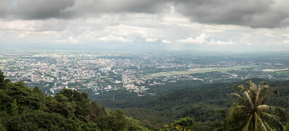
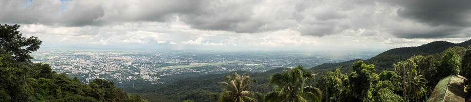 The view of Chiang Mai from the Doi Suthep Temple
A throng of tourists completely choked up the temple grounds, leaving me fairly disconcerted. We had already made our way up the 'Naga stairs' to the main entrance and were told that we had to pay an entrance fee of
THB30. All the tourists were making their way in to the main temple, so we decided to wander around the lower levels of the temple instead to avoid both the entrance fee and the ridiculous crowds. The crowds were still a little unbearable in and around all the viewpoints, so we decided to just head back out of the temple and down the road to the trail head.
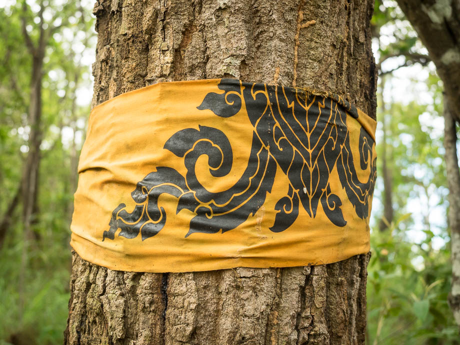 Doi Suthep trail markers
The trail head began at the curve of a huge U-turn that was next to an overtly large, unprepossessing billboard, that was just down the road from the temple. There were steps that were cut in the rock that brought us down and onto the trail. Every now and then, amongst the constant drone of cicadas
(Family : Cicadidae), we would pass orange pieces of cloth that were tied around the trunks and branches of the trees that acted as trail markers.
The trail began to widen after a few minutes of walking, and moss-covered stones lining the sides of the trail began to make their appearance. A stream appeared soon after with the trail leveling off, and we traced the edge of a rustling river to the right as we continued on. The trail then dipped a little and followed a line of unsightly electricity poles for a while.
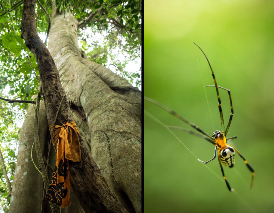
 A Doi Suthep trail marker and a tessellated orchard spider (Leucauge tessellata)