
Pine Tree Hill
Pine Tree Hill
The early gathering of the Kuala Lumpur Hiking & Trail Running group at the Fraser's Hill clock tower at 07:15 was very welcome after the long ride in the early hours of the morning. I found the night before to be completely devoid of sleep and as seems to always be the case, weariness began to creep in just as we were setting out.
The trek that day was to progress through the usual Pine Tree Trail, to the main peak, and on to Twin peak. From there the group would split into two groups with some heading back down the way they came and the rest continuing on down the trail towards Sungai Merah (Red River). From what I had been told, we were to expect the latter to be a lot tougher than anything that had preceded. Before setting off, I synchronized the reference elevation of 1311 metres with Alex, the organizer of the trip. We began the trek at 07:59 just after a short brief by Alex just below the large wooden frame that marked the start of the trek. The GPS coordinates for this point are '3.711861, 101.727591'. Before we go on, please jot down the numbers that are listed below. If you do see any suspicious behaviour when out hiking, encounter things like traps and snares, or even see protected animals or their parts that are sold as either collectibles, pets, or for (so-called) medicine, then please do not hesitate to contact the wildlife crime hotline. Be sure to try and document it as best you can with photos or video without putting yourself in danger, and take note of the details: descriptions of those who are involved, as well as when and where it took place."The Wildlife Crime Hotline, managed by the Malaysian Conservation Alliance for Tigers (MYCAT), provides YOU an avenue to report offences involving endangered wildlife in Malaysia. We protect the identity of all informants, only key info of the reports are forwarded to the authorities."
Emergency Numbers
Wildlife Crime Hotline 019-356 4194 Wildlife Department 1800 885 151 Hulu Selangor Forestry Department 03-6091 613 Fraser's Hill Police Station 09-362 2222 IPD Hotline Raub 09-355 4999 Fraser's Hill Health Clinic 09-362 2482 Klinik Desa Bukit Fraser 09-369 7919Difficulty Rating : 3.6 / 10.0
(Class 4 - Fairly Straightforward)

Elevation Profile

Getting There
The Trail
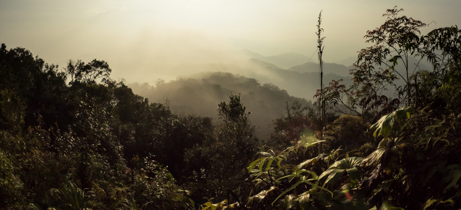
The trail itself began with a descent of about 120 metres that covered a distance of just over one kilometre. This took 20 minutes or so as the fairly large group had yet to spread out. The wide trail undulated up and down two minor hills before it reached the main steep ascent that ended at the peak of Pine Tree Hill (elevation : 1449 m). These multiple ascents and descents were made easier with the presence of steps as well as ropes that lined the sides of certain sections of the path. There were two main checkpoints that we passed along the way: the first one was called 'Gua Akar', and was located on the way up the second hill, approximately 2.6 kilometres in (also the half-way point between the trail head and Pine Tree Hill summit); the second was called Pine Tree Campsite, and was located 3.8 kilometres in.

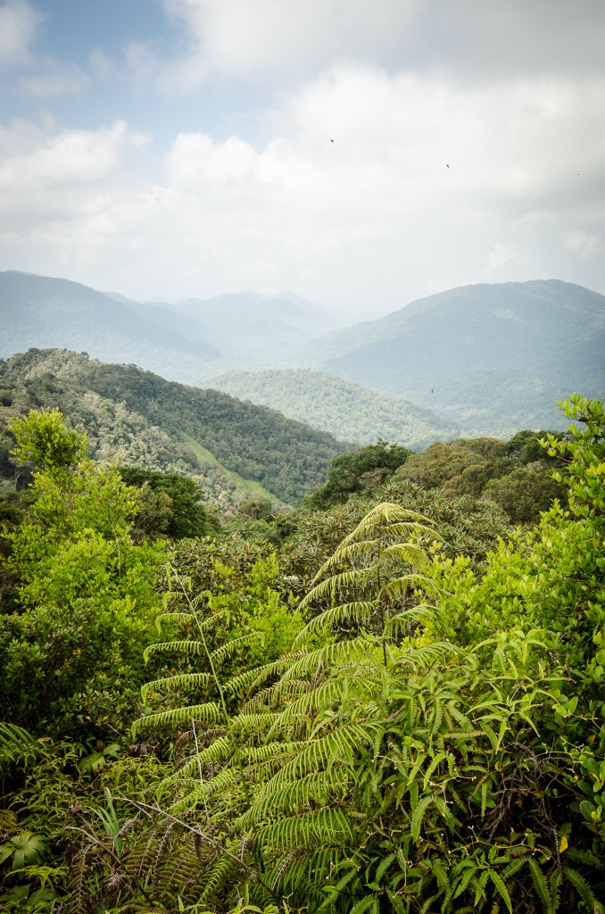

We traced our steps to rejoin the main trail and turned left to continue on to the Twin peak. The journey from there began with a brief decent followed by an even briefer ascent that took about 30 minutes (5.7 km mark). My Suunto Ambit gave an elevation reading of 1399 m. The fog had cleared by the time we reached and visibility had definitely increased giving us good views of the rolling hills surrounding us. The peak itself was crammed with other members of the group who had decided to stop there so I was forced to spend some time there waiting for an opportunity to take a 360-degree panorama. After almost an hour of waiting however, I had to resign myself to the fact that such an opportunity was not going to present itself, especially after more and more of the group kept on arriving as the others left the peak for their descent.
The lack of a 360 degree panorama for Twin peak and the ubiquitous and pervasive presence of bees at the peak compounded the irascible feeling that had already manifested itself due to the lack of sleep. As Andy, Raimy and I made our way down the trail, I found my patience begin to wane dangerously thin as we were forced to wait for some trekkers who were taking their time to ascend the ropes at the near-vertical section of the trail just after the peak of Pine Tree Hill.


My mood began to improve somewhat despite the slow pace as I found that the more I moved, the less lethargic I felt. We eventually reached the starting point after a total of 5 hours 35 minutes of trekking but spent just over 7 hours on the trail (including time spent resting). That's one more for the list!
'There was also a valuable lesson to be learnt here, to always get a good night's rest before starting a trek the next morning!
Route Playback
Suunto Movescount Stats


Mountains of Malaysia
Malaysia Overview

