

Mount Bunga Buah
Bunga Buah
We set off early in the morning to the small town of Goh Tong Jaya, which is a satellite town of Genting named after the former chairman of the Genting Group. We gathered at the 'Nasi Kandar Genting' mamak shop just next to the Seri Malaysia Hotel at 08:00, where we stocked up on some Nasi Lemak for breakfast as well as bottles of water to sustain us throughout the trek.
Before we go on, please jot down the numbers that are listed below. If you do see any suspicious behaviour when out hiking, encounter things like traps and snares, or even see protected animals or their parts that are sold as either collectibles, pets, or for (so-called) medicine, then please do not hesitate to contact the wildlife crime hotline. Be sure to try and document it as best you can with photos or video without putting yourself in danger, and take note of the details: descriptions of those who are involved, as well as when and where it took place."The Wildlife Crime Hotline, managed by the Malaysian Conservation Alliance for Tigers (MYCAT), provides YOU an avenue to report offences involving endangered wildlife in Malaysia. We protect the identity of all informants, only key info of the reports are forwarded to the authorities."
Emergency Numbers
Wildlife Crime Hotline 019-356 4194 Wildlife Department 1800 885 151 Bentong Police Station 09-222 2222 Bentong Hospital 09-222 3333Difficulty Rating : 3.8 / 10.0
(Class 5 - Moderate)
*Click here to learn more about the difficulty rating.
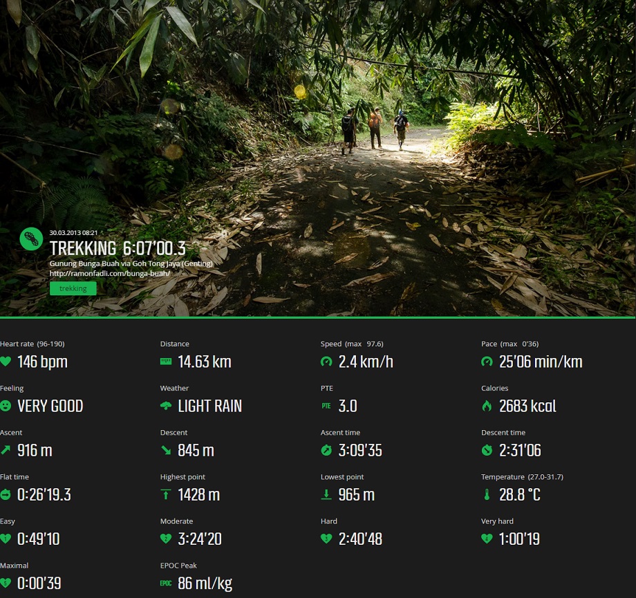
Elevation Profile

Getting There
The group walked to the entrance to the trail that lay behind the strawberry farm that is located at GPS coordinates '3.398365, 101.765719' but to our dismay, found that there was a gate barring the entrance that was padlocked. Fortunately for us, there was a second entrance relatively close by that is located at GPS coordinates '3.400009, 101.765821'. Before reaching the trail entrance however, our group which was being lead by veteran trekker MK Rahman from the 'Hiking & Camping Around Malaysia' Facebook group, merged with another group lead by Paul from the ABC group.
Location of the start of the trail
Elevation Profile
Getting There
The group walked to the entrance to the trail that lay behind the strawberry farm that is located at GPS coordinates '3.398365, 101.765719' but to our dismay, found that there was a gate barring the entrance that was padlocked. Fortunately for us, there was a second entrance relatively close by that is located at GPS coordinates '3.400009, 101.765821'. Before reaching the trail entrance however, our group which was being lead by veteran trekker MK Rahman from the 'Hiking & Camping Around Malaysia' Facebook group, merged with another group lead by Paul from the ABC group.
The Old Trunk Road
The entrance lead up a broad road that used to be a trunk road to Genting. After about 30 minutes, the trunk road made a sharp veer to the right but instead of following the turn, we instead took a small path just to the left of the turning that lead to the old road to the quarry.
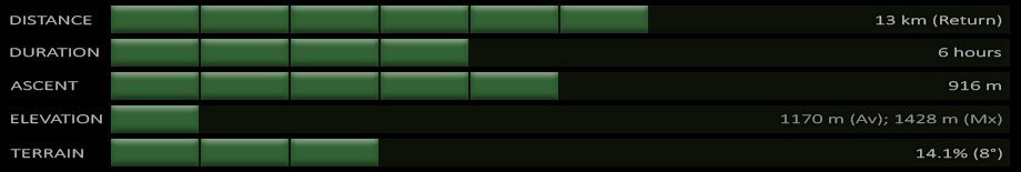
This road was extremely overgrown with vegetation and it turned out to also be heavily infested with leeches. The trail was so overgrown in fact that the width was reduced to just a narrow trail although this almost went unnoticed at first due to the rock face that lay to the right of the trail. The rock face was the remnant of an old quarry and it came across as serene with the quiescent morning mist lingering around it. The quarry wall looked like an excellent area for rock climbing although the fact that it had long been abandoned would probably call the safety of the area into question.
An hour of trekking brought us to what was referred to as the '1st Viewpoint' as it rewarded us with views of the intimidating-looking mountain range leading up to Mount Bunga Buah that we were about to summit. We regrouped here and checked for leeches before moving on. Ian had his leech removed by some ash from MK's cigarette and when MK was asked about his smoking, he wittily retorted that it was to simulate the low oxygen content of the air at high elevations!
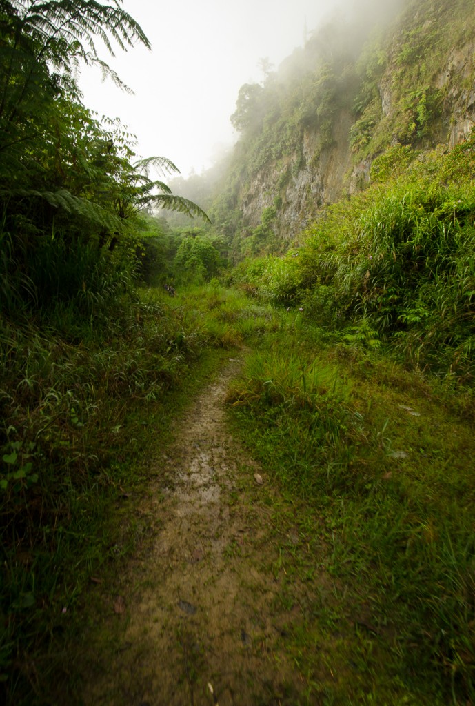
The path carried on for quite a distance and became more overgrown as we progressed. I found it interesting how a road could be completely swallowed up by nature, a clear testament to the resilience and unyielding power of it. Parts of the path became so narrow that one would have to squeeze through the branches and reeds that lined the path and hope that there were no leeches lying in wait eager to latch on. The path itself was also festooned with beautiful clusters of cobwebs with droplets from the mist forming intricate, almost crystalline patterns, as well as large numbers of pervasive wild orchids.
Roughly an hour and 15 minutes of trekking brought us to a large landslide that was shortly after followed by the path that we had to take on the right that had been made obvious by a little yellow sign that said 'G.BB'. Before proceeding on however, MK advised us to stay together in groups as apparently the footprint of a predator had been found recently in the area.
Ups & Downs
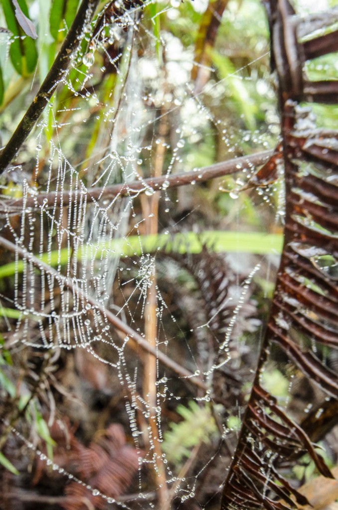
The path was composed of slippery yellow clay that reminded me of the path just before 'Puncak Pengasih' in Nuang but fortunately for us, it immediately began to descend. It was here that I was given the honor of my first ever leech (Order : Hirudinea), an accolade that was quickly cut short by the flick of a finger. The leech's presence had left a tingling feeling on my left heel but I found to my surprise an almost complete lack of bleeding.
After a while, our relentless descent ceased once we reached a small clearing where the trail began to ascend almost immediately. The trail remained muddy for the first few minutes before the ground became a lot firmer as tree roots became a lot more pervasive.
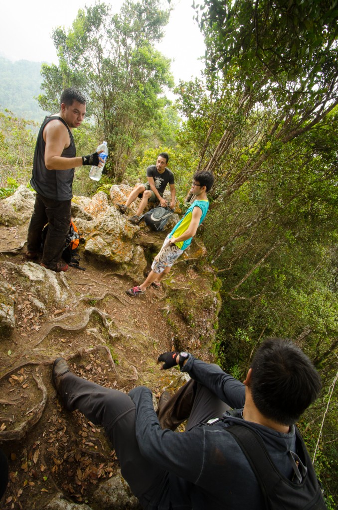
Rocky Garden (elevation : 1236 m) was reached 2 hours and 30 minutes into the trek. The trail basically just emerged from the surrounding foliage, greeted by views spanning both sides, that lead to a rocky ridge of sorts that was somewhat akin to what you would find on the Tabur Hill trek. I stopped here for a while to take some shots for the 360 degree panorama shortly before joining the group. We ended up resting for a good 30 minutes or so, leisurely munching away on the provisions that we had brought along. The time was 11:40 by the time we continued, leaving behind those who were struggling and had decided to stay behind.
Bunga Buah Peak
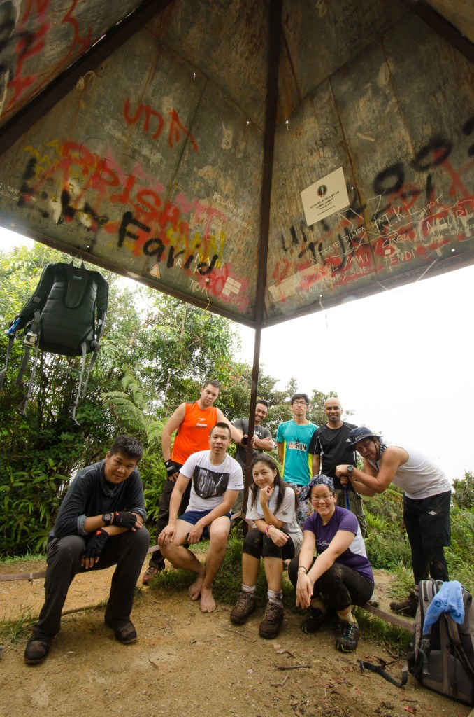
It took about 45 minutes to reach the peak of Mount Bunga Buah (elevation : 1430 m). We reached at 12:24 after 3 hours and 12 minutes of trekking. There was a False Peak, basically a clearing, just before the actual peak with the pyramid-like metal structure that marked the summit that the locals call a 'beirut', a structure that I think must be some sort of geodetic triangulation survey point.
After about half an hour just relaxing and chatting at the peak, the group began their descent. This time we reached Rocky Garden after half an hour where we once again stopped to regroup.
It was 15:00 by the time we reached the junction where the path met the overgrown road which meant that we took 1 hour and 20 minutes to get there from the Rocky Garden. This was somewhat surprising considering the leisurely pace that we had taken as well as the presence of the muddy, slippery, steep ascent just before the junction that we had to navigate through. Looking back I feel that that muddy section could possibly have been the toughest part of the trek as the level road that followed came as quite a relief. From that point, it only took about 45 minutes to reach the gate that marked the start of the trek. That's one more mountain to tick off the list!
Route Playback
Suunto Movescount Stats

Mountains of Malaysia
Malaysia Overview
")

