
Saga Hill & Waterfall
Waterfalls of Malaysia
Saga Hill
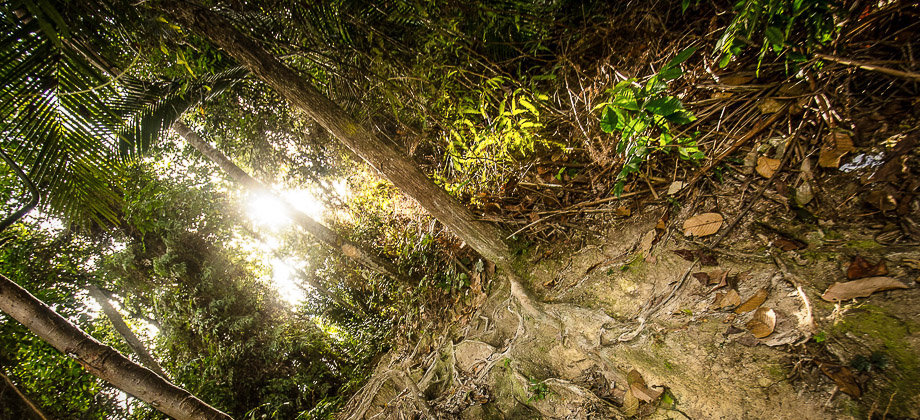
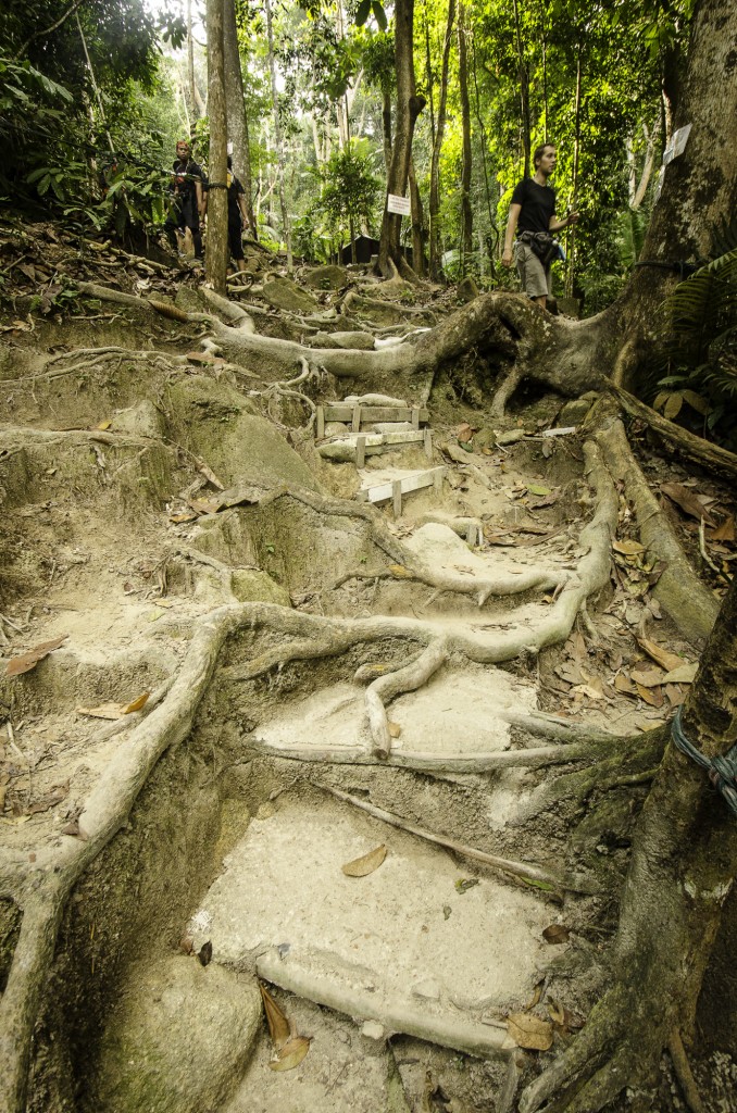
Saga Hill was a pretty straightforward trek compared to almost everything else that I had done before. Despite the pace being very slow as the fairly large group had a lot of beginners, the peak was reached with roughly a half hour of steady trekking. The trail up to the peak lacked a view however but due to the low level of difficulty and its proximity to the city center, it is optimal for those who are either new to trekking and don't want something too strenuous or for those who are looking for a quick trek close by. We followed trail C which had an ascent that was fairly constant up to the summit, with a trail that seemed to be fairly well maintained, even with steps built in at certain points.
Before we go on, please jot down the numbers that are listed below. If you do see any suspicious behaviour when out hiking, encounter things like traps and snares, or even see protected animals or their parts that are sold as either collectibles, pets, or for (so-called) medicine, then please do not hesitate to contact the wildlife crime hotline. Be sure to try and document it as best you can with photos or video without putting yourself in danger, and take note of the details: descriptions of those who are involved, as well as when and where it took place."The Wildlife Crime Hotline, managed by the Malaysian Conservation Alliance for Tigers (MYCAT), provides YOU an avenue to report offences involving endangered wildlife in Malaysia. We protect the identity of all informants, only key info of the reports are forwarded to the authorities."
Emergency Numbers
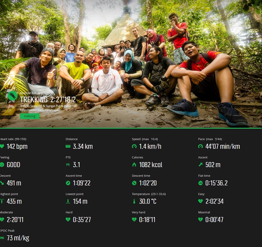
Wildlife Crime Hotline 019-356 4194 Wildlife Department 1800 885 151 Selangor Tengah Forestry Department 03-9075 2885 Ampang Police Station 03-4295 2222 Ampang Bomba 03-4292 4444 Ampang Hospital 03-4289 6000Difficulty Rating : 2.6 / 10.0
(Class 3 - Straightforward)

Getting There
There is a carpark located at the coordinates '3.114438,101.772065' but the actual trail begins from '3.113407, 101.773736'.

From the summit, we continued on towards the Sungai Putih waterfall (also known as Bukit Apek Waterfall) which took us another 45 minutes or so. The summit and the waterfall had an elevation difference of only 150 metres although the trail itself did involve a series of short ascents and descents. The waterfall itself was somewhat a disappointment as it was not very large and due to it being a weekend, there were large groups gathered around almost to a point where one could not find a clearing on the ground to set one's bag down. Time under the waterfall was limited although the company I was with more than made up for this.

Route Playback
Suunto Movescount Stats

Waterfalls of Malaysia
Malaysia Overview


