EBC Day 08 – Tengbouche to Dingbouche
EBC Index
Chortens
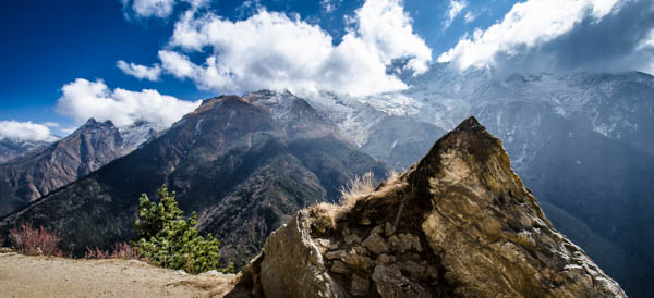
The path wound its way up and through the beautiful, tranquil hillside with the picturesque and regal Ama Dablam (elevation : 6812 m) completely dominating the eastern view, and passed countless mani stones and several chortens (the Tibetan word for 'stupa') along its way. Chortens tend to be fairly simple structures when found up in the mountains but despite this, are still seen as religious focal points in the landscape. They can contain offerings such as mantras that have been written or printed on paper and occasionally even valuable items such as jewellery. Chortens also contain a wooden stick that has been covered with mantras and gems that is referred to as the 'tree of life'. Each section of the chorten is representative of one of the elements - working up to the top, the square base represents 'earth', the rounded dome represents 'water', the thirteen ridges of enlightenment on a cone represent 'fire', and a small umbrella-like hood near the top represents 'wind'. Right at the tip lies a sphere that represents the unity of the sun and the moon.


Junction to Periche
I came upon the small town of Syomare with an even smaller settlement called Orsho soon after. Right after Orsho, there was a fork in the road that lead left down to Periche and right up towards Dingboche. I turned right as I considered Dingboche to be the better option of the two, as it was said to be less effected by the cold winds that descend down the valleys at night. To be honest, I really think that I would have been fine with either one, as long as I was able to find a place to take my shoes off and to put my feet up for the night... I took the left fork down to the bridge that crossed the Khumbu Khola. As the Imja Khola roared below me to the right, the clouds started to roll in from above, obscuring the clear skies that I had started to get used to. Occasionally the clouds would part and Everest would appear through the ridge of Nuptse and Lhotse, first shyly, and then slowly revealing itself as the rays of the setting sun turned the snow-covered peaks blazing red. Lower Dingboche
The Periche - Dingboche Junction
Route Playback
Suunto Movescount Stats
Day 8 Expenditure


