Western Arthurs Day 3 : To Lake Oberon
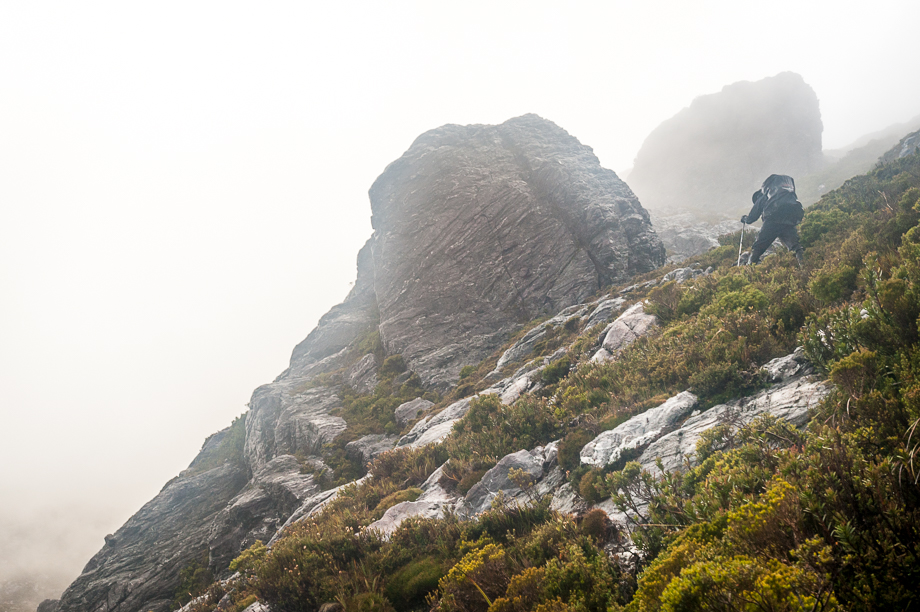
White Out

The original plan had us pushing past Lake Cygnus and on to Lake Oberon on the same day but the inclement weather that had suddenly rolled in had forced us to stop at the
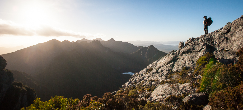
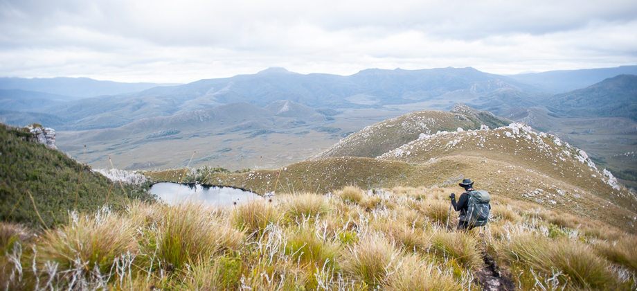
Lake Cygnus campsite instead. We ended up taking our sweet time getting ready that morning, knowing that we only had about half a day of hiking ahead of us, and set off around 10:00, unperturbed despite the weather still remaining gloomy and the rain intermittent. We made the steep climb north-west back up to the junction and turned right to follow the main track as it continued east along the crest of the range.
As we made our way along the ridge, the clouds suddenly rolled in and quickly blanketed both of us in a complete whiteout. This drastically reduced the visibility, causing the large ghostly formations of pinnacles and buttresses to suddenly appear out of the mist as we walked on. The track continued up the hill and around and under huge cliffs, passing ancient Gondwanan Pandani trees
(Richea pandanifolia) with water dripping off the ridges above. The clouds parted a little and a slight, faint shadow of a steep peak that might have been Mt.Hayes appeared momentarily in-front of us. We rounded the hill (0.86 km mark) and followed the track as it made its way south-easterly on rubber mats for a short while before switching back to gravel once again.

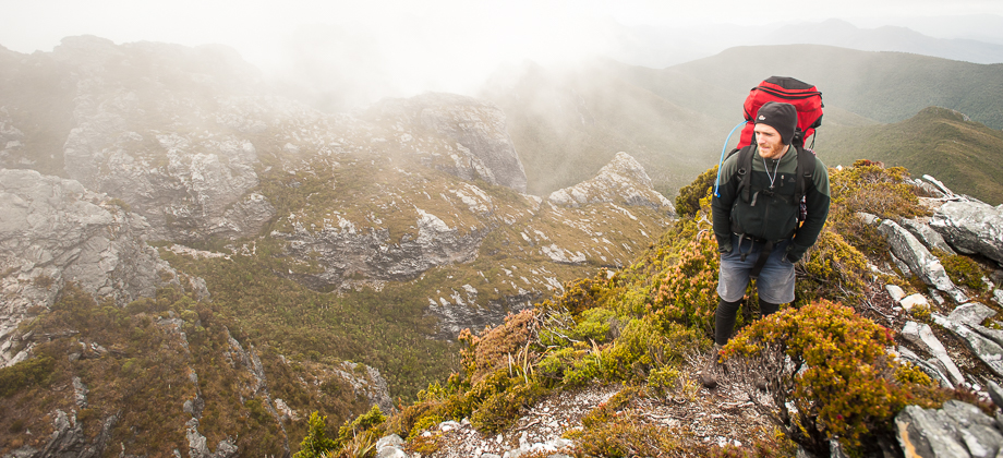
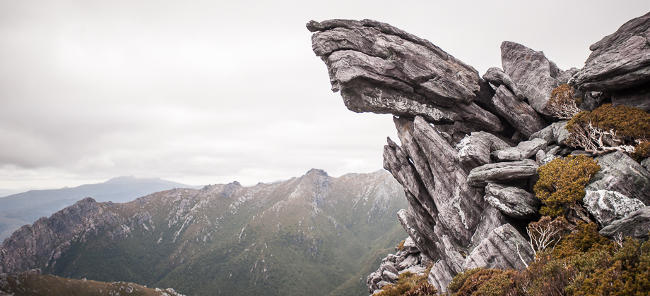
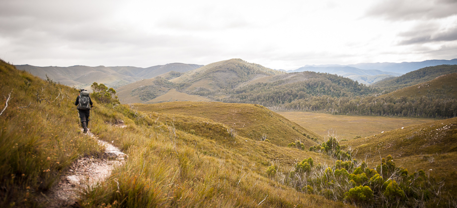
At the 1.4 km mark, the path swerved around the summit, past cairns that showed the point where the path branched off to the left that lead up to the summit of Mt. Hayes (
elevation : 1119 m) and to the right following the path that continued around and to the east past jagged pinnacles and buttresses. The path then descended down a precarious scree-filled gully, leaving me slipping and sliding downwards haphazardly.
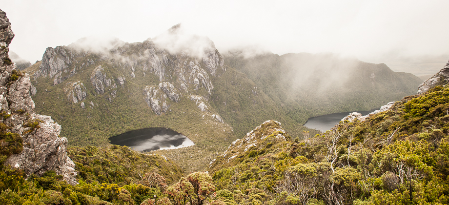
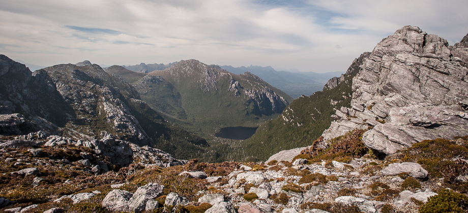
As I rounded the next shoulder, the views opened up momentarily and I caught a glimpse of the path disappearing up ahead, a short respite from the clouds before they engulfed us once again. Just after the 2 km mark, the trail started to ascend up a channel of sorts where water ran down and eventually made its way to a stream. From here the trail went up and around some rocks, with more pinnacles on the right, before heading once more into the bushes. The visibility was extremely bad at this point and we could only see a few metres in front of us. The clouds parted again momentarily and we briefly caught a glimpse of lake Ceres off to our right.
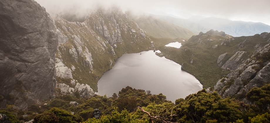
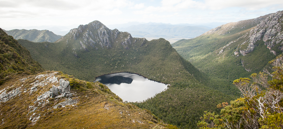
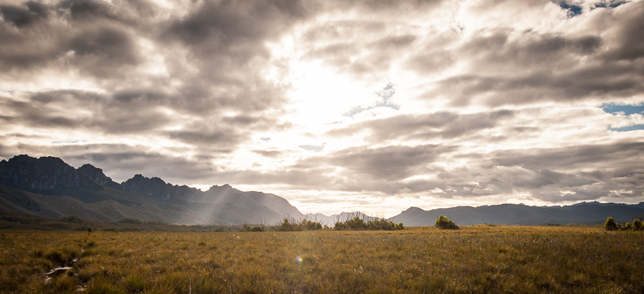
With nothing to focus on in the whiteout except for what was directly beneath our feet, the climb up and over, and in and around, boulders and pinnacles seemed almost endless. Fortunately, this spell was interrupted as the boulders gave way to a lot of mud that was immediately followed by a fast flowing stream that disappeared into dense bushes. Square Lake appeared right in-front of us as we emerged from the shrubbery. The Lake was nestled cosily at the foot of a wall of sheer cliffs with the sounds of crashing waterfalls coming from the far side. Strong winds constantly whipped up across the lake sending ripples skittering across the water.
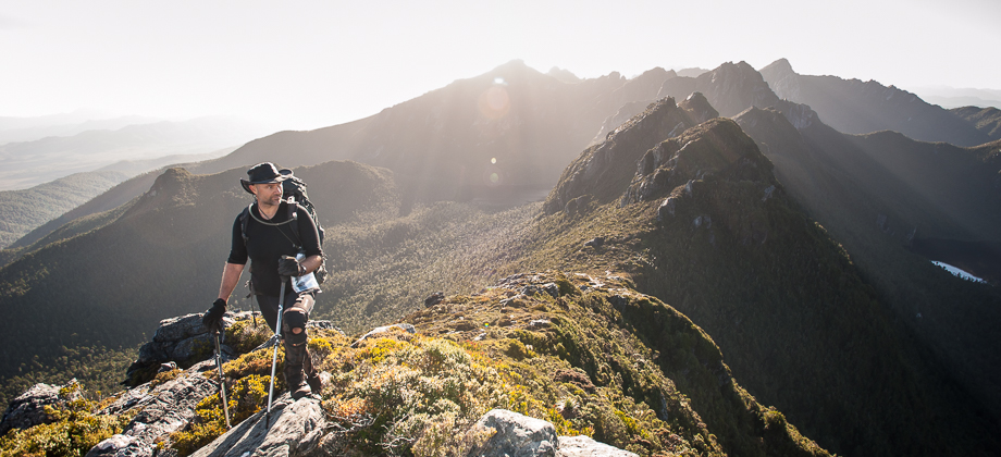
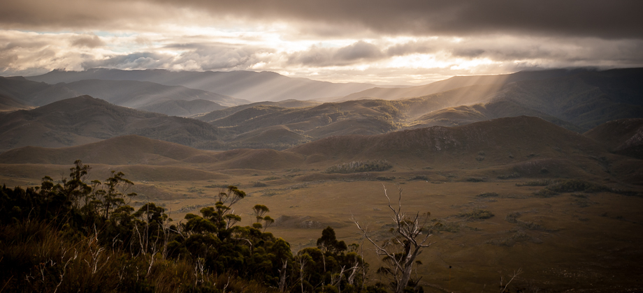
The route continued to climb up the steep slope, through narrow gaps in the bushes that we struggled to squeeze our large packs through, before turning into a small stream that we followed upwards. As we ascended, everything suddenly seemed to light up. I turned around to look behind me and saw the sun shining brightly over the lake but seconds after, the clouds quickly wafted back in and everything just simply disappeared into the whiteness, including the lake which had completely dominated the view just moments before. We continued to climb up and over the col with just enough visibility in front of us to see where our next few steps would go. At the 3.8 km mark, we descended a little with the peak of Mt. Sirius (
elevation : 1151 m) just off to our right and followed the ridge for a bit before rounding the next shoulder.