


March 15, 2015
Posted by Ramon Fadli in Australia, Camping, Class 8, Hiking, IUCN Protected Category 2, Lakes, Looped Hike, Multiday Hike, National Parks, Oceanic, Peak Labels, Ridges, Tasmania, Temperate Deciduous Forests, UNESCO
Western Arthur Range
Day 1 - Scott’s Peak Dam – Junction Creek
Day 2 - Junction Creek - Lake Cygnus
Day 3 - Lake Cygnus – Lake Oberon
Day 4 - Lake Oberon – High Moor
Day 6 - High Moor – Haven Lake
Day 7 - Haven Lake – Promontory Lake
Day 9 - Promontory Lake – Lake Rosanne
Day 10 - Lake Rosanne – Wullyawa Creek
Day 11 - Back To Scott’s Peak Dam
Western Arthurs' Campsites
The Western Arthur Range
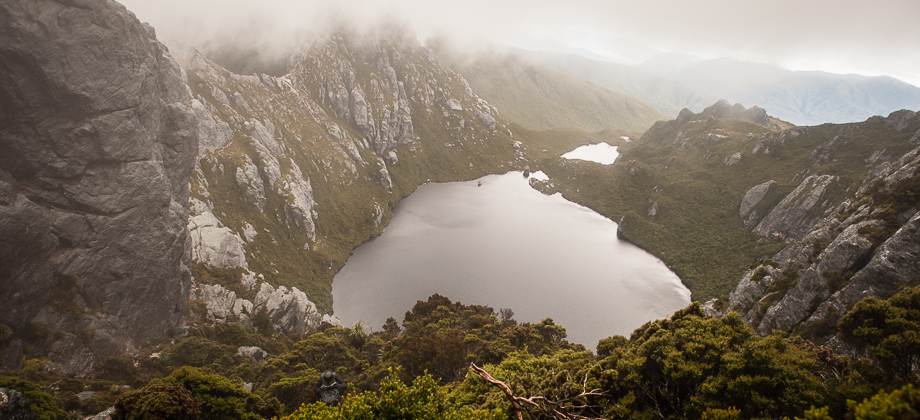
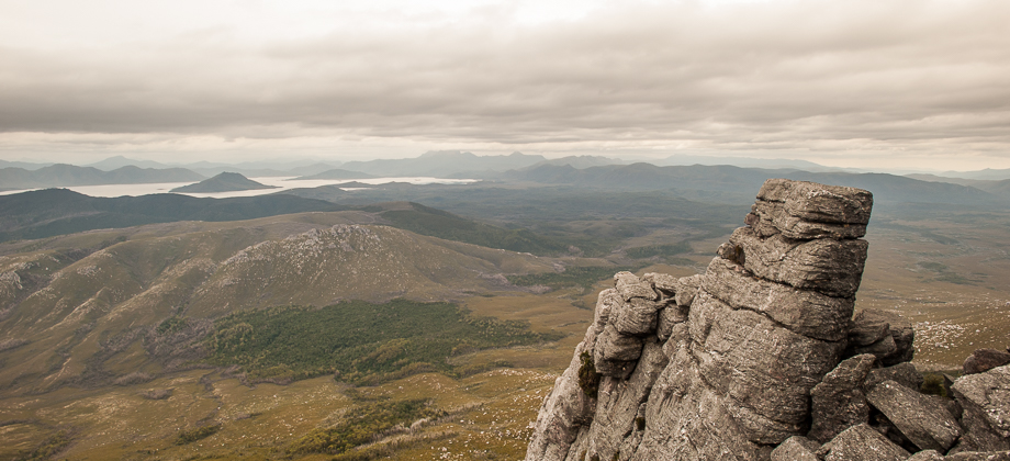
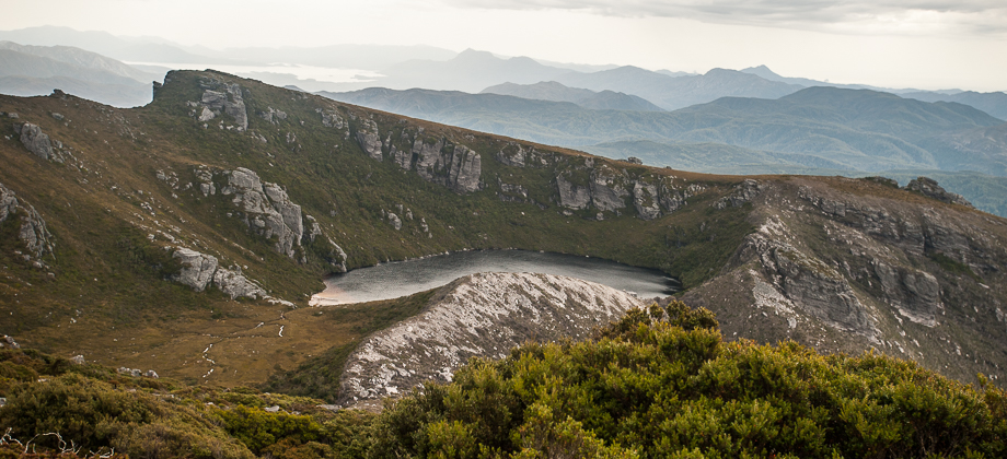
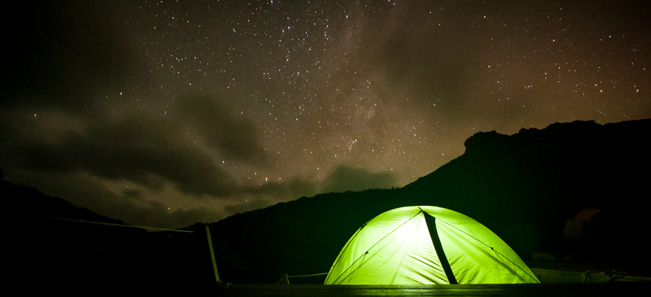
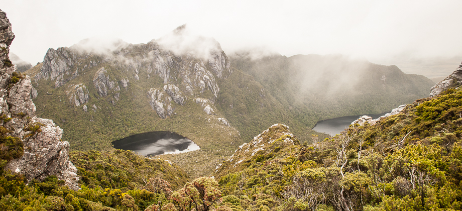
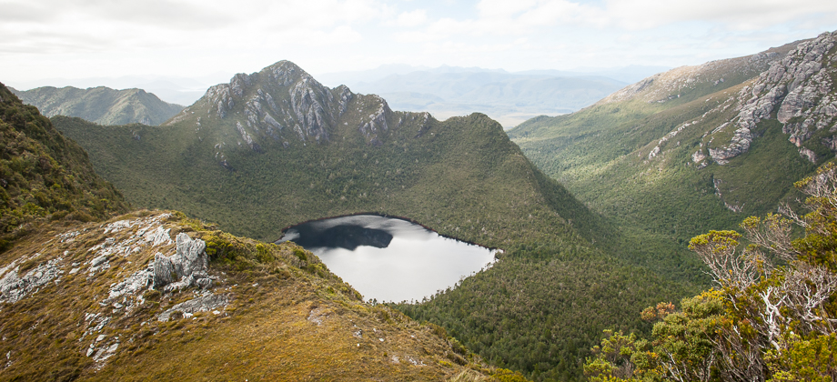
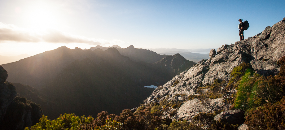
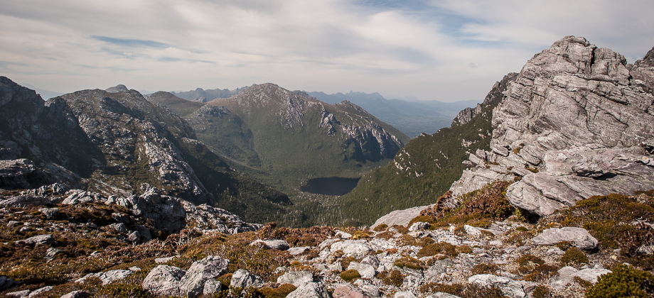
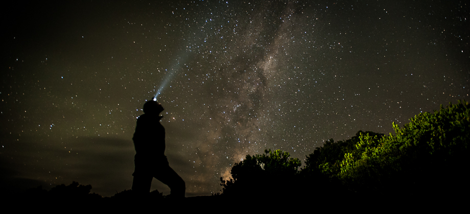
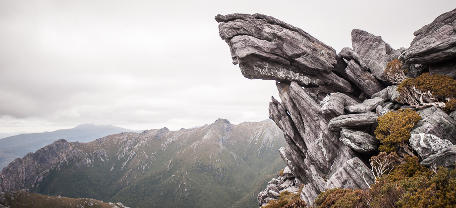
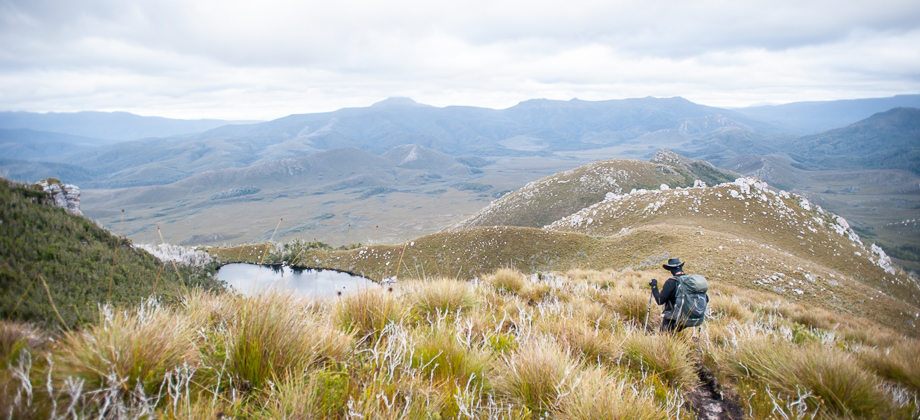
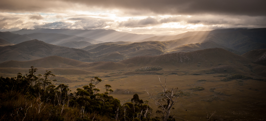
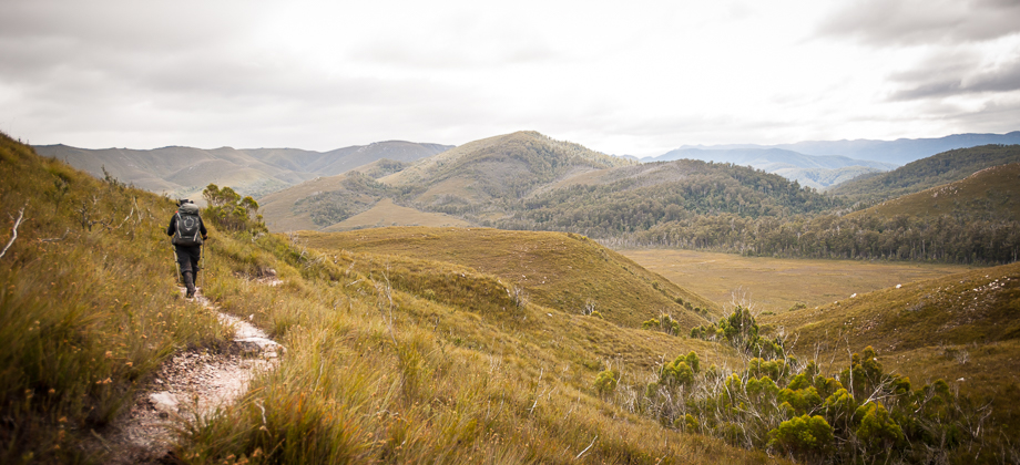
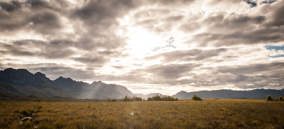
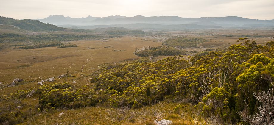
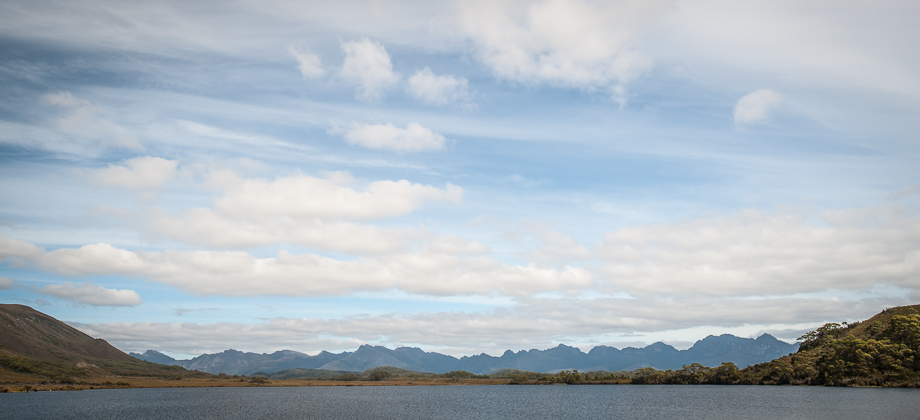
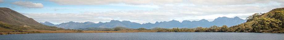
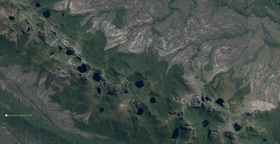
 The Western Arthur Range lies in South-West National park, in south-west Tasmania, and is one of the most dramatic mountain ridges in the whole of Australia. This UNESCO World Heritage Site is known for its glaciated landscapes, jagged quartzite crags, spectacular lakes (approximately 30 of them, and along with the peaks and ridges, were named after celestial objects), unpredictable and violent weather, and of course the magnificent views! This of course makes it a wonderful location for not just hiking, but for other activities as well (as seen below).
Access
The traverse of the range is a circuit that begins and ends near the Huon Campsite at Scott's Peak Dam that is located at the southern end of Lake Pedder, which is 3-4 hours (by car) south-west of Hobart. The trail head for the Western Arthur Range is also shared with the Port Davey Track, which leads down to Melaleuca and the start of the South Coast Track. To drive to Huon Campsite from Hobart, take the main road north-west up to New Norfolk, then carry on heading west along the B61 road towards and past Maydena. There will be a junction where the road branches off to the left to continue circling around to the southern end of Lake Pedder and past several apiary sites. The road that leads off to the Huon Campsite (and the trailhead) branches off to the left at Scott's Peak Dam.Getting There
Difficulty
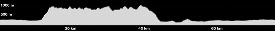
The traverse of the Western Arthur Range takes approximately 9-11 days, including the time taken to access and depart the range from Scott's Peak Dam. There are shorter options however if you have limited time. Walking to Lake Oberon and back will take approximately 4-5 days, and the half traverse up Alpha Moraine and back down to the plains via Kappa Moraine will take you between 7-9 days.Difficulty Rating : 5.6 / 10.0 (Class 8 - Very Challenging)
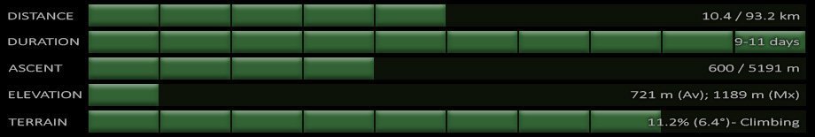 The Western Arthur Range report from the Bushwalking and Track Review (BATR) Panel to the Parks and Wildlife Service divided the range into three areas and ranked them by difficulty : from Alpha Moraine to Lake Cygnus (including the Lake Cygnus Campsite), designated a class 3 (class 5 with my grading); from the junction down to Lake Cygnus to Kappa Moraine (including the moraine descent), designated a class 4 (class 6 with my grading); and from junction of Kappa Moraine on the range to Strike Creek, designated a class 5 (class 7 with my grading). The report also recommends that party sizes should not exceed 8 people for Lake Cygnus to Kappa Moraine, and should not exceed 6 people for Kappa Moraine to Strike Creek. The reason for this is to minimise erosion and to limit track widening.
Weather
Equipment
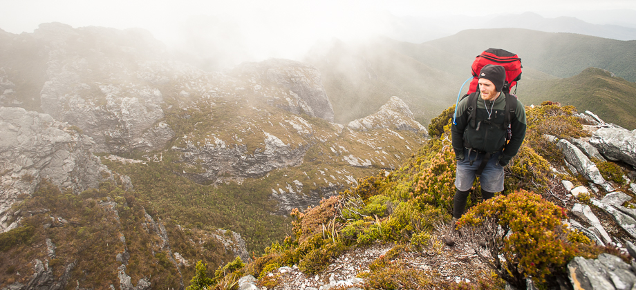
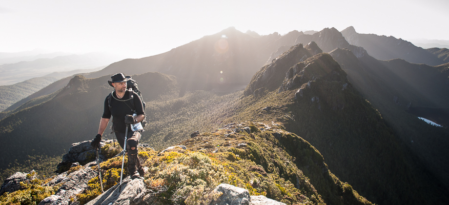
A decent, tough tent is absolutely essential on this range. A lot of sites say that 4-season tents are mandatory, but 3-season tents that can hold up to the heavy rain and the strong winds of the Western Arthur's should be fine. A decent waterproof and windproof jacket is essential, and so is a warm sleeping bag. Take care to keep your sleeping bag dry at all times as a wet sleeping bag could drastically shorten your trip. Here is a list of some of the gear that I brought with me: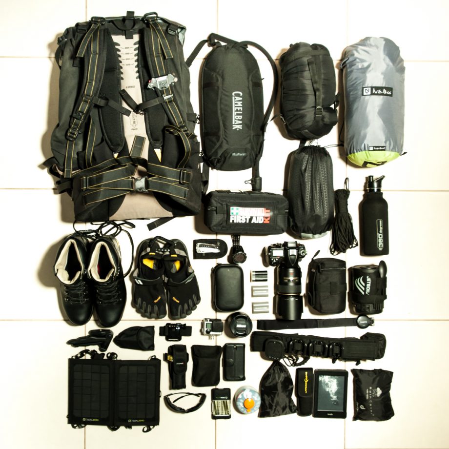
| 01.85 l One Planet Strezlecki (Gridlock Waterproof Canvas) 02.Camelbak StoAway 03.OEM Sleeping Bag 04.Nemo Galaxi 2P Backpacking Tent (Birch Leaf Green) 05.First Aid Kit 06.Exped Downmat 7m 07.550 Paracord 08.360 Degrees Bottle 09.Karrimor Orkney 5 Walking Boots 10.Vibram Fivefingers TrekSport 11.Leatherman Freestyle 12.Suunto Ambit 13.Headlamp(s) Pouch 14.Nikon EN-EL15 Battery 15.Nikon EN-EL3e Battery 16.Nikon EN-EL3e Battery 17.Nikon D7000 18.Nikkor 105 mm f/2.8G IF-ED AF-S VR 19.Lens Pouch 20.Jetboil Zip | 21.M-07 Adjustable Mini Tripod 22.Foldable Trowel 23.GoPro Headmount 24.GoPro Hero 4 Black Edition 25.Nikkor 50 mm f/1.8G AF-S 26.Suunto Dual Comfort Belt 27.GoalZero Guide 10 Plus Solar Kit 28.LED Lenser P7.2 29.Battery Pouch 30.HTC One SV (4G LTE) 31.Bobster GXR Sunglasses 32.GoalZero Guide 10 Plus Solar Kit 33.Jetboil Fuel Cannister 34.SPOT Connect Satellite Communicator 35.Utility Belt 36.Sawyer Mini Water Filter 37.Adventurer Opti Water Purifier 38.Kindle Paperwhite 39.Deuter Raincover | ||||||||
Sustenance
Water is fairly abundant along the range. There are however certain sections of the trail that lack sources of water so be sure to bring at least a day's supply of water with you each time you set out. Try and collect your water from streams or from the inlets of the lakes, rather than the lakes themselves. I would also recommend treating the water prior to consumption - I personally use a combination of the Sawyer Mini Water Filter and the Adventurer Opti Water Purifier. Open fires are also banned on the range, so fuel stoves are the only way to boil water and cook food. I personally do not like open fires because of the impact that they leave (Leave No Trace), and urge you to try and avoid them elsewhere even if they are allowed.The Full Traverse
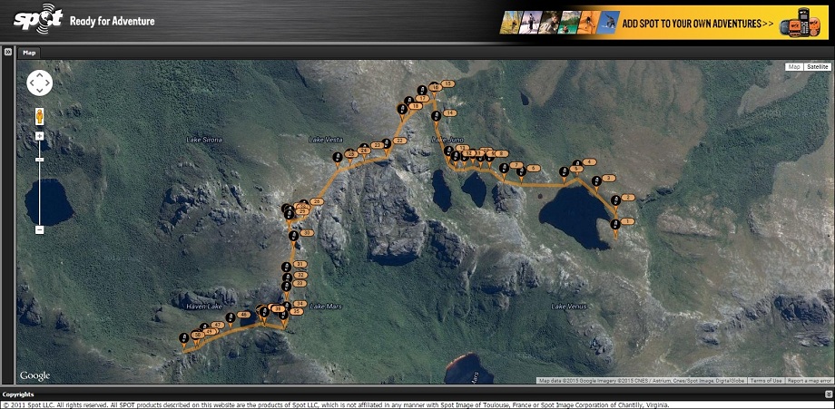
The map below has sections of the path that I followed hyperlinked and clicking on each section of the route will bring you to its respective page (if the map does not work for any reason, you may also find the links at the top of this page). The GPS routes for each leg of the journey can also be found at the end of the post for each of the respective days.Interactive Location Map
Next : Western Arthurs Day 01 - Scott’s Peak Dam – Junction Creek (Part 1)
Australia Overview


