Cape to Cape Day 05 – Conto's to Deepdene
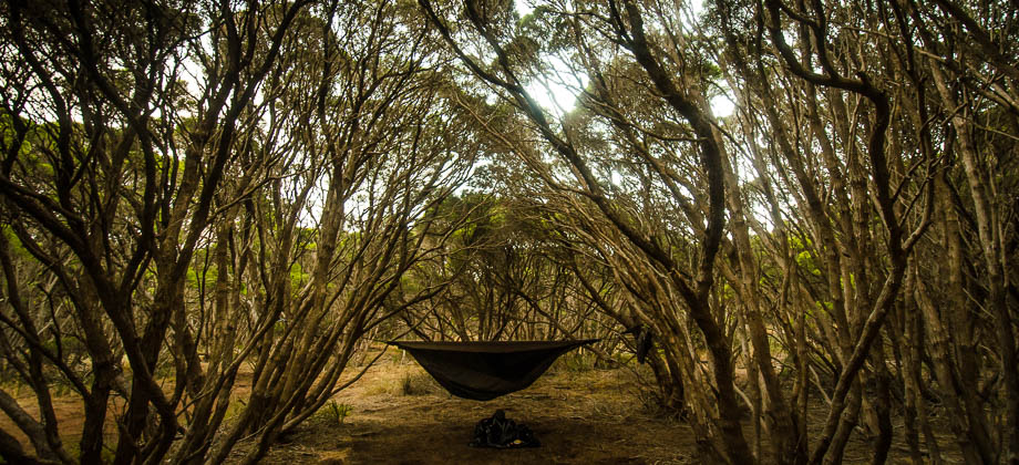
The Boranup Karri Forest

I was very eager to get away from the crowds of
Canto's Campsite that morning, so I packed up my
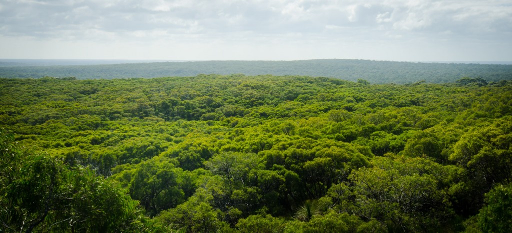
hammock quickly and skirted the hoards of camper vans and oversized (and excessive) tents in order to make my way out of the campgrounds. I arrived at the sign outside the entrance and turned left down the trail, circumventing the boundaries of the massive campsite. The trail was refreshingly thin here and undulated around the bushland for approximately 900 metres or so with views opening up of the beautiful green carpets of the canopies of trees off in the distance to my right. I reached a junction that branched off left back to Canto's (that is how big the campgrounds were!) and right descending into the woods along a firebreak that carved through the foliage as far as my eye could see.
I continued along the path as Australian magpies
(Cracticus tibicen) and Australian ringneck parrots
(Barnardius zonarius), also fondly known as 'Twenty-Eights'
(Subspecies : semitorquatus), flitted from tree to tree above my head singing and squawking as they did. The path veered left as it joined a dirt road that brought me straight through the
Point Road campsite, approximately 2 kilometres away from the entrance to
Canto's Campsite. The campsite was fairly large, albeit no where near as large as Canto's, and subsequently much quieter. Despite the camping fee of $7.50 per adult imposed, I would much rather have stayed the night here instead of Canto's. I came to the
junction of Point Road and Georgette Road and turned right continuing on south along the Cape to Cape track.
The forest came to life at this point, with the birds flitting around in the 20-30-metre-high canopies, entertaining me with their chirping and whistles. Hoots and squawks of parrots
(Family: Psittacidae) and cockatoos
(Family : Cacatuidae) - the name having been derived from the Malay word 'kakak tua', meaning 'old, elder sister') soon joined in, along with the cackles of the occasional laughing kookaboora
(Dacelo novaeguineae). The soundtrack of the forest had begun, and for a moment I felt as if it was being played solely for me, welcoming me to the magnificent Boranup Karri Forest.
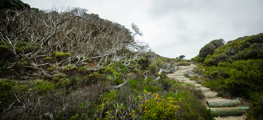
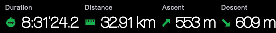
After 3.7 kilometres from Canto's, I veered left at the crossroads and settled into a comfortable and relaxed pace of 4.4 km/h, walking down the leaf-strewn path as crepuscular rays of sunlight pierced through gaps in the canopy above.
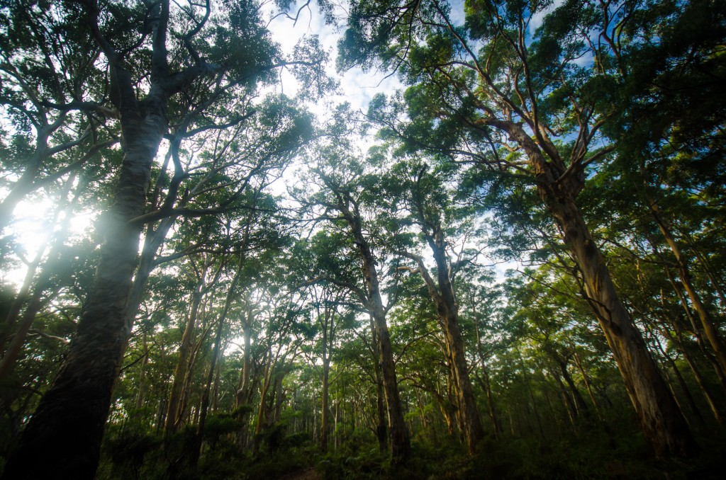
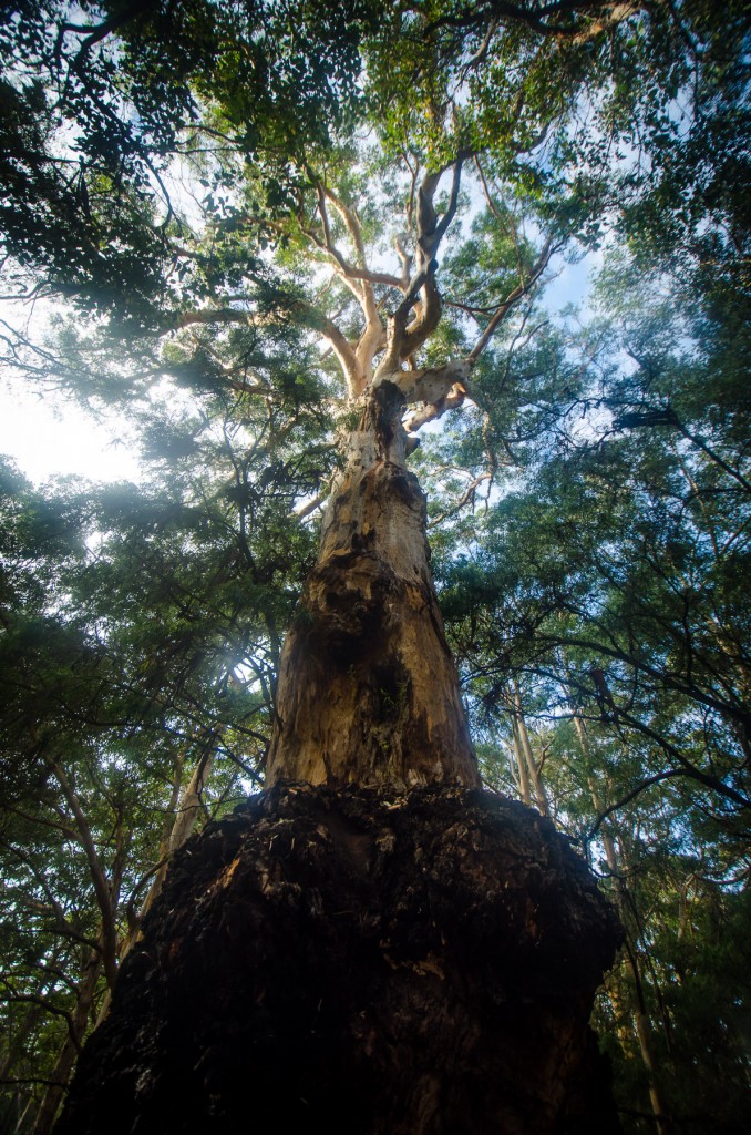
The trail ended up turning right once again into Daves Road (from Brozie Road) at the 4.3 km mark. Here the canopy of the Karri trees
(Eucalyptus diversicolor), with their smooth pale grey trunks that shot up to easily 40 metres high, completely towered over me. Karri trees are a type of Eucalypt that can reach heights of up to 90 metres, making them the third tallest tree in the world. My
Suunto Ambit was indicating that 5 kilometres had already passed (almost 16% of the entire days hike!) since I broke camp, which surprised me as I still felt as fresh as I had been then. There was no hint of weariness at all, and I wasn't too sure why this was - perhaps it was the gorgeous forest surrounding me, the soft and pleasant morning light, the firm ground that I was hiking on, or perhaps it was because of the good night's rest and the hearty breakfast I had that morning...
I found the layer of leaves on the forest floor to be almost compost-like and the soil underneath to be soft (possibly nutrient-rich loam?) - the sparseness of the vegetation very different from the rainforests of
Malaysia that I was used to. I reached another junction at the 5.9 km mark, with the right turning heading down Donovan Road and the Cape to Cape track continuing straight along Daves Road. At the 9.1 km marker, Davies road met a junction where the trail turned right leading uphill along Trig Road, crossing Georgette Road half a kilometre later. Trigg Road carried on uphill and finally reached the junction that turned right to the viewpoint at the 10.5 km mark.
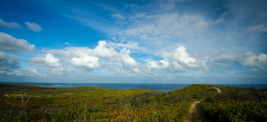
I had been making decent progress since I had started that morning, with an average speed of 4.6 km/h so I decided to take a short detour and head up to the
Boranup Hill viewpoint, thinking that after having already covered more than 10 kilometres, a viewpoint at the top of a hill would make a perfect place for the first rest stop of the day. The viewpoint was basically a small clearing with a small tower that had a metal ladder leading 2.5 metres up to the viewing platform. I stopped to take in the views for 20 minutes or so and made an altimeter reference adjustment (peak height was 194 metres) before descending back down to the junction.
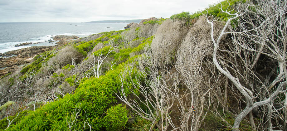
I continued along Trig Road, past another junction, and to a gate right in the middle of the path (this was at the 13.2 km mark - if you skip the viewpoint, please take into consideration that an extra 1 kilometre was added on due to the Boranup Hill detour from here on in). Since it had just turned noon and the sun was high in the sky, I stopped for a minute or two here to take out my
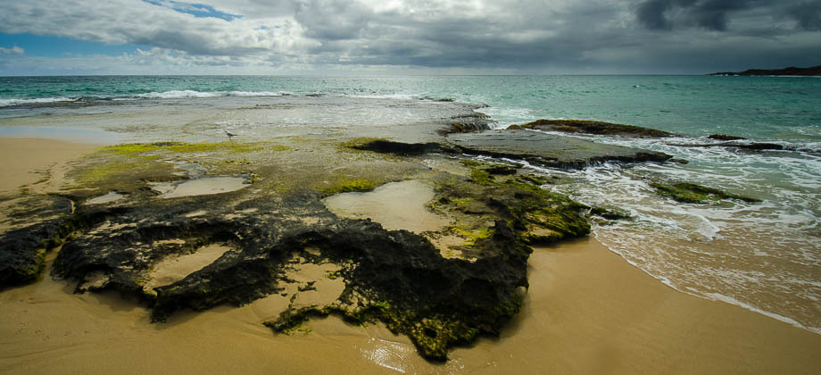
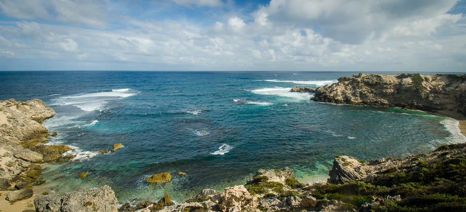
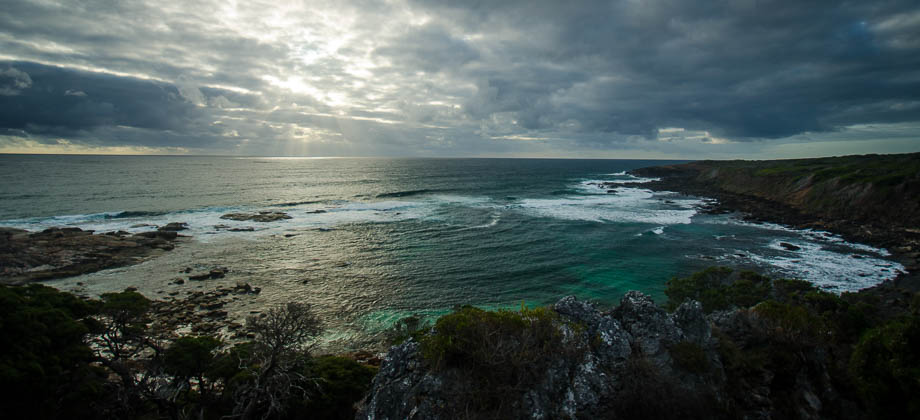
GoalZero Solar Kit and to strap it to the top of my backpack. The path then descended down the hill before turning right at the junction to Boranup Road. As the trail made its way down to the coast once again, the trees became more sparse and the path a lot more sandy.