
April 6, 2014
Posted by Ramon Fadli in Australia, Class 2, Day Hike, Hiking, IUCN Protected Category 2, Looped Hike, Mediterranean, National Parks, Outback, Sclerophyll & Mediterranean Forests, Western Australia
Echidna Trail
Top Trails of Western Australia
Echidna Trail
Difficulty Rating : 2.2 / 10.0
(Class 2 - Very Straightforward)
*Click here to learn more about the difficulty rating.
Getting There
Location of carpark (-31.731984, 116.074934)
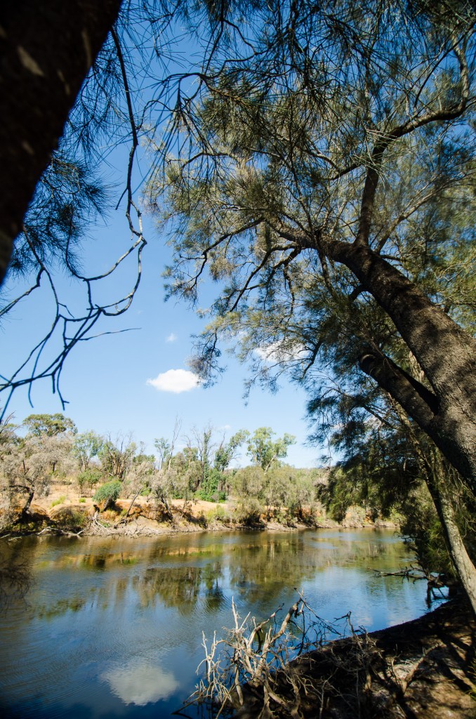
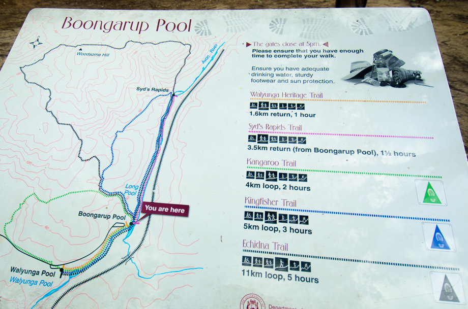
 This part of the Avon River is well known for its rapids that thunder and crash through the valley in winter but just trickles along past pools separated by boulders in summer. The rapids used to end at a rock garden - an area that was strewn with rocks and stones and was completely blocked by a large boulder in the centre. Back then in order for kayakers and canoers to circumvent this obstacle, portaging used to be required (carrying water craft over land), something that often required quite a lot of effort.
According to legend, a team from the Swan Canoe Club came down to the rock garden some time ago and broke up the boulder with sledge hammers in order to create a path for kayaks and canoes to be able to get through without portaging. They had then decided that the first person to get through the section successfully without any portaging would have the rapids named after them. This honour fell to a young man called Syd Ambler - thus the name 'Syd's Rapids'. The rapids are also known for the Avon Descent, an annual white water rafting event that passes through the area.
This part of the Avon River is well known for its rapids that thunder and crash through the valley in winter but just trickles along past pools separated by boulders in summer. The rapids used to end at a rock garden - an area that was strewn with rocks and stones and was completely blocked by a large boulder in the centre. Back then in order for kayakers and canoers to circumvent this obstacle, portaging used to be required (carrying water craft over land), something that often required quite a lot of effort.
According to legend, a team from the Swan Canoe Club came down to the rock garden some time ago and broke up the boulder with sledge hammers in order to create a path for kayaks and canoes to be able to get through without portaging. They had then decided that the first person to get through the section successfully without any portaging would have the rapids named after them. This honour fell to a young man called Syd Ambler - thus the name 'Syd's Rapids'. The rapids are also known for the Avon Descent, an annual white water rafting event that passes through the area.
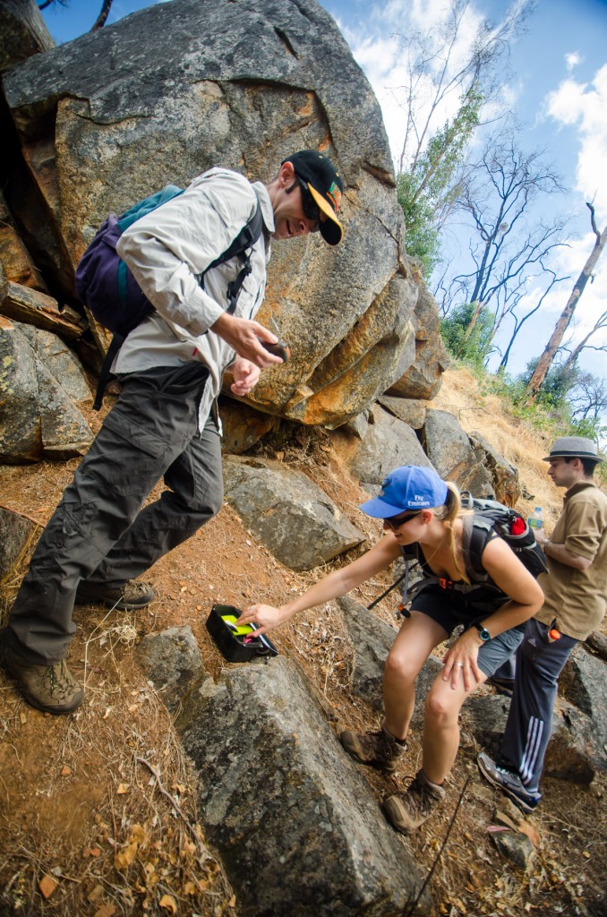
A short introduction to Geocaching
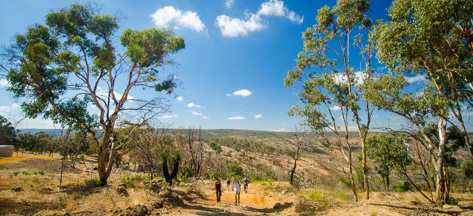
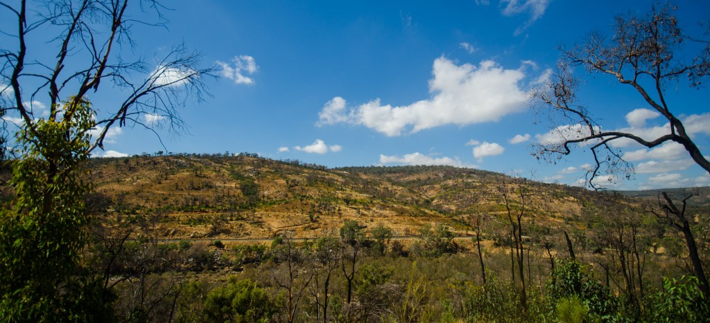
At the junction, the trail that veered left continued to head south-westerly along the five-kilometre-long Kingfisher Trail, so the group carried on northwards along the Echidna Trail instead. The trail began to ascend almost immediately, gaining 150 metres of elevation in one kilometre of walking. I enthusiastically welcomed the climb though as the views off to the east had opened up revealing the train tracks that ran parallel to where we were but on the other side of the river instead. We carried on climbing up the wide trail caked with hardened brown earth as freight trains occasionally rumbled through the valley.
Getting There
Next : Echidna Trail (Part 2)
Australia Overview


