GBB (CUS Connection) - Day 4
Camera Traps

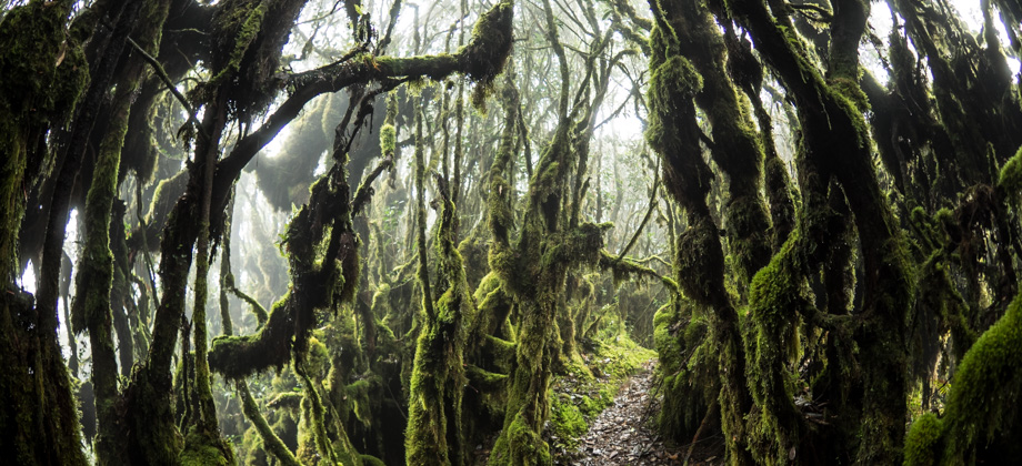
The early part of the day's trail was confusing at best. The water-point from 'Kem Sarsi' was a small stream that could be reached with a five minute downhill walk via at least four left turnings just after the campsite. The trail that continued on from there was through a convoluted mixture of turns that went down the same path, but the 'combination' was left, left, right, then left, instead.
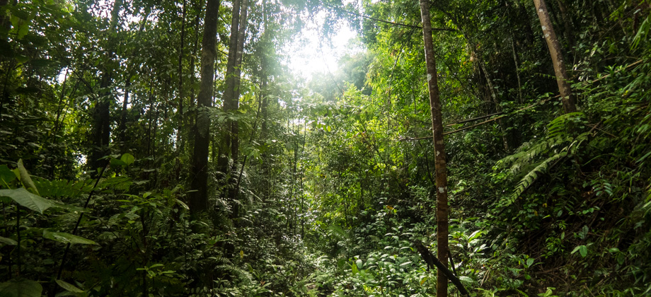
We packed up and left camp late again that day, and made our way along the sometimes narrow and sometimes wide trail. The trail passed camera traps that were attached to the trunks of trees. These motion-sensor-triggered cameras were installed to both document the types of wildlife that can be found in the area as well as help reduce the number of poachers. Most people are under the impression that poachers are only in search of wildlife and their parts to sell to collectors and for (so-called) medicine, but poachers also search for forest resources such as the much-sought-after and critically endangered agarwood
(Aquilaria malaccensis), or 'gaharu' in Malay. When agarwood becomes infected with dark-walled fungus
(Phaeoacremonium parasitica), it excretes a resin that gives its wood a fragrance that is used to make both incense and perfume.
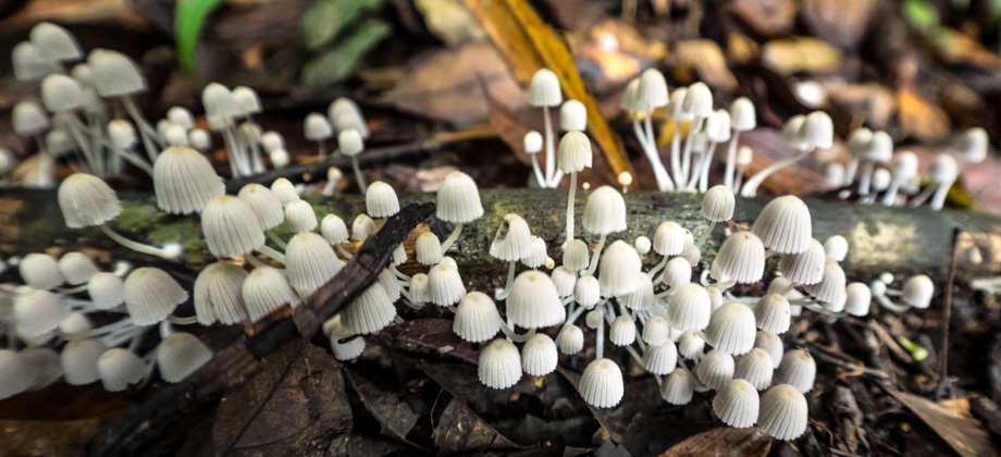
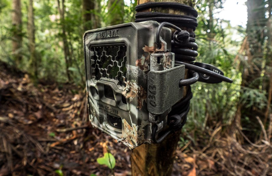 One of several camera traps that we encountered
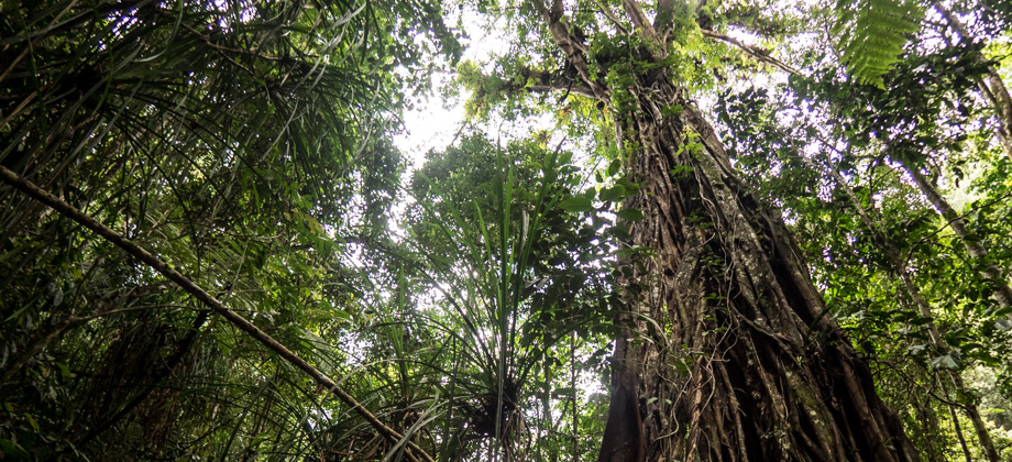
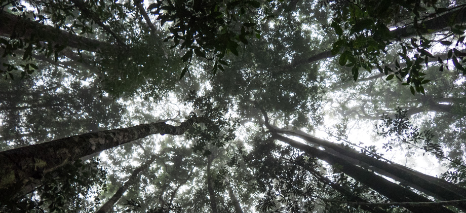
About 2.5 kilometres into the trail, the foliage began to thin out and we stopped for a while on the side of the hill. It was the last point where we were able to get mobile reception (at least for Celcom and U Mobile), so we made some quick calls back home just to check-in. We then dipped down the shoulder of the hill, before climbing back out once again and straight up to a point that is referred to as 'Puncak Lunch', or 'Lunch Summit'. Along the way, we passed openings to the south-east that showcased some lovely views of the verdure that surrounded us.
There were plenty of flowers along the trail. Aside from numerous red rhododendrons
(Rhododendron spp.) and yellow and white orchids
(Family : Orchidaceae), several flowers from the
Henckelia genus were spotted. Henckelia flowers are typically seen in low altitudes in forests that are cool and that have plenty of shade. A lot of the flowers had yellow nectar guides on their lower lips that looked almost like a landing strip. These guides are patterns that are meant to lead pollinators to the pollen on the stamen of the flowers. The fruit of the plant could also be seen emerging as a long capsule or pod above the flowers themselves.
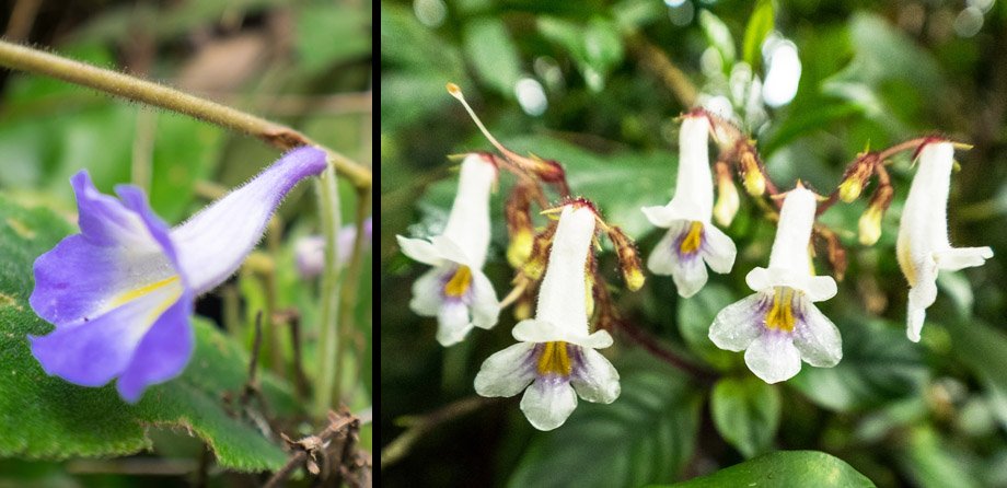 Henckelia curtisii and the long fruit pod above the flower; a cluster of Henckelia hispida
The Weird & the Wonderful
We then dropped down to another shoulder where dense foliage weighed down the forest and refused to let light through. Strange armoured creatures were spotted on the sides of the trail here. Some had bright aposematic colouration and scuttled frighteningly fast across the path, such as an almost half-metre-long venomous giant centipede
(Scolopendra dehaani); whilst others were more subtle and barely moved, such as a female trilobite beetle
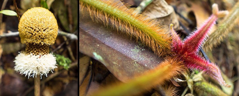
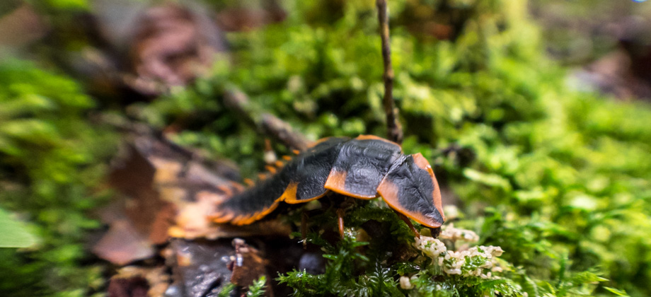
(Platerodrilus sp.) that was tending to her eggs.
 A female trilobite beetle (Platerodrilus sp.); her cluster of tiny eggs can be seen smeared across the moss just in-front of her tiny head
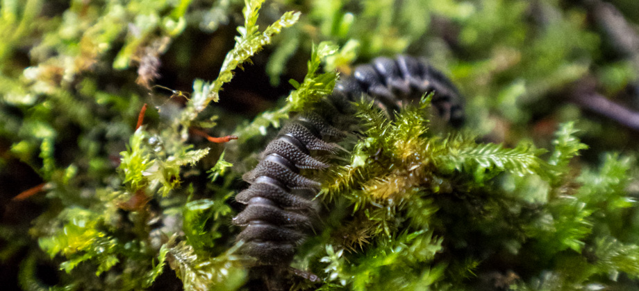
There were fluffy plants and creatures too. The bulb-like flower-heads of the stink bean tree
(Parkia speciosa), also known as 'petai', were occasionally seen; the seeds of which are commonly eaten all around Southeast Asia. The frilly white 'tails' of planthopper nymphs
(Superfamily: Fulgoroidea) could also be seen moving about on the forest floor and were sometimes seen completely covering other plants, leaving the stems blanketed in white fluff. Their 'tails' are actually wax secretions from glands on their abdomen that are thought to be used as a form of concealment.
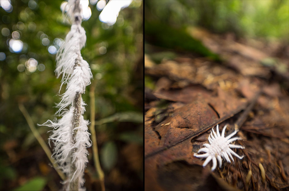 Planthopper nymphs (Superfamily: Fulgoroidea) on the left; ladybird beetle (Family: Coccinellidae) larvae on the right, most likely that of the dusky ladybird beetle (Tribe: Scymnini)--both of which display wax secretions
We came upon a large red warning sign soon after. The sign stated that the surrounding area was the customary land of the
Temiar, the second largest group within the 'orang asli', or indigenous peoples of Peninsular
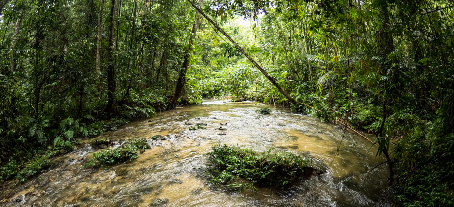
Malaysia. There was a junction almost immediately after with a turn to the right that was completely blocked off. The main trail continued onwards instead and veered sharply to the left before it descended to the river down below. We followed the river to the left before ascending up to the shoulder not too long after. From there, the trail ran parallel to the river (on its left) and then crossed several streams before reaching 'Perodua Camp' at the 6.75 km mark. Perodua Camp consisted of a wide clearing next to a large and fast-flowing river, and was a perfect place to stop for a quick lunch break.


")
 - Day 3")
 - Day 2")