


October 5, 2018
Posted by Ramon Fadli in Broadleaf Rainforests, Camping, Class 7, Forests, Guided Hike, Hiking, Kelantan, Malaysia, Mountains, Multiday Hike, Perak, Tropical Rainforest
GBB (CUS Connection)
GBB Day 1 : Ascent from Pos Balar
GBB Day 2 : Rata Air to Huhuhu Camp
GBB Day 3 : Gerah, Bilah, Bieh
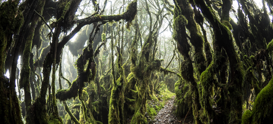
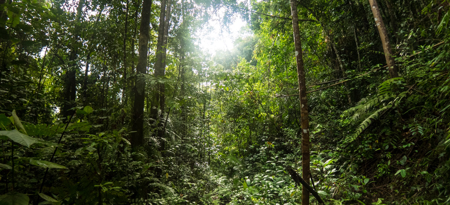
Titiwangsa Range
GBB (CUS Connection)
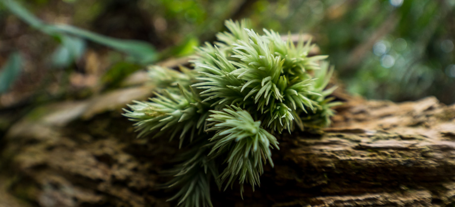
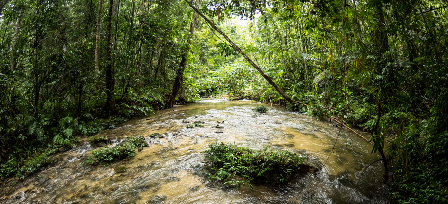
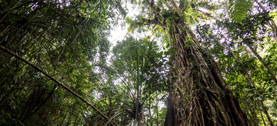
The hike to Mount Gerah (elevation : 2103 m), the 13th or 17th highest mountain in Malaysia (based on prominence or sheer elevation respectively), almost always covers its sibling-peaks as well: Mount Bilah (elevation : 2077 m) and Mount Bieh (elevation : 2073 m); and is always referred to as 'GBB'. While the GBB hike normally begins and ends at the Temiar settlement of Pos Kemar
Disclaimer
This hike is one of five entries on this website (out of more than a hundred) that made use of a guide. I personally am a big advocate of independent travel and self-guided hiking that does not require guides or porters. My reasoning is as follows (in no particular order): Less costly: Aside from the cost of permits, self-guided hiking has no guide expenses that need to be covered, and hikers also have full control over the cost of their meals. Guide expenses tend to normally be shared out amongst the group, which means that the larger the group, the less each hiker will have to pay. Less environmental impact: Without the burden of guide expenses, group sizes can be kept much lower. Small groups tend to be far more mobile and significantly reduce their impact to trails and campsites. Large groups also have a profound impact on other groups that are sharing the trail. I personally feel that groups of more than 4 or 5 people tend to be too large. Read up on Leave No Trace (LNT) principles for more info. More independence: Self-guided hiking requires hikers to be knowledgeable in multiple skills--navigation and route-finding, survival techniques, and wilderness medical skills just to name a few. It requires a level of fitness that allows hikers to be fully independent and to be able to carry all the gear that they will need without requiring the services of porters. Hikers that are unprepared should simply not be allowed on the trails. The trails are currently overloaded with hikers who should not be there in the first place. High customisability: One of the best things about independent travel is researching the location prior to the trip. This inevitably means that you will know far more about the area that is traveled through compared to someone who just goes in blindly expecting the guide to handle everything. You get full control over the planning of the route as well as developing contingency plans in situations such as inclement weather or medical emergencies. You also get to determine your own pace and can choose to stop if you need a moment of peaceful reflection. Who wouldn't want to enjoy nature on their own terms?"The Wildlife Crime Hotline, managed by the Malaysian Conservation Alliance for Tigers (MYCAT), provides YOU an avenue to report offences involving endangered wildlife in Malaysia. We protect the identity of all informants, only key info of the reports are forwarded to the authorities."
Emergency Numbers
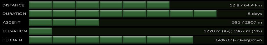
Wildlife Crime Hotline 019-356 4194 Wildlife Department 1800 885 151 Gua Musang District Police HQ 09-9121222Difficulty Rating : 5.0 / 10.0
(Class 7 - Challenging)
Interactive Location Map
Continue on to the entries for each day by clicking on their respective
sections on the map below. If the map does not work for any reason,
you may also find the links for each day at the top of this page
GBB
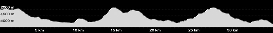
Elevation profile for the entire route (hovering your cursor over the image below will reveal highpoints )
Next : GBB (CUS Connection) Day 1 - Ascent from Pos Balar
Mountains of Malaysia
Malaysia Overview
 - Day 3")
 - Day 1")
 - Day 2")
 - Day 4")
Very very informative blog. please keep these up and perhaps you can back track your previous hikes too. I recently did CUS dayhike. unfortunately i am reading your blog AFTER i finished. But i was quite prepared. managed to finish in 30 hrs (with 3 hrs sleep in the middle)