Western Arthurs Day 6 : The Beggary Bumps
The Beggary Bumps

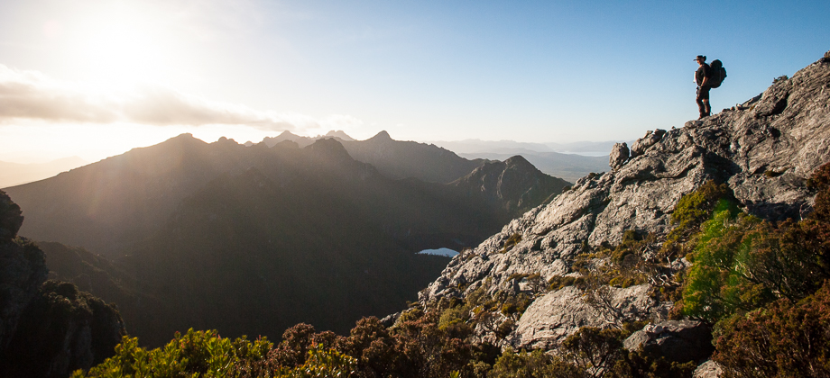
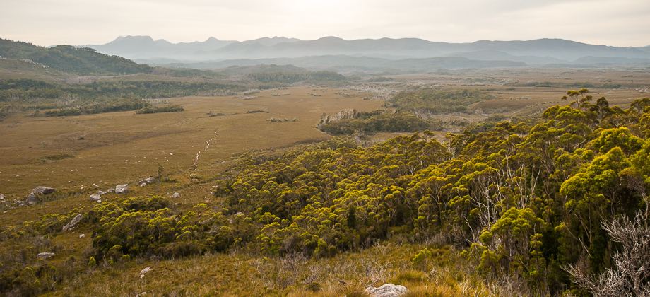
We set off from
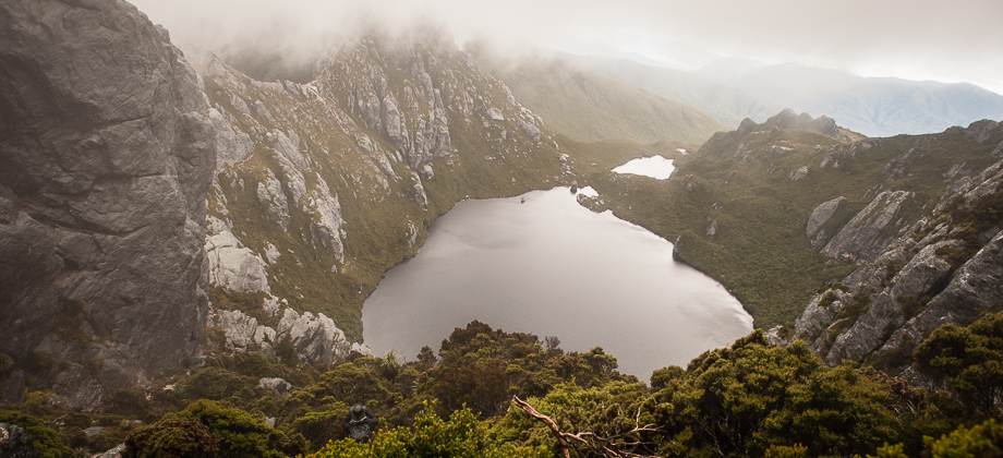
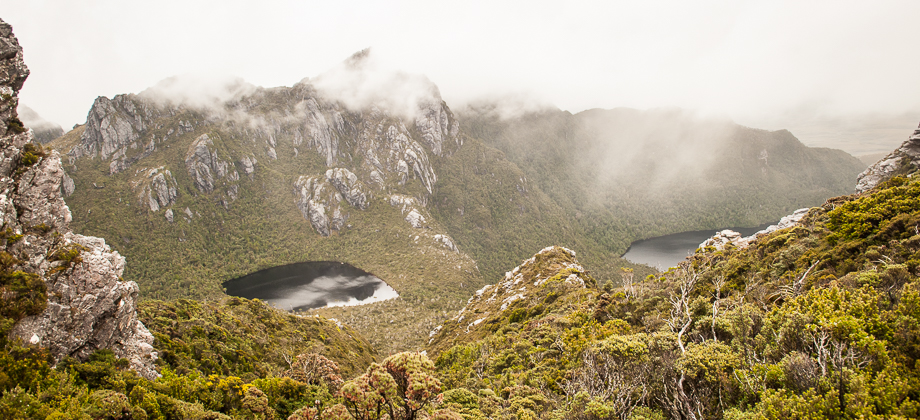
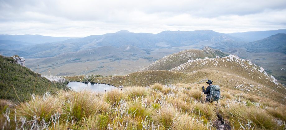
High Moor at 10:00 that day, very glad that the storm had finally subsided. After clearing camp, we walked south-eastwards along the wooden walkway, past the toilet, and began the short climb onto the ridge above us. When we reached the top, we were greeted by spectacular views of the lakes as the ridge ran above and between the two lakes of Lake Saturn and Lake Ganymede, with the former on the left and the latter on the right (traveling eastwards).
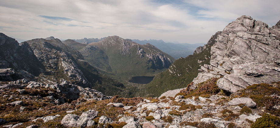
 Lake Ganymede from the High Moor ridge
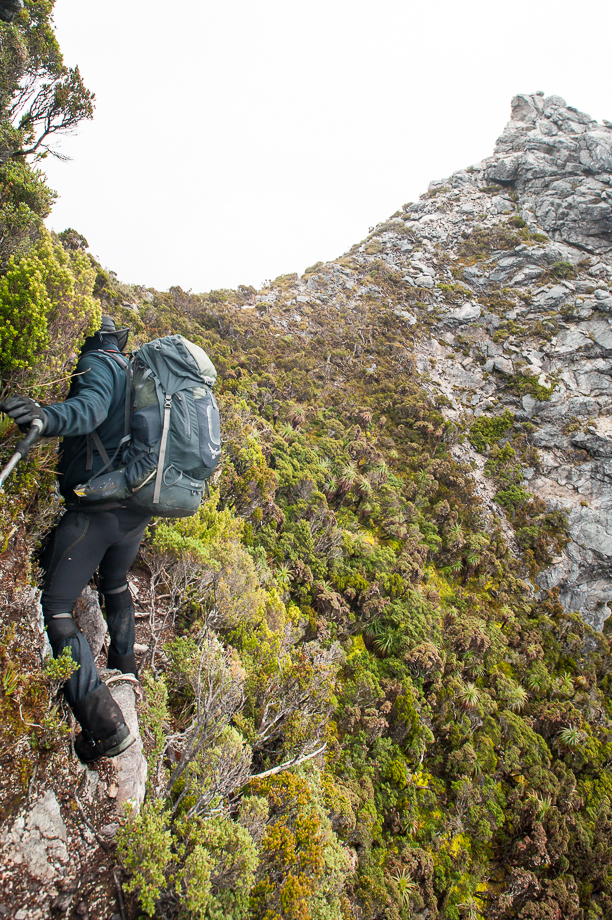
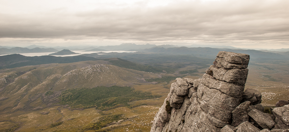
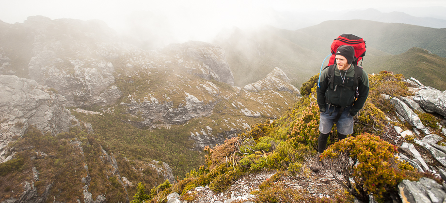
The Beggary Bumps lay just ahead of us and we were able to see a lot of sections where descents had to be made down scree-filled gullies as well as large, jagged rock formations, that would require us to scramble up and over, trying our best to avoid the very exposed drops between each formation. Everything that I had read about the Beggary Bumps had left me feeling a little apprehensive about this section but I pressed on nonetheless.
We made a sharp right turn and scrambled steeply down a gully before rounding a bump on the left side that brought us to a shoulder that had glorious views of Lake Dione and Lake Saturn with Dorado Peak in-between. As we were rounding the next bump, but on the right side this time, we passed a high-altitude trail runner who was equipped with just a water bladder and some energy bars. He stopped for a minute to say that he was trying to run the full traverse (more likely Kappa to Alpha Moraine) in just 12 hours, before running off once again. We continued on past the shoulder and up and over the bump with another steep, almost vertical, descent right after.
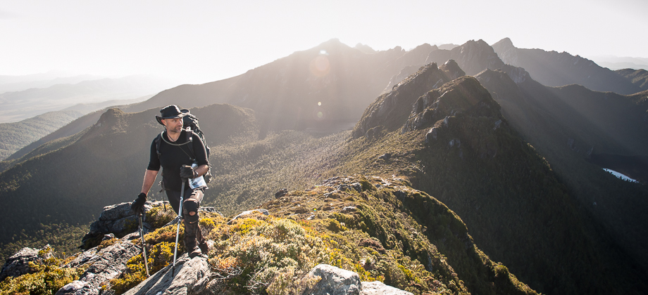
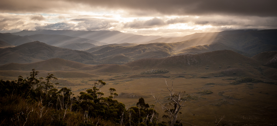
I was glad the weather had improved. The skies were clear and the views around us were completely breathtaking. It was still wet and slippery though as residual water still dripped slowly down the rocks, through the moss lining the sides, and down to the mud and roots below. We reached the tilted chasm not long after and began the steep descent down. I immediately found myself marveling at the stark contrast between the soft green moss on the right and the hard, bare rock on the left of the chasm. The surface of the chasm however, was very eroded and filled with plenty of loose scree, so I decided to drop back a little to ensure that none of the rocks would end up getting knocked down onto anyone below. At the bottom of the chasm, the path wound around the edge to traverse east along the southern foot of the cliffs, before beginning its ascent up to the Dragon (
elevation : 1006 m).
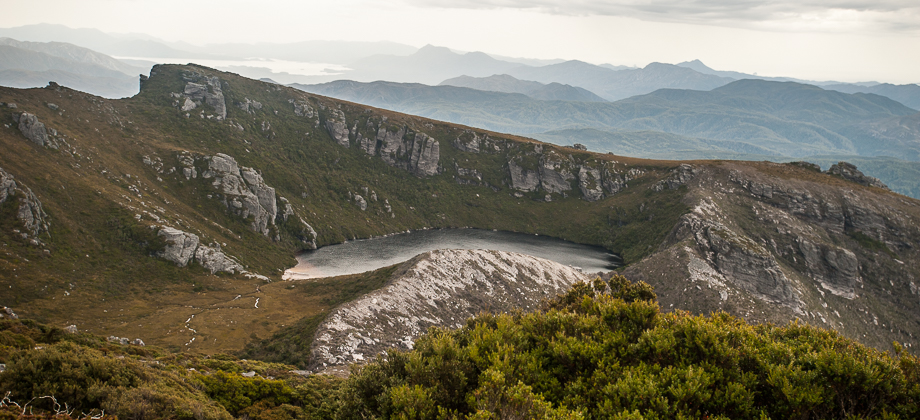
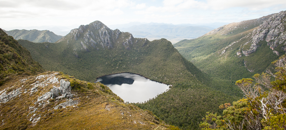
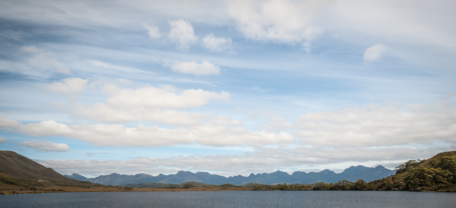
 Looking back at Lake Dione and Lake Saturn
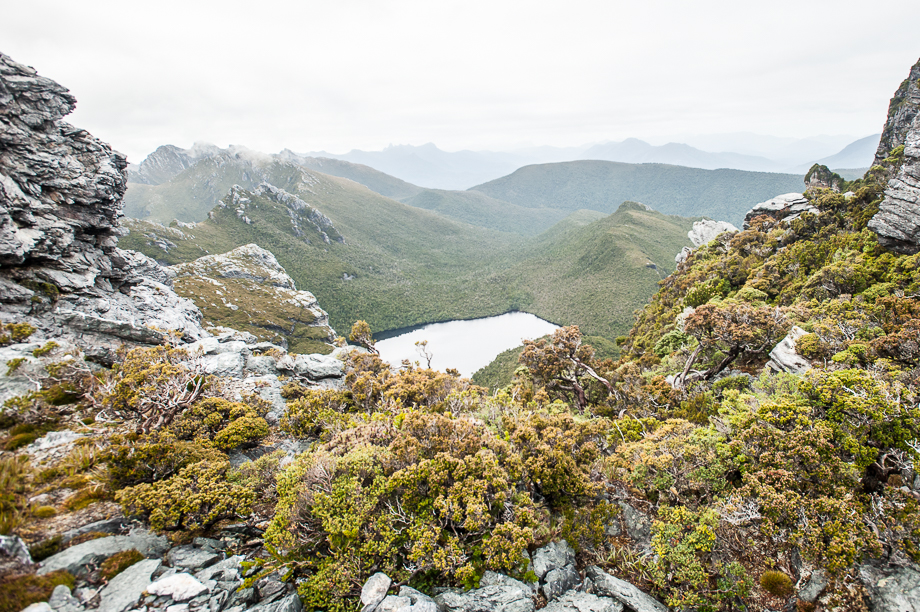
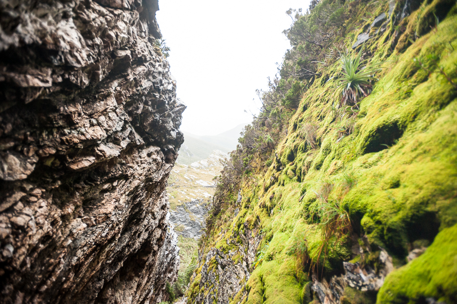 The Tilted Chasm
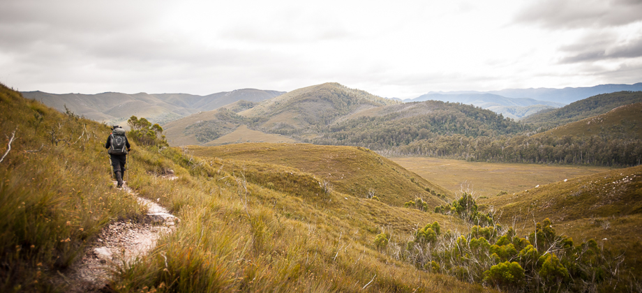
The path curved right to once again traverse the southern side of the range on the slopes of the Dragon, before dropping down into another scree-filled chasm. Looking down this chasm, one could see the curve of the eastern bank of Lake Ganymede down below, peaking out from behind the sides of the cliff. I stopped here for a while to take some macro shots, but in my haste to catch up, I negligently continued to descend down the gully past a thin string that had been strung across the path. The descent down the gully ended up becoming increasingly treacherous and it dawned on me that I must have gone off the path. I laboriously made my way back up and soon found that the path had very obviously snaked off to the left instead of continuing down the chasm.