
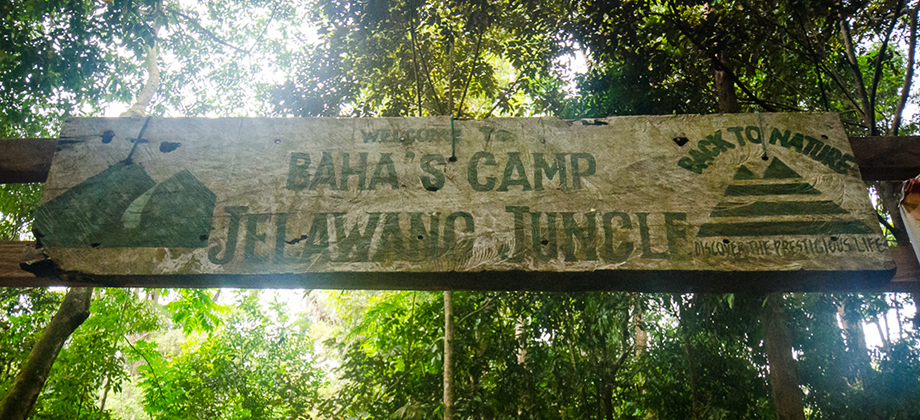
Baha's Camp
Stong Waterfall - Mount Stong, Ayam, Baha
Stong State Park
Baha's Camp lies near the top of the (apparently) 270-metres-high seven-tiered Stong Waterfall, making it one of the tallest waterfalls in Peninsular Malaysia, that is located in the 21,950 hectare 'Gunung Stong State Park' (formerly known as Jelawang Forest). The camp serves as a launching point for trips up to the higher levels of the waterfall as well as for treks to the multitude of peaks that one can find in the area, the most renowned being Mount Stong and Mount Ayam.
Before we go on, please jot down the numbers that are listed below. If you do see any suspicious behaviour when out hiking, encounter things like traps and snares, or even see protected animals or their parts that are sold as either collectibles, pets, or for (so-called) medicine, then please do not hesitate to contact the wildlife crime hotline. Be sure to try and document it as best you can with photos or video without putting yourself in danger, and take note of the details: descriptions of those who are involved, as well as when and where it took place."The Wildlife Crime Hotline, managed by the Malaysian Conservation Alliance for Tigers (MYCAT), provides YOU an avenue to report offences involving endangered wildlife in Malaysia. We protect the identity of all informants, only key info of the reports are forwarded to the authorities."
Emergency Numbers
Wildlife Crime Hotline 019-356 4194 Wildlife Department 1800 885 151 Kelantan Forest Territories 09-9556 055 Jeli Health Office 09-9440 333 Jeli Bomba 09-9440 444 Jeli Police Station 09-7867 222The entrance to Gunung Stong State Park lies relatively close by the small town of Dabong in Kelantan. The town can be reached by either following the road from Kuala Lipis to Gua Musang and then on to the D29 trunk road that goes straight up to Dabong, or by taking the overnight intercity KTM train (also known as the 'Jungle Train' since it passes through heavily forested areas) that leaves KL Central around 20:30 and arrives in Dabong around 07:00 the next morning. Once you arrive in Dabong you will find signs alongside the road (or when in doubt ask the locals) that point the way to the park.
Getting There
By the time we arrived at the park, it was pretty late so we quickly repacked our backpacks after paying the entrance fee and started to make our way towards the trail entrance. Before that however, one of the guides came over and foolishly tried to scare us with talk of bears and tigers and the difficulty and trickiness of the trail. Since there were no guides (apparently) available, he was going to let us go on to Baha Camp without one, and said it in such a way as to almost seem as if he were doing us a favour. He then went on to sternly state that if we were to head for any of the summits, we would have to retain the services of one of the guides that we would be able to find at Baha Camp.
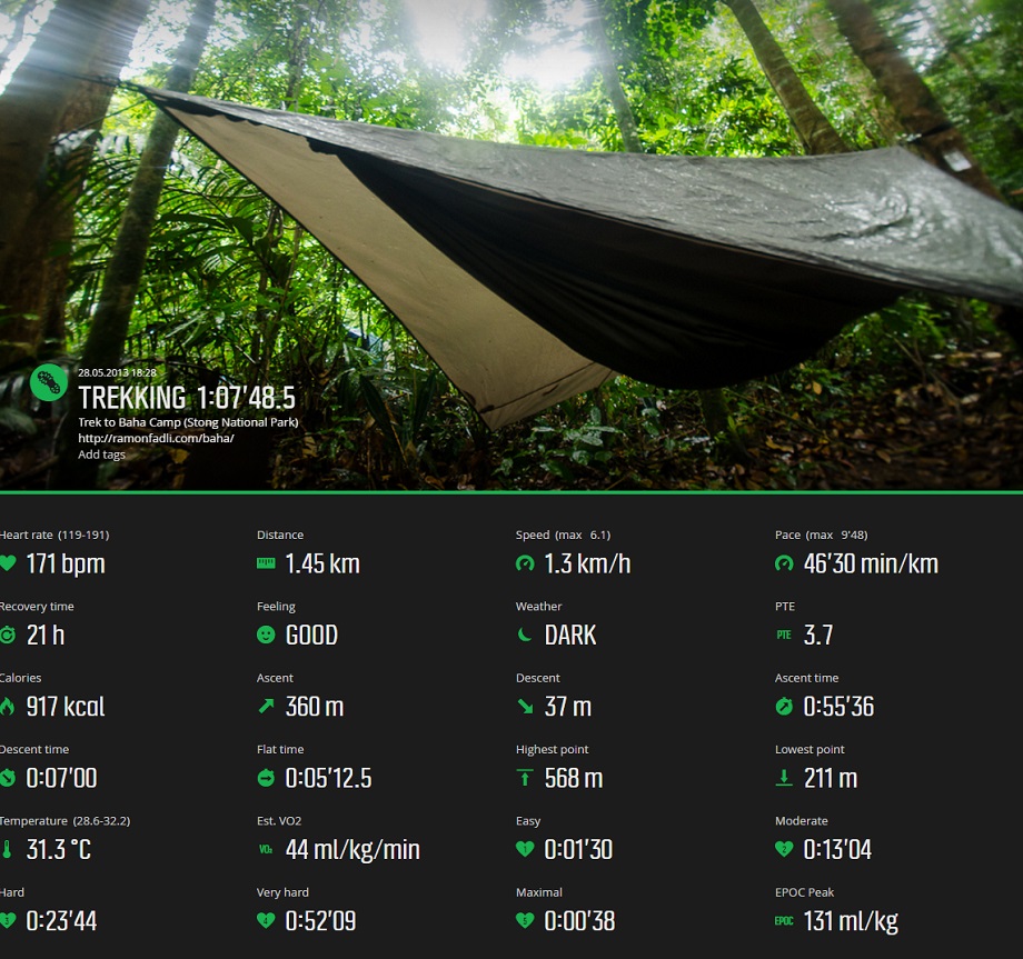
Trail up to Baha's Camp
Difficulty Rating : 2.2 / 10.0
(Class 2 - Very Straightforward)

We made our way west up the slope and onto the concrete stairwell that lead us past tall trees with huge, sprawling buttress roots and old, dodgy looking wooden chalets that were scattered around the area. The path lead to a bridge at the base of the waterfall which was the junction between the waterfall trail and the forest trail. The path just before the bridge continued to lead west and would have taken us up along the southern side of the waterfall whereas the trail that continued on after the bridge took us into the forest. Since it was starting to get dark fast at that point, we chose the latter.

The very obvious trail also bore west after the bridge (northern side of the waterfall) and began to climb almost immediately. The inclination was normally between 30 to 45 degrees but reached 60 degrees or more at certain sections, although there were ropes that had been setup to assist the ascent. The climb felt a little bit more strenuous than it normally would have as we were also carrying fairly large backpacks (possibly up to 15kg in weight).
We reached a little shed after about 30 minutes of very slow trekking (covering a distance of 570 metres) where a left turning would have taken us to the side of the waterfall. Those who follow the waterfall trail from the park entrance would have to cross the waterfall and make their way up this path to converge with the main trail that we were on. Shortly after, with just over an hour of trekking, we reached Baha Camp.
Route Playback
Suunto Movescount Stats

Next : Baha's Camp (Part 2)
Malaysia Overview


