

Tabur X (Extreme)
Tabur West - Tabur East Tabur Far East - Tabur Extreme
Tabur X
Tabur Extreme is the one of the higher points along the quartz dike known as Bukit Tabur. The nearly 14-km-long dike has a few sections that are accessible to trekkers that range from the easier and more popular Tabur West and Tabur East that lie closer to the Klang Gates Dam in Taman Melawati to the slightly tougher Tabur Far East and Tabur Extreme that lie closer to the National Zoo.
Before we go on, please jot down the numbers that are listed below. If you do see any suspicious behaviour when out hiking, encounter things like traps and snares, or even see protected animals or their parts that are sold as either collectibles, pets, or for (so-called) medicine, then please do not hesitate to contact the wildlife crime hotline. Be sure to try and document it as best you can with photos or video without putting yourself in danger, and take note of the details: descriptions of those who are involved, as well as when and where it took place."The Wildlife Crime Hotline, managed by the Malaysian Conservation Alliance for Tigers (MYCAT), provides YOU an avenue to report offences involving endangered wildlife in Malaysia. We protect the identity of all informants, only key info of the reports are forwarded to the authorities."
Emergency Numbers
Wildlife Crime Hotline 019-356 4194 Wildlife Department 1800 885 151 Hulu Selangor Forestry Department 03-6091 613 Taman Melawati Police Station 03-4108 1222 Wangsa Maju Police Station 03-9289 9110Difficulty Rating : 3.2 / 10.0
(Class 4 - Fairly Straightforward)
*Click here to learn more about the difficulty rating.

Tabur Elevation Profile

Notice: Tabur Trails Temporarily Closed
Recently Bukit Tabur has been plagued with a number of unfortunate accidents which have prompted the authorities to temporarily close all the trails. The notice that was issued today (when translated from Malay) Read more
Getting There
To get to the start of the Tabur Extreme trail, you will have to go through the residential area of Sunway Rydgeway via Jalan K5, and through a construction site that has some space where you can park your car. From there you have to head up the dirt track that heads north-east and to the start of the trail (3.228811, 101.760895).
The start of the road that veers north-east
 It was 10:26 by the time we passed through this road as we had come over straight after the Tabur East sunrise trek. The heat from the sun was excruciating as the road was completely exposed and without shelter. We were very relieved as we passed through a small gate shortly after and entered a path that was under some tree cover. The path wound its way past a house that was filled with barking dogs and then made its way up a grassy plain that ended at the edge of a grove of trees. Mosquitoes were swarming us at this point so we quickly located the small nondescript opening that lead up the side of the ridge through the forest in order to keep moving to escape the blazing sun and dense swarms of mosquitoes.
Tabur Elevation Profile
Notice: Tabur Trails Temporarily Closed
Recently Bukit Tabur has been plagued with a number of unfortunate accidents which have prompted the authorities to temporarily close all the trails. The notice that was issued today (when translated from Malay) Read moreGetting There
To get to the start of the Tabur Extreme trail, you will have to go through the residential area of Sunway Rydgeway via Jalan K5, and through a construction site that has some space where you can park your car. From there you have to head up the dirt track that heads north-east and to the start of the trail (3.228811, 101.760895).
The path up to the junction (elevation of 400 metres) on the ridge averaged out to about 30 degrees (an ascent of 70 metres over a distance of 200 metres). We reached the junction that lay about 1.3 km from the start after about 30 minutes of trekking. A left turning at the junction would have lead us to the Tabur Far East trail but we instead turned right towards Tabur Extreme.
The trail was fairly overgrown and tangles of low-growing ferns and other shrubs left a huge number of scratches on my calves. It struck me as fairly ironic that the only time that I had decided to wear shorts instead of my trekking pants was at a time when I would have benefited most from the added protection. There were also swaths of soft earth that felt as if they could give way as the trail came close to the southern edge of the ridge.
After approximately 1.7 km of trekking, we caught a glimpse of the imposing face of Tabur Extreme looming above us. Shortly after this the trail, which before then had cut through the southern side of the ridge, dipped into a valley where a refreshing breeze greeted us before the trail switched over to cut through the northern side of the ridge instead. The trail began to descend into the forest briefly as it curved its way around the back (the Eastern side) of the Tabur Extreme face, which was required as the western side of the face was a sheer vertical cliff that was impassable without technical climbing gear.
X for Extreme
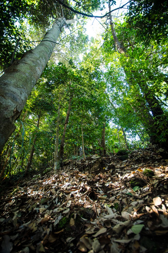
The forest was more dense and overgrown here with dead tree branches and fern leaves occasionally completely obscuring the trail. The sounds of wildlife, including the songs of birds and the calls of dusky langurs (Trachypithecus obscurus) were incongruous amongst the constant drone of cicadas (Family : Cicadidae). The trail here was also somewhat ambiguous although there were small patches of red paint on the occasional rock or tree that helped to validate that you were on the correct path. The trail curved around to head back west approximately 2.2 km in before beginning an ascent at a sharp right turn before a large boulder. The climb here was a short, albeit relentless one, that was made easier by the fixed ropes that had been placed along the trail to assist trekkers as they made their way up the steeper sections.
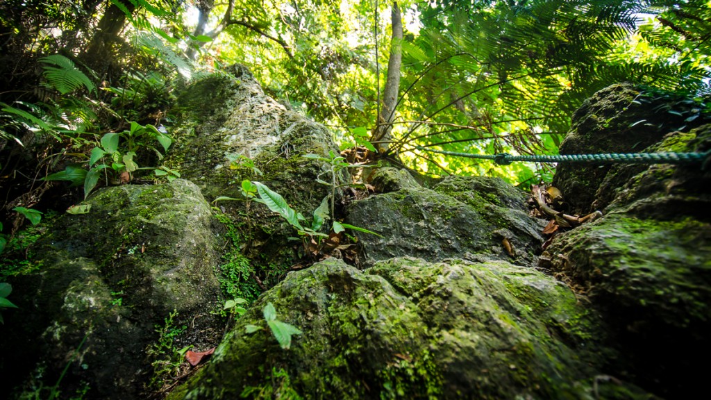
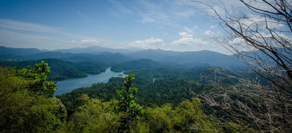
The ridge itself continued with some bouldering and clambering over rocks until it plateaued for an easy walk to the edge. We reached the summit after about 30 minutes of trekking from the point where the trail curves and begins to ascend, or rather just under two hours from the start of the trek. Swarms of butterflies (Superfamily: Papilionoidea) greeted me as I reached the plateau of the ridge that mainly consisted of shrubs that gave way to groves of dead, spindly low-lying tree branches towards the summit. The brittle deciduous branches left little to no shelter from the harsh midday sun which left us no choice but to return back down shortly after we arrived, urged on by the thought of some cold, refreshing ice cream.
360 Panorama
Route Playback
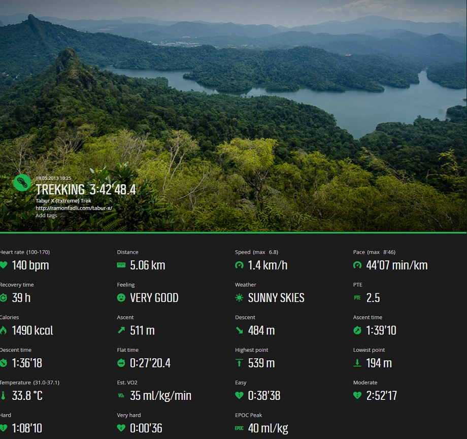
Suunto Movescount Stats

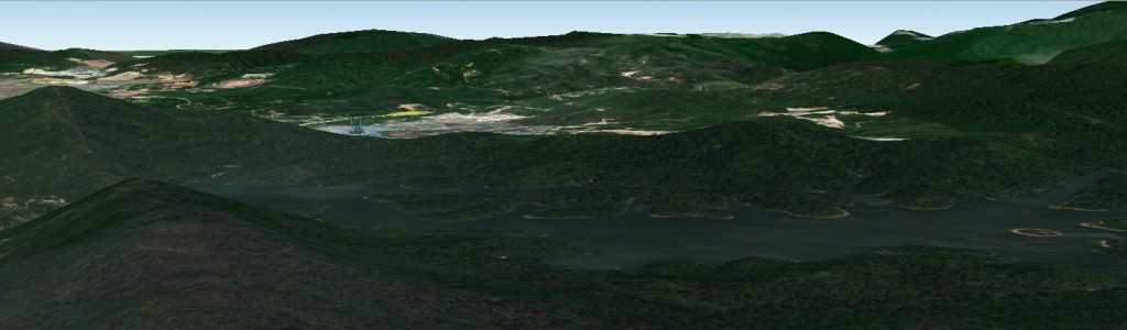
Malaysia Overview


