ACT Day 15 - Kagbeni to Jomsom
Onwards to Jomsom
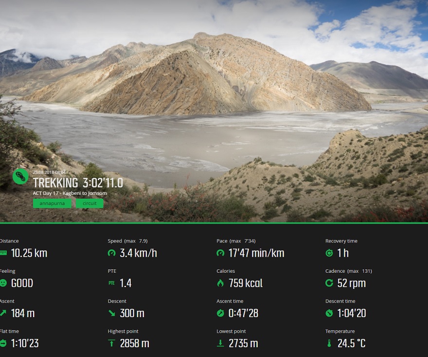
We left Kagbeni (
elevation : 2800 m)

at 08:00, which was the latest recommended time to avoid the blistering Kali Gandaki wind that was bound to build up later that day. All we really had to do before we left the guesthouse was to repack and freshen up, as we decided to skip breakfast and instead have a much larger meal for lunch later on in Jomsom (
elevation : 2720 m)
. The water pressure the night before had also been so low that the upper floors of the guesthouse had had no water at all. As such, we had been unable to make coffee or refill and treat the water from the taps, so the first stop that we made after leaving the guesthouse was to a safe drinking water station (
NPR40/litre).
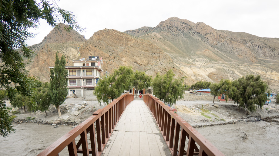
We made our way back to the
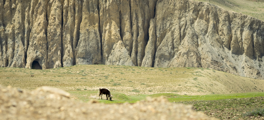
suspension bridge on the south-western side of town, but instead of crossing it like we did the day before, we continued walking south along the road from there instead. We passed a makeshift football field almost immediately after and saw a large group of child monks playing football--some of them had slippers, whilst some were completely barefoot, and only a few of them had actual shoes on. The road continued to run parallel with the huge Kali Gandaki river but ascended up the slopes just a kilometre on. As we climbed, the views improved considerably, with serpentine waves licking the grey river below and vibrant green pastures across on the other side. The sky was overcast however, and it seemed as if the clouds had absorbed all the colour from the hills themselves. The wind began to pick up on the other side of the rise, and I welcomed it gratefully in the heat of the morning sun.
The cliffs on the left had graffiti scrawled on them from time to time, and upon closer inspection, they turned out to be 'billboards' that were advertising guesthouses. As we walked on, I made a mental note to boycott all of the hotels and guesthouses that had had their names graffitied, as giving them my money would be akin to condoning the defacement. We reached the Kagbeni-Muktinath junction just over 2 kilometres in. The mood was a little sombre by then, not because of the bleakness and the lack of colour around us, but because it felt as if the trip was already drawing to an end. We reached Ekle Bhattee (
elevation : 2740 m)
after 2.6 kilometres, which took us approximately 45 minutes, and not too long after that, passed a massive information board that contained information about Upper Mustang.
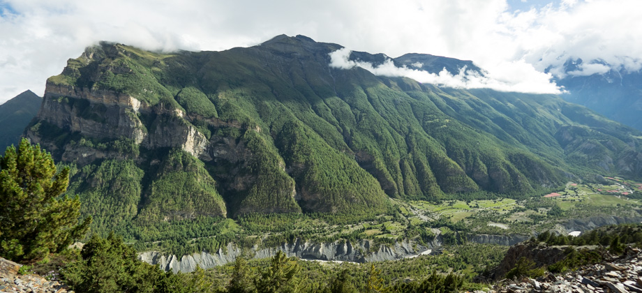
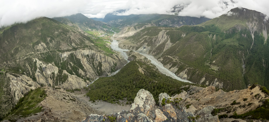
 Looking west across the Kali Gandaki river
After the trail ascended to join up with the road once again, we came upon a suspension bridge that was so long that stabilisers (that reminded me of traditional
Indonesian 'jukungs') had been added on the sides. The bridge crossed over to Pangling
and Phallyak
, and was an alternate (and much longer) way to Jomsom that ascended to and crossed over the Windy Pass (
elevation : 3435 m). We had skipped breakfast that morning, so decided to just continue along the shorter route.
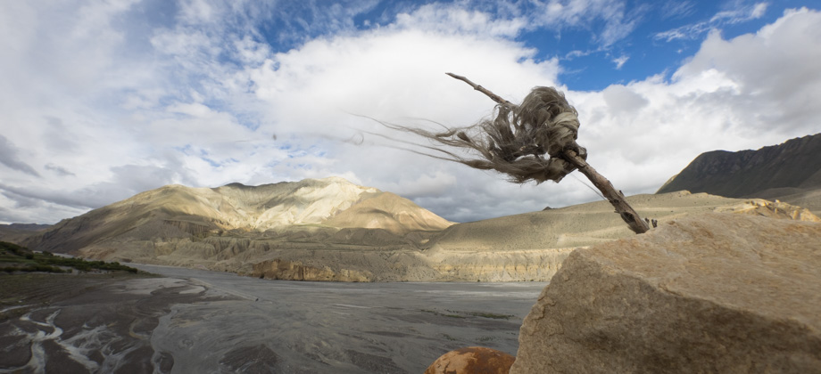
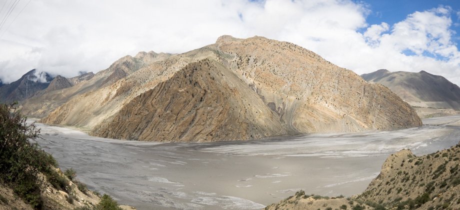
Following the road, however, gave us some decent views of the cliffs across on the other side of the Kali Gandaki river. Pronounced buckling of lines and faults was quite apparent and it made the cliffs a magnificent showcase of the spectacular geological pressures that had shaped them over the eons. The sun was also still behind the hills on our left so walking along the road at that time meant that we were walking in the shadow of the hills; that, and the brisk wind that occasionally gusted upriver ensured that we were kept cool. The hills on our right, however, were lit very brightly by the sun. The wind also made the clouds whip across the sky above us and the shadows that the clouds occasionally cast on the hills, known as
'rionnach maoimeans' in Gaelic, rolled quickly by.
The road then continued across a huge field of rubble, before leading up to a bridge. This was where the trail to Lupra
continued east, and was where the Panda Khola flowed into the Kali Gandaki river. The road switchbacked up the hill not too long after, so we decided to take a shortcut that cut across the slopes to avoid the long switchback and some construction further down the road. As we climbed, the wind picked up once again and views of Jomsom were slowly revealed to us. From there, it was a rather unremarkable but fairly straightforward walk to the town.
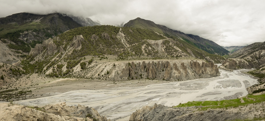
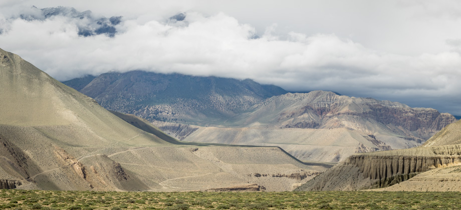
 Crossing into Jomsom
Jomsom (
elevation : 2720 m)
turned out to not be too pleasant. The sheer amount of people left the town quite dirty, and the number of vehicles that passed through ensured that dust was constantly kicked back up into the air. The prices of the hotels and guesthouses were also very high due to the constant pilgrim tourism flow from India--one hotel even had the gall to quote
NPR1200 for a room! We eventually found a nice place called 'Nandika Guesthouse and Thakali Kitchen', that was in a good location and had basic rooms with attached toilets for
NPR400/2. The guesthouse was located just south of the airport and the ACAP checkpoint, which meant that it was also much closer to the point where the buses to Pokhara were to depart from.
We had a simple lunch of vegetable thali (
NPR350) with milk coffee (
NPR20), before heading back out to buy bus tickets to Pokhara for the next day. The ticket office turned out to be directly across the road from the guesthouse, so after securing our tickets (
NPR1000/pax), we went back to the guesthouse to freshen up before taking a long and well-deserved rest.
*Alone once again: Day 10/15
Suunto Movescount Stats
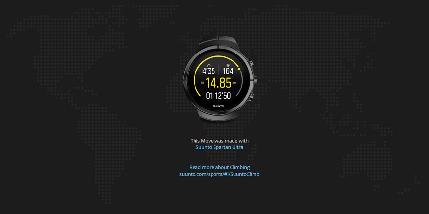 Download GPX file here (right click and save link as)