ACT Day 14 - Ranipauwa to Kagbeni
Quaint Villages
We left Ranipauwa (
elevation : 3700 m)

at 08:30, shortly after we finished our honey pancakes (
NPR300/2) and Tibetan bread with jam (
NPR350/2). The mist had lifted slightly by then, but despite all the posters that were scattered around the town advertising the Yartung festival that was supposed to have begun that morning, the town was still sleepy and there was really not much going on.
From the start, the town had felt too touristy and a little too large for my liking: the roads were wide yet still very muddy, the hotels were several stories high, and the place seemed to lack any sort of authenticity and just seemed to exist for the tourists and religious pilgrims that constantly passed through. As such, I was very glad to leave the town and be on my merry way.
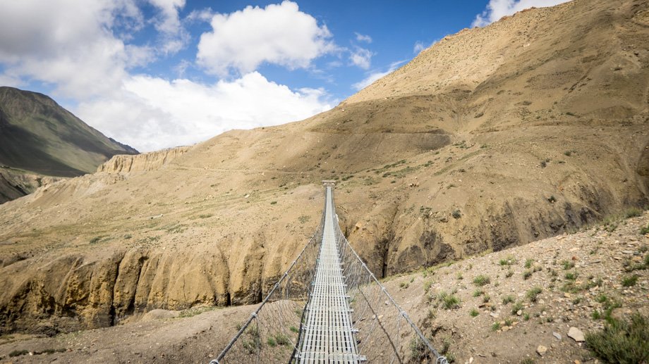
The route that we needed to take was back the same way that we had come from the day before, which was east towards the pass. We walked out of the town and past the main gate, but veered left as we followed the signs. The trail was muddy at first, and remained so at least until just after the power station, but thankfully the ground hardened about a hundred metres or so in and the path began to feel like an actual trail once again. We continued north and approached a suspension bridge about 800 metres in that crossed one of the tributaries of the Jhong Khola. Instead of climbing up the slopes to cross it, however, we dipped down to the river and crossed a small bridge directly underneath it. The trail then slowly morphed into narrow lanes that funneled us into the small village of Chongur (
elevation : 3690 m)
.
In Chongur, we passed herds of livestock that were so large for the narrow lanes of the village that they were forced up into the stone walls of the buildings that fringed the sides. The sheepdogs
(Canis lupus familiaris) that were there seemed quite helpless, and all they could really do was bark every now and then just to prod the herds forward. Cobwebs that lined the stone walls were ubiquitous, and a large number of the buildings seemed to have fallen into a state of disrepair.
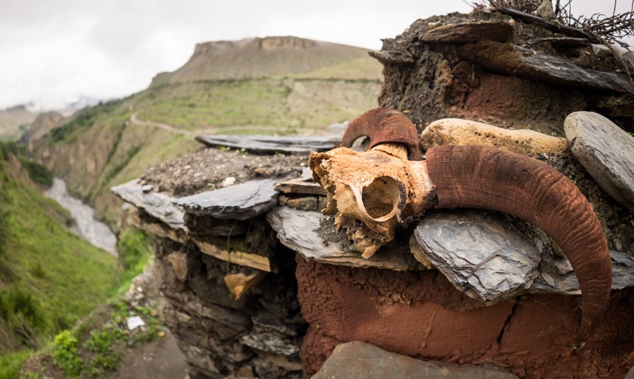 A skull-decorated chorten
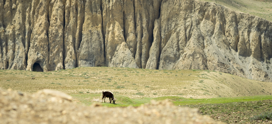
The trail swerved out of the village and to a viewpoint with a skull-decorated chorten. Down below was a valley that contained the Jhong Khola, and across was a sheer cliff with chimney-like spires that interlaced and merged together, which were pock-marked with numerous caves. The trail wound down to another suspension bridge that was just under two kilometres in, and beyond it lay edelweiss flowers
(Leontopodium sp.) and bushes of woolly catmint
(Nepeta floccosa). The trail swung to the left after the bridge and rose to merge with the road above, which led to the next village, Jhong. I was a little disappointed to find myself walking on a road once again, but was relieved to find out later that the road from that point all the way to Kagbeni (
elevation : 2800 m)
, which lay more than eight kilometres away, was barely used. In fact, only four motorbikes passed us the entire day.
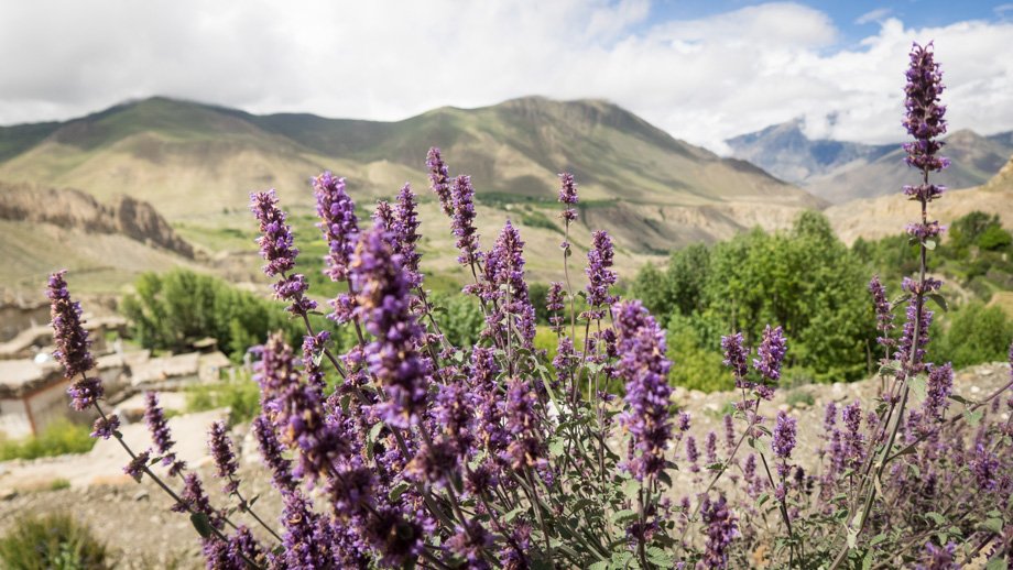 Bushes of woolly catmint (Nepeta floccosa) lined the trail
Jhong (
elevation : 3580 m)
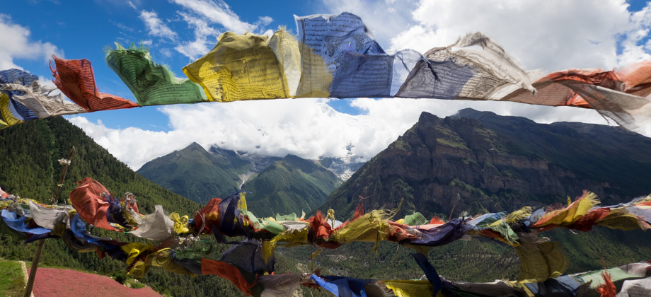
is a quaint little village with old houses and is where the ruins of the former Jhong Fortress is located. We walked straight through the village, however, and did not linger around to explore the ruins as we were quite eager to just get away from people and to be back out in the countryside. As we continued out of the village, the views of the valley opened up and the first hints of a blue sky was seen. We passed the ridge on the left that was festooned with prayer flags and we caught glimpses of the northern slopes of Puchchhardanda (
elevation : 3971 m), which was also on the left but a lot further away. The wind caused the clouds to whip across the sky above us, and the shadows that they cast, known as
'rionnach maoimeans' in Gaelic, rapidly rolled across the slopes of the hills.
 The ruins of the Jhong Fortress
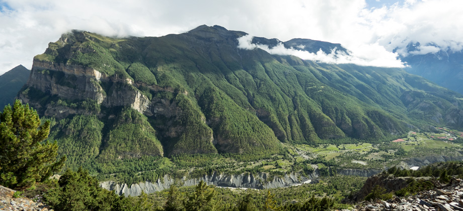
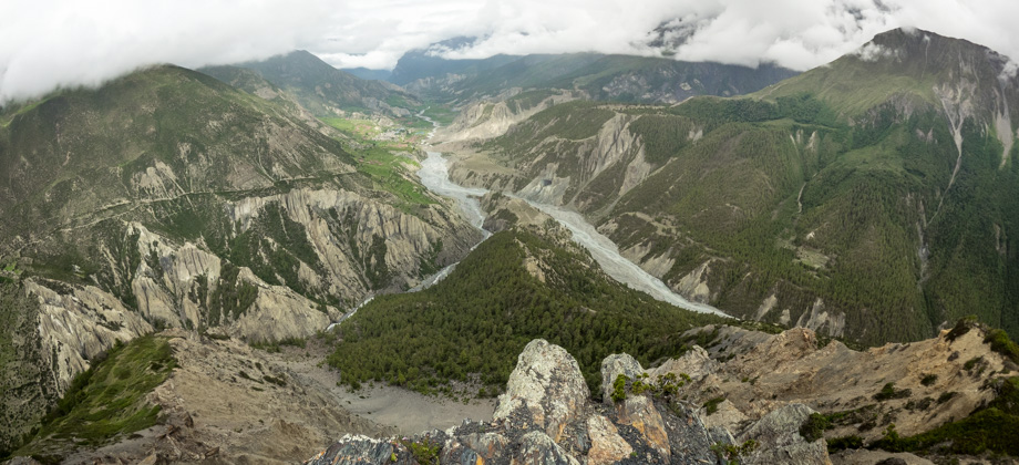
Just after Jhong, we could see the Kali Gandaki valley, which is the deepest gorge in the world. The gorge separates the peaks of Dhaulagiri (
elevation : 8172 m) on the west, which happens to be the seventh highest mountain in the world, and Annapurna I (
elevation : 8091 m) on the east, which is the tenth highest. As the tectonic forces formed the accretionary wedge which gave rise to these massive mountains, the massive Kali Gandaki river cut its way down and through the valley over many millions of years.
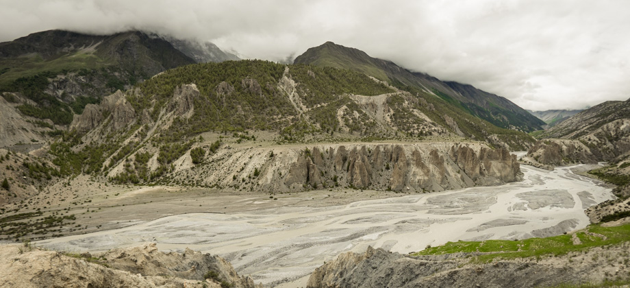
 The Kali Gandaki valley lies just beyond
To get to the Kali Gandaki valley however, we had to first traverse the long and exposed road--all 8 kilometres of it. The sun was out and it was fiercely hot, so we had to completely cover ourselves for protection from the harsh ultraviolet radiation. Less UV radiation gets filtered out as the air 'thins out' due to the increase in elevation, so for every 1000 metres increase in altitude, the level of UV radiation increases by about 12%!