ACT Day 06 - Dhikur Pokhari to Ngawal
Clear Skies

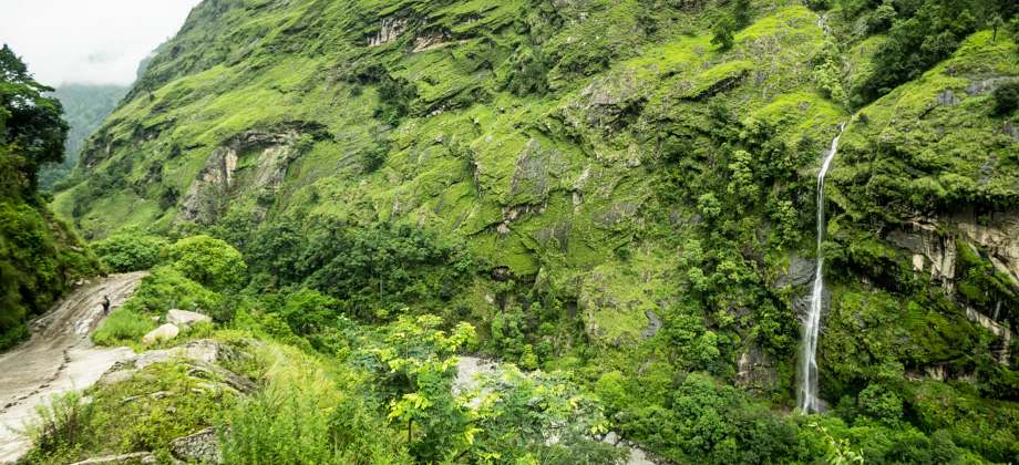
The weather was excellent that morning, and the gateway to heaven, 'Swarga Dwari Danda', could clearly be seen. We watched the sun slowly rise over it before the strong rays drowned out all but the largest of the gateway's features. To the south, Annapurna II (
elevation : 7939 m) could occasionally be seen each time the clouds parted, and the sight of the unnamed 'black pyramid' in front of us, its sides so sheer that they could barely hold the snow, made me look forward to seeing Khangsar Kang, or 'Roc Noir' (
elevation : 7485 m) later on in the trip.
To the north, the imposing tree-covered ridge was blocking Pisang Peak / Jong Ri (
elevation : 6091 m), and to the west was the deep blue sky.
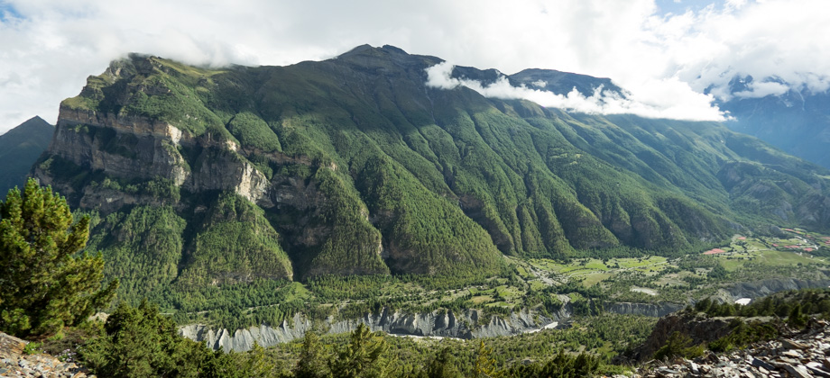
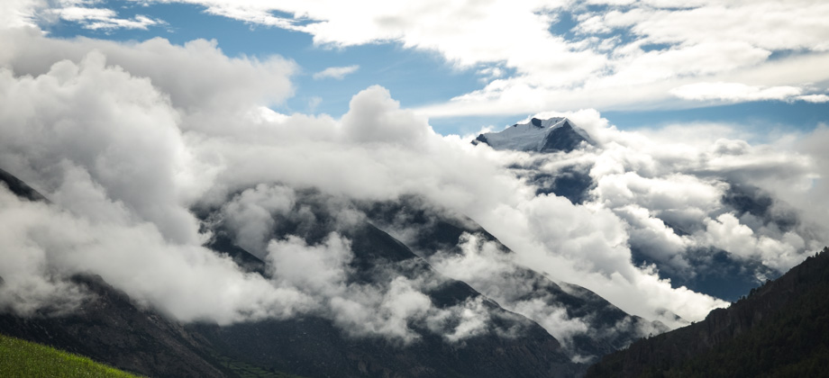
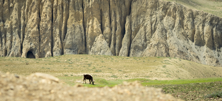
 The unnamed 'black pyramid' lies at the end of the ridge that runs from AnnapurnaII (elevation : 7939 m) to peak 7740 (metres), and then north-east towards DhikurPokhari (elevation : 3060 m). Hover the cursor over the image to clean the window!
We left Dhikur Pokhari

(
elevation : 3060 m) at 08:30, after breakfast which was pancake and jam (
NPR350/2) and ordered Tibetan bread (
NPR300/2) to take-away once again. We made our way past the rest of the buildings that made up the hamlet and reached the junction after the mani wall, with the left branch heading to Lower Pisang (
elevation : 3200 m), and the right to Upper Pisang (
elevation : 3300 m). We decided to take the latter, the high route, for two main reasons: the high route was known to have far better views of the mountains, and was much better for
acclimatisation.
We reached the bridge that crossed the river to Upper Pisang. Looking back, the sunlight was so strong that the polished slopes of Swarga Dwari glinted with a mirror-like sheen, a sharp contrast with the deep fissures that snaked down from the top. The path here was fringed with the tall stalks of great mulleins
(Verbascum thapsus). At first I had thought that they were the flower-spikes of Asiatic poppies
(Meconopsis sp.) since both plants are remarkably similar. Some poppy species also have hairy
basal leaves with a velvety texture that are arranged in a dense rosette at the base of the stems, very tall flower-spikes that grow up to two metres high, and bloom around July to August. Upon closer inspection though, the leaves of these poppies are seen to be pinnately lobed, and they usually have flowers (in their final year of growth just before they die) that hang downwards.
Great mulleins on the other hand, have flowers that are almost sulphur-yellow and that face outwards rather than downwards. This plant is usually found on roadsides and would turn out to be characteristic of the area that we were to hike through over the next few days. This plant is believed, in both Asia and Europe, to have the power to safeguard against evil spirits, and is thought to be the plant that Odysseus, the hero of the Odyssey, used to protect himself against the goddess of magic, Circe.
 An orange blister beetle (Hycleus sp.) on a great mullein flower (Verbascum thapsus);
the gateway to heaven, 'Swarga Dwari Danda', can be seen in the background on the left
An orange blister beetle (Hycleus sp.) on a great mullein flower (Verbascum thapsus);
the gateway to heaven, 'Swarga Dwari Danda', can be seen in the background on the left
Wherever there were great mulleins, there were also aposematically coloured orange blister beetles
(Hycleus sp.). These beetles are named because of a blistering agent that they secrete when they are attacked. This agent is quite potent and can cause severe chemical burns, and even when diluted can be used to remove tattoos and warts. During the entire hike, we did not spot even a single blister beetle larva, which at the time struck me as strange considering how ubiquitous the adults were. It turns out that the larvae emit a scent that tricks male bees into thinking that the larvae are female bees. The larvae hitch a ride on the male bee, transfer over to the female bee, who then brings them to the nest. The larvae then stay there consuming the nectar and pollen as they progress through their developmental stages.
The trail was wide and fairly exposed, and crossed several meadows. Aside from the blister beetles, plenty of butterflies
(Superfamily : Papilionoidea) flitted around and bees
(Family : Apidae) zipped around pollinating a huge variety of flowers. Upper Pisang
(
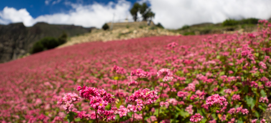
elevation : 3300 m) seemed to appear out of nowhere. The relatively large hamlet was built on the slopes of the hill, and was hidden from the trail for most of the way. As I reached Upper Pisang, I looked back at Swarga Dwari for one last time, thinking that I would not see its impressive face any more, and then made my way through the hamlet and out to the vibrant pink fields of wild buckwheat on the other side.
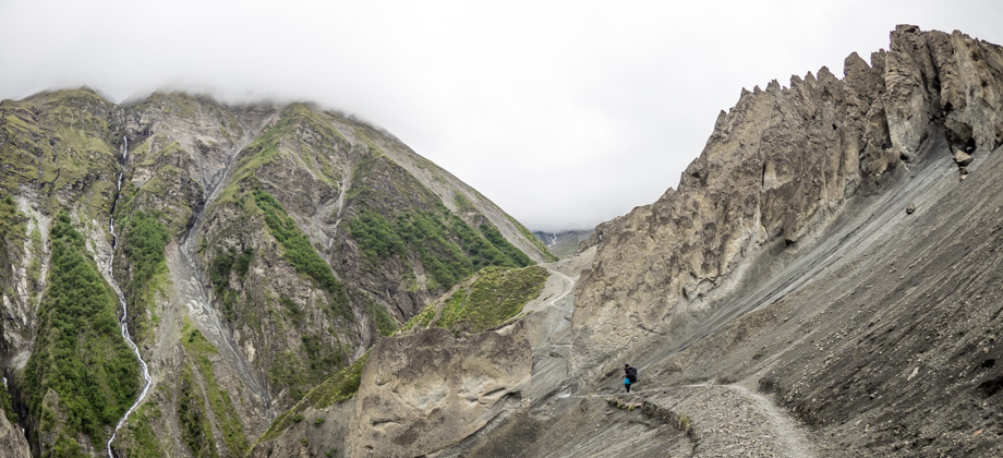
 The gateway to heaven, 'Swarga Dwari Danda', could always be seen in the background
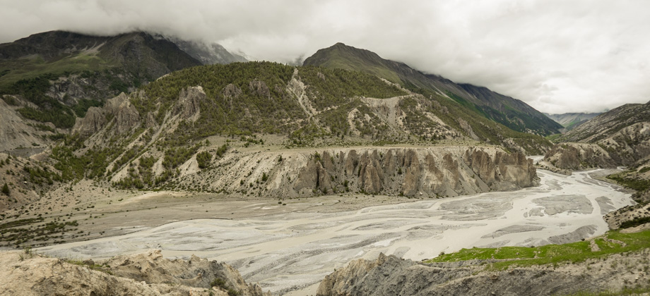
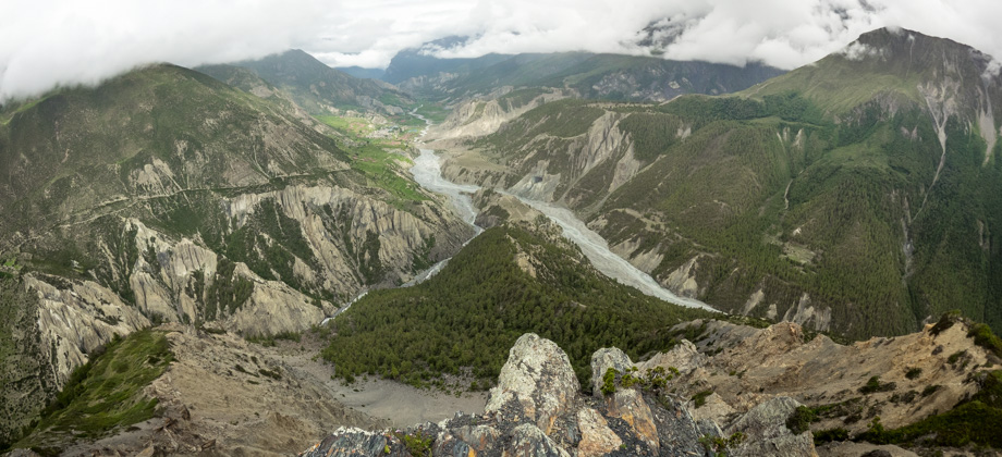
The views of the mountains that lay beyond were excellent here, so we decided to stop for brunch--which was Tibetan bread and peanut butter once again--just after the stupa on the rise at the end of the hamlet. Johann from Denmark passed us once again and we had a little chat before continuing on past the open fields and down to the pine forest at the bottom of the hill. As we looked back, the valley that channeled the melt-water from the glacier that ran down the sides of Annapurna II (
elevation : 7939 m) could clearly be seen. The actual peak however, still remained elusive.
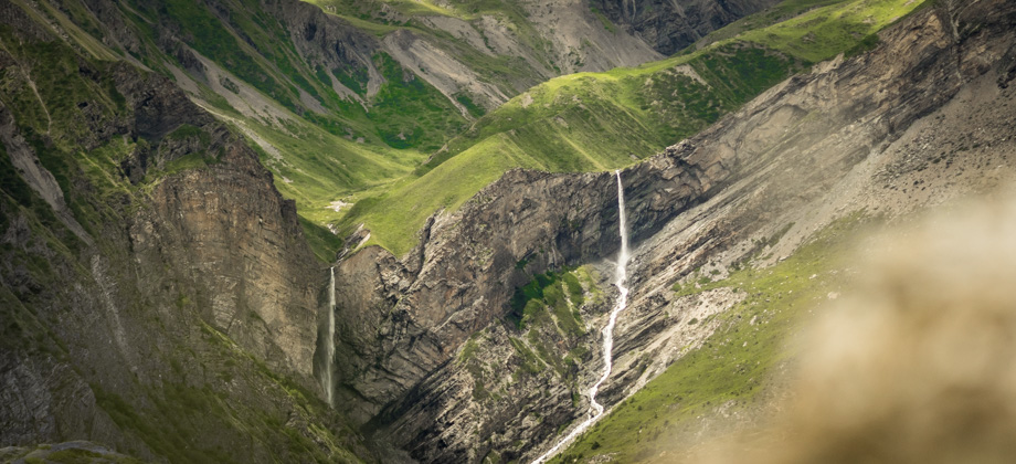
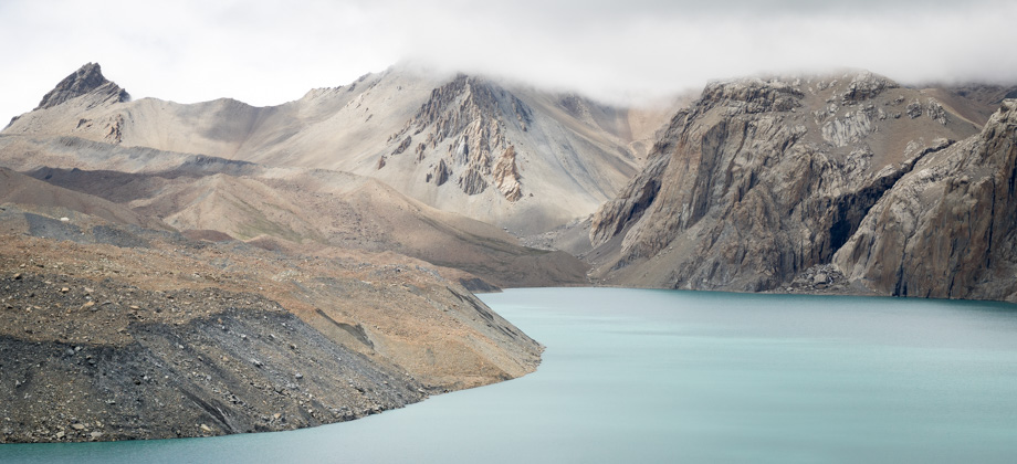
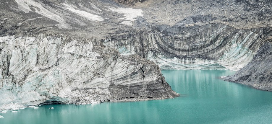
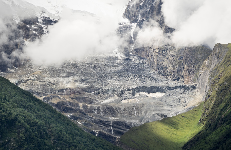 The glacier that runs down Annapurna II's (elevation : 7939 m) northern face; themeltwater flows into Chauwi Khola before meeting Marsyangdi at Lower Pisang