
Tabur East Sunrise
Tabur West - Tabur East Tabur Far East - Tabur Extreme
Tabur East
This trek was another of a series of sunrise treks that were undertaken in the wee hours of the morning. By the time we parked the car and located the huge twin pipes that we needed to follow, it was already 05:10. The pipes can either be located from the end of the Jalan Kolam Air road or from the road that leads to the Klang Gates Dam where trekkers park there car for the Tabur West trek (marked 'A' in the map). If one goes from this road however, you will need to walk along the green fence from the dam entrance until you come upon a short flight of steps. Head through this entrance and pass a small creek (where you can wash up after either the Tabur East or Tabur West trek) until you come upon the pipes.
Before we go on, please jot down the numbers that are listed below. If you do see any suspicious behaviour when out hiking, encounter things like traps and snares, or even see protected animals or their parts that are sold as either collectibles, pets, or for (so-called) medicine, then please do not hesitate to contact the wildlife crime hotline. Be sure to try and document it as best you can with photos or video without putting yourself in danger, and take note of the details: descriptions of those who are involved, as well as when and where it took place."The Wildlife Crime Hotline, managed by the Malaysian Conservation Alliance for Tigers (MYCAT), provides YOU an avenue to report offences involving endangered wildlife in Malaysia. We protect the identity of all informants, only key info of the reports are forwarded to the authorities."
Emergency Numbers
Wildlife Crime Hotline 019-356 4194 Wildlife Department 1800 885 151 Hulu Selangor Forestry Department 03-6091 613 Taman Melawati Police Station 03-4108 1222 Wangsa Maju Police Station 03-9289 9110Difficulty Rating : 2.6 / 10.0
(Class 3 - Straightforward)
Tabur Elevation Profile

Notice: Tabur Trails Temporarily Closed
Recently Bukit Tabur has been plagued with a number of unfortunate accidents which have prompted the authorities to temporarily close all the trails. The notice that was issued today (when translated from Malay) Read moreGetting There
Follow the pipes northward until you come to the trail head (3.232556, 101.750389) on your right.
As we walked north along the right side of the pipes (pipes were on our left), we came across a large blue sign that said 'Taman Negeri Selangor' that had a right turning which we took that lead into the foliage for a short distance before turning right once again just before a hole in the fence. The climb itself is fairly steep up and over boulders and tree roots for the first 35 minutes or so before the trail begins to level off as you reach the ridge. There were multiple viewpoints along the way facing south towards KL with the first coming up 15 minutes or so into the trek. Genting Highlands could also be seen glimmering in the north whenever you reached a clearing.
There were ropes conveniently placed on certain steep sections to assist trekkers as they made their way up. I found that my gloves helped somewhat as the chances of friction burns were greatly diminished. I would strongly advise you to use some element of caution when using the ropes and to ease your weight onto them (using the rocks at the same time if possible) as some of the ropes seemed to be a little frayed. Once you are on the ridge, just keep on following the trail until you come upon an impassable abyss of sorts where the quartz ridge just ends with a sheer vertical drop down to the forest floor below.
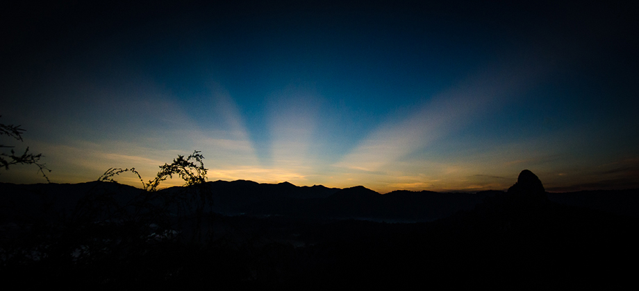
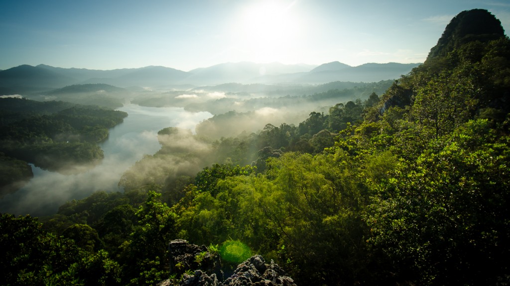
Sunrise over Tabur East
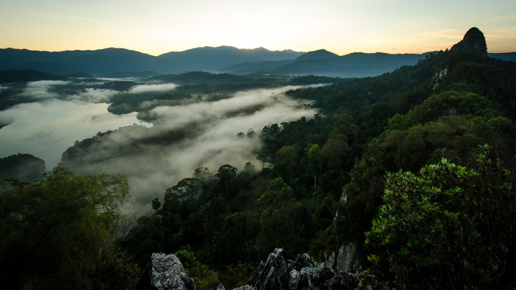
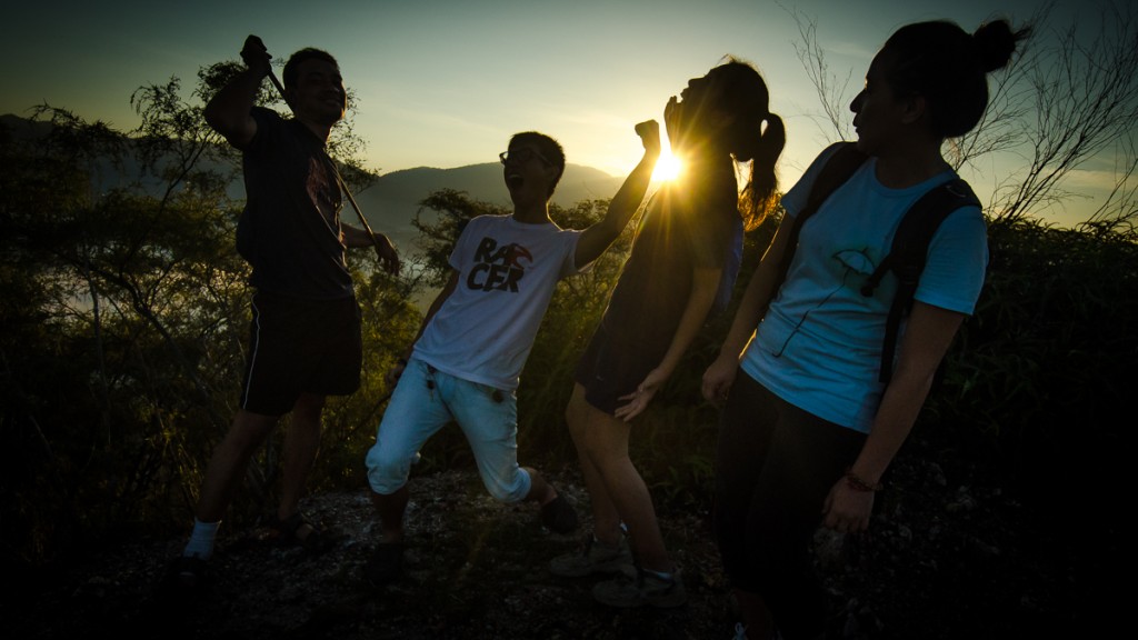
As the sun began to rise, it cast its rays across the dam to illuminate the low lying fog (which is a type of stratus cloud) as well as their shimmering reflections. We spent some time at the peak just soaking in the gorgeous scenery before making our way back down the trail.
360 Panorama
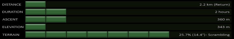
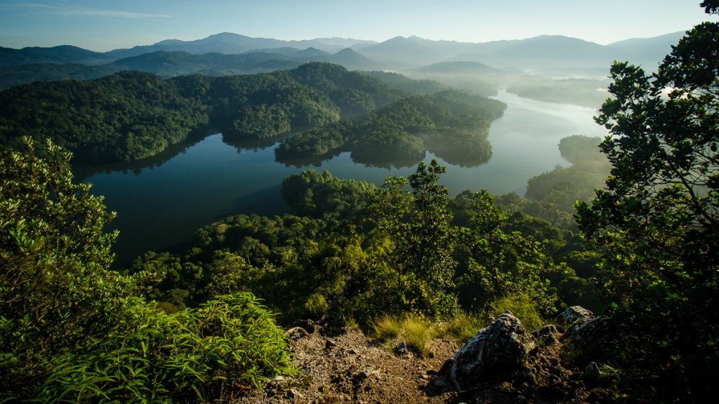
The trek back down felt very different as the trail was now clearly visible and the waters of the dam that lay to the north gave the entire area a serene feel as it was bathed with the soft light from the sun. The quartz dike that ran along the ridge was also very conspicuous and I found the crystalline white structures that were formed by the deposition of hydrothermal quartz very fascinating. I was also somewhat surprised by the inclines as I tend to not be aware of the level of inclination when trekking with very limited visibility. The entire trek only took us just over 2 hours of trekking (covering a distance of only 2.2 km) to complete.

Route Playback
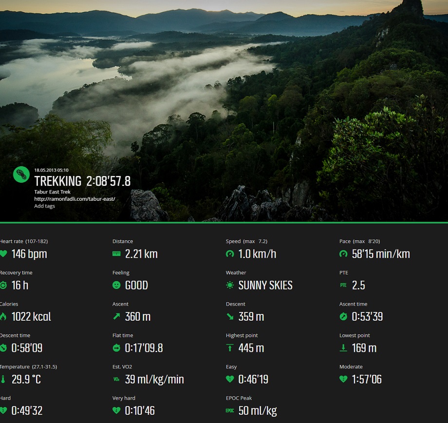
Suunto Movescount Stats

Malaysia Overview
")


Nice photos – and good advice about the ropes. I went a few weeks ago and avoided the ropes completely. They were pretty frayed. https://hikingtheworld.blog/2020/01/09/bukit-tabur-east-dragons-back/