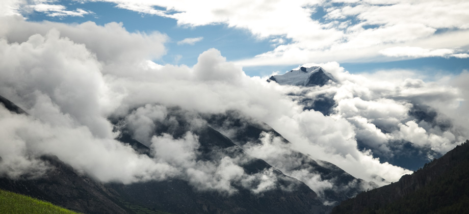
ACT Day 10 - Tilicho Lake
Tilicho Tal
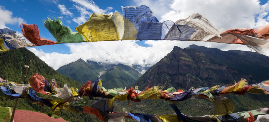
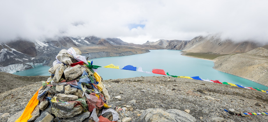
As we ascended the small rise towards the festooned prayer flags above, the massive turquoise body of water that was Tilicho Lake

(
elevation : 4920 m) revealed itself slowly with each and every step that we took. It had taken us four hours to cover the five kilometres to the lake at a very relaxed pace, and we realised that we had the entire lake completely to ourselves as we reached the top of the rise. The four-kilometre-long glacial lake was absolutely breathtaking in every way and exuded a beauty that could only be rivaled by the lakes of
Gokyo. We stood there and looked out to the lake in silence for a long while, completely and utterly mesmerised.
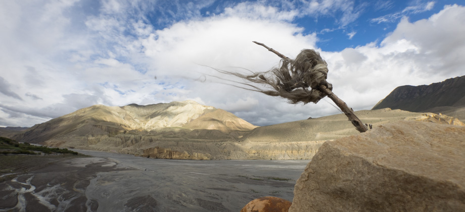
 Prayer flags atop Tilicho Lake
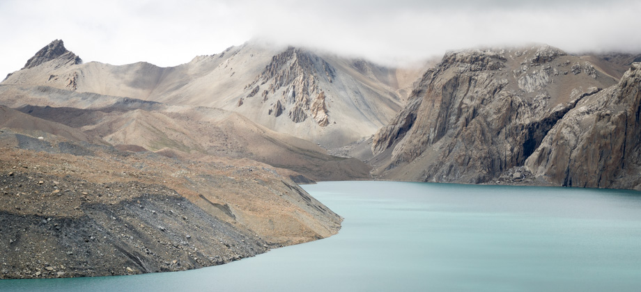
Tilicho Lake is a tarn--a mountain lake that has been created by glacial activity--that was formed by the meltwater and icefall from the eastern slopes of Tilicho Peak (
elevation : 7134 m), and is guarded to its south by the imposing and impassable 7000 metre-high mountain range known as Annapurna's Grande Barriere. The lake may be located at a very high elevation, but despite the multitude of websites that state matter-of-factly that Tilicho Lake is the highest lake in the world, it is not the highest by far--simply looking at satellite imagery of the Tibetan plateau 150 kilometres or so directly north will reveal dozens of lakes that are located at higher elevations (the title of the highest lake in the world is held by the Nevado Ojos del Salado Lake in Argentina at
6390 m).
Tilicho Lake does however hold both scientific and religious significance. The lake was not only the site of one of the highest
scuba dives in history but it has also been the site of several scientific expeditions, some of which tested maximum safe depths and decompression stops (using 'Cross Corrections') for scuba diving at high-altitudes. This lake is also believed to be the location where the Hindu epic Ramayana was first told to Garuda, the king of birds.
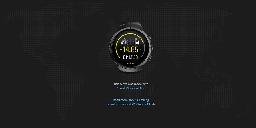
 Exactly 5000 metres on my Suunto Spartan Ultra--breathtaking in every way!
After we emerged from our reveries, we decided to go explore the lake's vicinity. We began by making our way south along the ridge towards the multiple icefalls. We sat there for a while, and listened to the avalanches that rumbled down from high above; and watched huge blocks of ice calve off the edge of the icefall and fall into the lake tumultuously, sending huge waves rippling off in every direction. We were in awe at the sheer power that we observed just in-front of our very eyes.
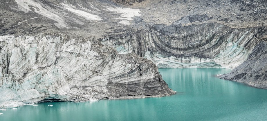
 The 70-metre high icefall terminus. Enormous blocks of ice would occasionally calve off and fall into the lake below
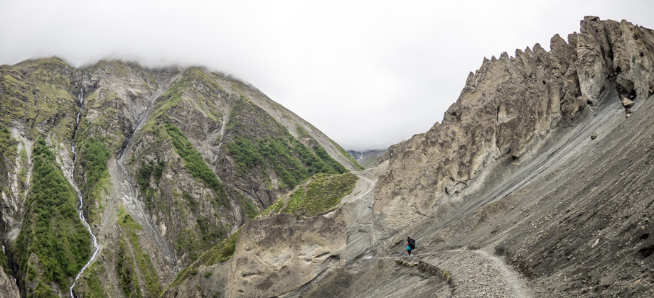
After a while, we turned around and made our way northwards. The well-defined trail began to arch west after passing the seasonal tea house that was opened in 2014, and followed the contour around the hill. Different views of the lake with the icefalls now as a backdrop began to be revealed. Directly ahead of us lay a small hill, and directly behind it, the green eastern shore of Tilicho Lake. The trail continued around the eastern side of the hill and just as we passed in-between two mounds, the path diverged--with the main path continuing straight down to the shore, and the smaller path leading towards the high-altitude passes.
The trail to the high altitude passes does not follow the eastern shore as some older maps tend to show. This is because further north of the shore is an area that is very prone to rockfall that is very dangerous, and perhaps now even impassable. Instead, the smaller path deviates 45-degrees to the right and circumvents the huge crumbly
5550 m wall directly north of that point. The path ascends the slopes before swinging westward to what is referred to as the 'Eastern Pass' (
elevation : 5340 m), and from there on to either the classic 'Mesokanto La Pass' (
elevation : 5245 m), which lies further west just before the fang-like peak, or up to the pass that is sometimes called 'Mesokanto North Pass' and sometimes 'Tourist Pass'.
 Looking north-west towards Mesokanto La pass. The trail traces the ridge to the left andthen crosses over to the other side just before it reaches the fang-like peak on the farleft of the image. The precarious rockfall area can be seen on the right of the image
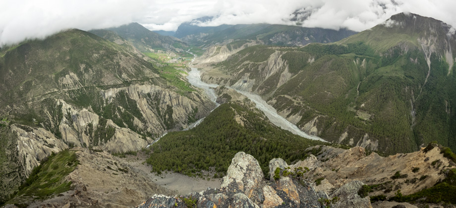
The mist descended upon us not too long after and we were forced to abandon our plans to head down to the shore of the lake, and to instead make our way back to base camp. The temperature began to plummet shortly after we turned around, so we decided to stop at the teashop to take shelter from the ever intensifying wind and to prepare something quick--muesli and hot milk--to help keep us warm. We made our way back to Tilicho Base Camp
(
elevation : 4150 m) not too long after, and the descent turned out to be a much quicker journey than the ascent, taking us just an hour and a half. As we dropped down below the mist, the visibility improved significantly and we were greeted once again by magnificent views of the valley below.
As we walked into the guesthouse, hoards of porters, easily numbering twenty or so, began to arrive. These porters were all there to accommodate the huge group of eighty-five people that had been flown in to Tilicho Base Camp by helicopter for a yoga retreat. We found out later that three of the participants were immediately evacuated due to
altitude sickness from their rapid ascent. Foolish, no?
* The dhal bhat dinner cost
NPR630 and the accommodation
NPR100/2.
Suunto Movescount Stats

 Download GPX file here (right click and save link as)