May 5, 2019
Posted by
Ramon Fadli in
Class 5,
Day Hike,
Hiking,
Ireland,
Looped Hike,
Mountains,
National Parks,
Oceanic,
Temperate Deciduous Forests,
Wicklow Lugnaquilla
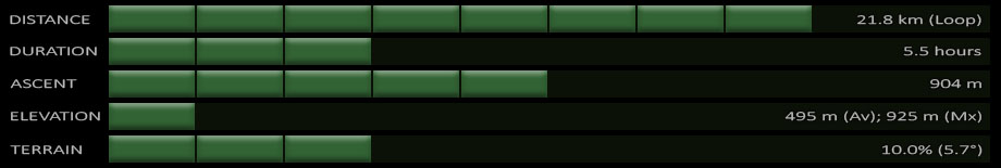
Lugnaquilla
PROTECTED STATUS :
Lugnaquilla is located in the
Wicklow Mountains, and is the highest mountain in Ireland outside of County Kerry. Standing 925 metres-high with a prominence of 849 metres, Lugnaquilla qualifies as a furth and is the
63rd highest mountain (with a prominence of at least 600 m) in the islands of
Ireland and Great Britain, sitting just one place ahead of
Galtymore. Lugnaquilla is also known as the 'Lug', but despite the name being the same as one of the most prominent gods in Irish mythology, it just means "hollow of the wood" (
Irish: Log na Coille).
There are many trails that lead to the peak of Lugnaquilla (
elevation : 925 m) with all of them having a
difficulty of moderate or less. This entry describes the one that begins at
Glenmalure Lodge 
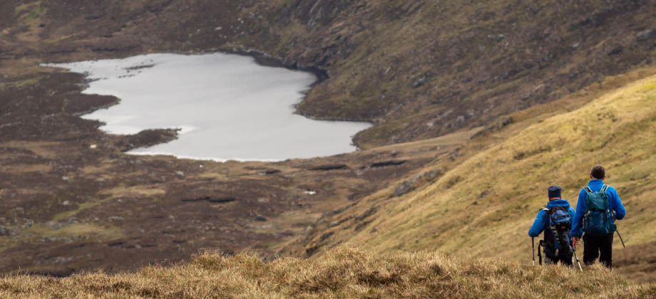
, skims Kelly's Lough, passes through Corrigasleggaun (
elevation : 794 m), and then descends via the zig-zags. Without navigational aid such as a GPS device, however, the walk on the summit plateau can be a little tricky in poor weather or in poor visibility, as the trail tapers off at places and can be quite indistinct. There are also steep glacial corries that drop from the summit plateau that you need to be aware of, as well as the chance of strong winds that quite often buffet the area.
*Click here to learn more about the difficulty rating.
Getting There
The trail head is located beside Glenmalure Lodge . To get there from Dublin or any of the towns just south of the city, you need to take the N11 southwards. Once you reach Kilmacanogue, turn off to get to the R775 heading west, and follow the road as it curves southwards towards Roundwood. Keep going south through the towns of Annamoe, Killifin, and then Laragh. Approximately a kilometre south of Laragh, you will reach a fork in the road with signs that say Glenmalure. Turn right here and continue southwards for just over seven kilometres until you reach the carpark at Glenmalure Lodge.
Directions to Glenmalure Lodge from Bray
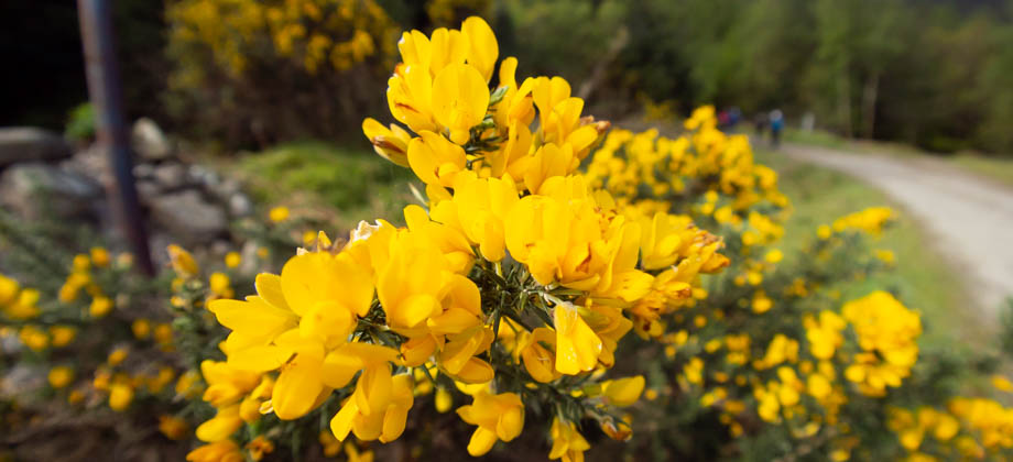 Furze bushes (Ulex europaeus) are ubiquitous along the sides of the trails
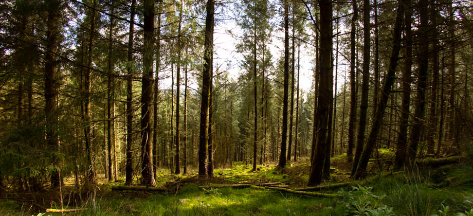
Sitka Spruce
We began the hike by walking south-west and crossing the Avonbeg river via the Drumgoff Bridge. The bridge connected to a military road, where we turned right approximately half a kilometre in, and followed a wide dirt track that was fringed by forested areas on both sides. There was a junction at the half-way point of the Wicklow Way, where the left branch continued along the Wicklow Way, heading west at first before zig-zagging multiple times first southward, and then westward. The dirt track gradually ascended from around 200 metres at the Wicklow Way half-way point to about 1400 metres just after the sixth bend (
3.5 km mark). We passed a left turning just before the fourth bend which, had we taken it, would have looped us around the Carrawaystick summit (
elevation : 728 m) and to the junction just after the climb up from Kelly's Lough. This point could also have been accessed had we followed the military road at the beginning instead of starting from the Wicklow Way half-way point.
 New growth tips of Sitka spruce (Picea sitchensis)
From the mid 16th century to the early 20th century, Irish land had been given out by the English monarchy to settlers from England, Wales, and Scotland. These settlers cleared huge swathes of land to create pasture for livestock. This land clearing not only ensured systematic deforestation, but also the extinction of numerous native animal species such as the wild boar
(Sus scrofa) and the Irish grey wolf
(Canis lupus). Since the independence of Ireland in 1922, however, there have been efforts to reforest the land, mostly in the form of commercial plantations.
The forests that surrounded us consisted almost entirely of plantations of Sitka spruce
(Picea sitchensis), which is originally a North American species. Sitka is known to be both one of the world's largest spruce, as well as being fast-growing--a combination that makes it a very high-yield tree. The problem with Sitka, however, is that unlike native deciduous woodlands, conifer plantations are generally poor in ground flora. This is because the sunlight that reaches the forest floor is limited by the formed canopy of trees that are planted at the same time. The fact that sitka spruce is an evergreen tree also ensures that the forest floor remains in the shade even throughout winter, as the leaves are not shed.
 The Suunto 9 Baro (review here) indicating the approach to the second bend.
The (straight) military road can be seen running along the top of the screen