


Mount Irau
Mount Irau - Part 1 : Mount Irau
Mount Irau - Part 2 : False Peak
Mount Irau - Part 3 : Irau Peak
Cameron Highlands Index
Mount Irau
"The Wildlife Crime Hotline, managed by the Malaysian Conservation Alliance for Tigers (MYCAT), provides YOU an avenue to report offences involving endangered wildlife in Malaysia. We protect the identity of all informants, only key info of the reports are forwarded to the authorities."
Emergency Numbers
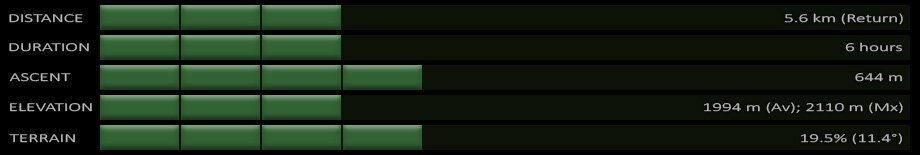
Wildlife Crime Hotline 019-356 4194 Wildlife Department 1800 885 151 Cameron Highlands Forestry Department 09–3551 060 Cameron Highlands Hospital 05-4911 966 Cameron Highlands Bomba 09-4911 003 Tanah Rata Police Station 05-4915 443 Ringlet Police Station 05-4956 222 Kg. Raja Police Station 05-4981 222 JKR Cameron Highlands 05-4911 105Difficulty Rating : 3.4 / 10.0 (Class 4 - Fairly Straightforward)
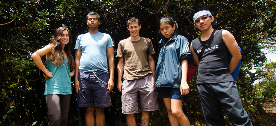
 The group set off in the morning from the Pauh Campsite after breakfast and after purchasing some food for lunch since the trek was expected to take about 6 hours. To get to the start of the trail, we had to make our way up the road that lead up to the peak of Mount Brinchang. The road is fairly long at approximately five kiometres in length, and the fact that the road is also very narrow (there is barely enough space for two cars to pass abreast), filled with pot-holes and is is made up of a large number of sharp turns as it winds its way up the mountain, can render the journey somewhat precarious if you aren't paying attention to the road and other vehicles that may be coming around the bends. The scenery is gorgeous however as you will end up passing the lush rows of the bright green flushes of tea plants (Camellia sinensis) that cover the rolling hills. After being harvested, these tea leaves will then undergo different types of processing to make the various types of true teas that are made commercially available. Other so-called teas that are not derived from the tea plant (such as mint tea for instance) aren't actually considered 'true teas'. Anyway I digress (and for good reason).
The road itself begins at a left turning as you make your way north from Brinchang and can be found by following the signs that show the way to the Sungai Palas Boh Tea Plantation. The maps below shows the road from the junction of the C7 road till the clearing that marks the beginning of the trail that leads up to Mount Irau.
The group set off in the morning from the Pauh Campsite after breakfast and after purchasing some food for lunch since the trek was expected to take about 6 hours. To get to the start of the trail, we had to make our way up the road that lead up to the peak of Mount Brinchang. The road is fairly long at approximately five kiometres in length, and the fact that the road is also very narrow (there is barely enough space for two cars to pass abreast), filled with pot-holes and is is made up of a large number of sharp turns as it winds its way up the mountain, can render the journey somewhat precarious if you aren't paying attention to the road and other vehicles that may be coming around the bends. The scenery is gorgeous however as you will end up passing the lush rows of the bright green flushes of tea plants (Camellia sinensis) that cover the rolling hills. After being harvested, these tea leaves will then undergo different types of processing to make the various types of true teas that are made commercially available. Other so-called teas that are not derived from the tea plant (such as mint tea for instance) aren't actually considered 'true teas'. Anyway I digress (and for good reason).
The road itself begins at a left turning as you make your way north from Brinchang and can be found by following the signs that show the way to the Sungai Palas Boh Tea Plantation. The maps below shows the road from the junction of the C7 road till the clearing that marks the beginning of the trail that leads up to Mount Irau.
Getting There

Mount Irau Trail
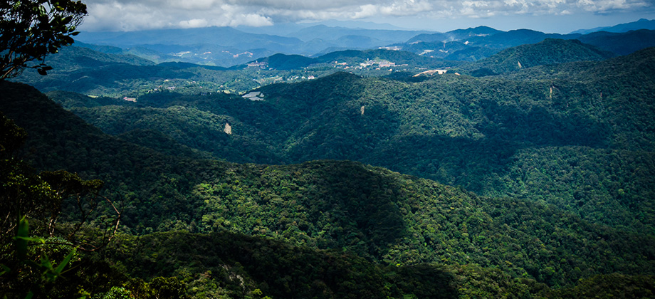
The trail begins just behind a gazebo with a raised wooden walkway that immediately ascends up the mountain. The ascent is brief however as the trail undulates up and down for roughly 38 minutes after only covering a distance of 0.64 km. The trail begins to descend from this point as it makes its way down Mount Brinchang and towards the point (just less than a kilometre away) where you start to climb up Mount Irau. You should get to this point after about an hour and a half of trekking.
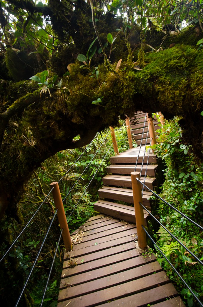

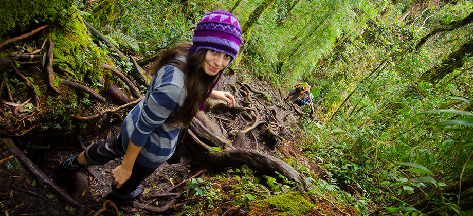
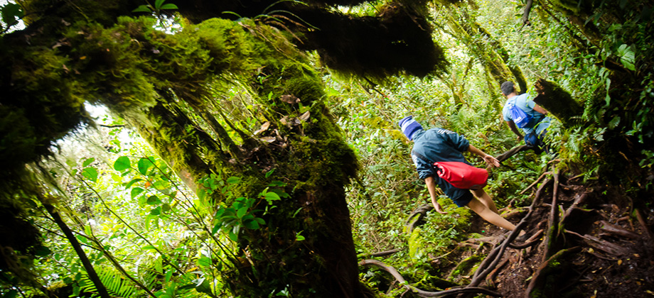
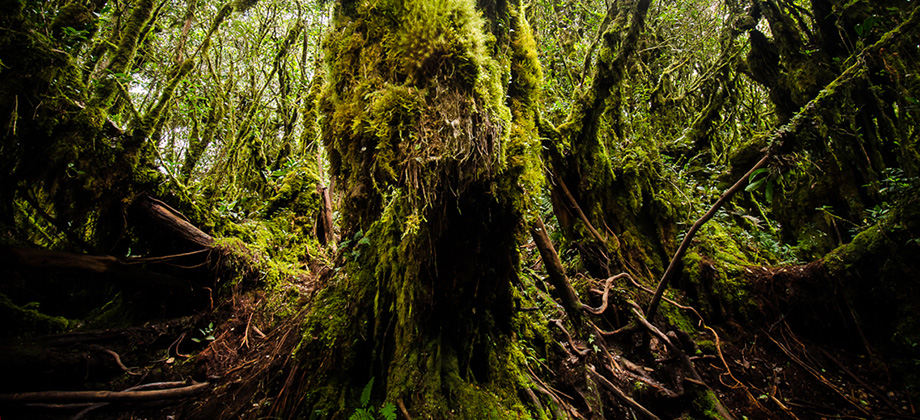
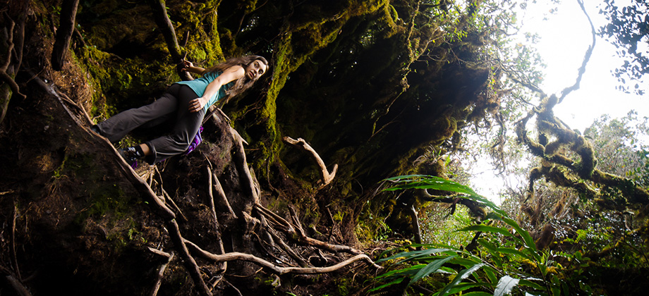
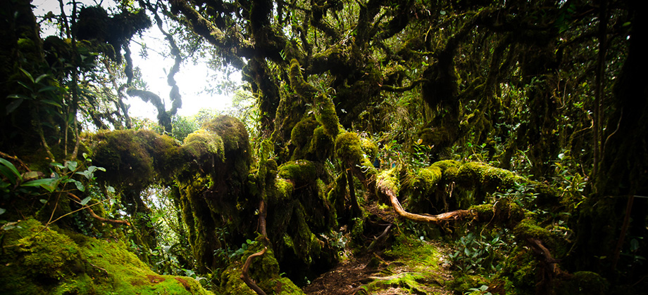
The wooden walkway only covers a distance of two hundred metres or so and gives way fairly quickly to a soft, pulpous terrain that is heavily moisture-laden. We learnt fairly early on to watch where we were stepping as the slightest misstep could leave you floundering to free your feet from the clutches of the unyielding mud. The tree roots that criss-crossed the path proved a boon however as their presence would not only ensure a certain firmness to the immediate terrain, but would also act as both handholds and steps of sorts which helped significantly on sections that had steep inclines.
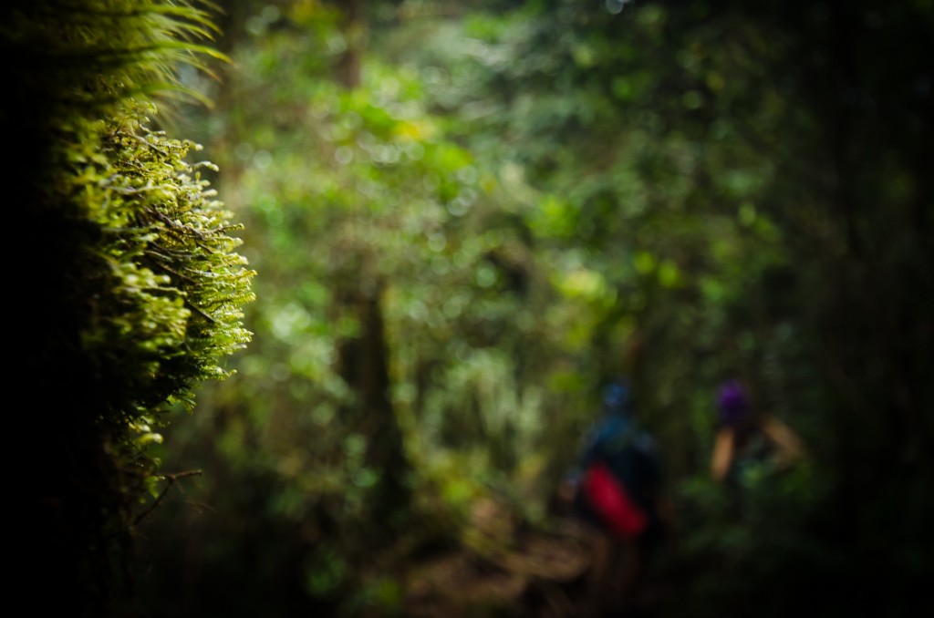
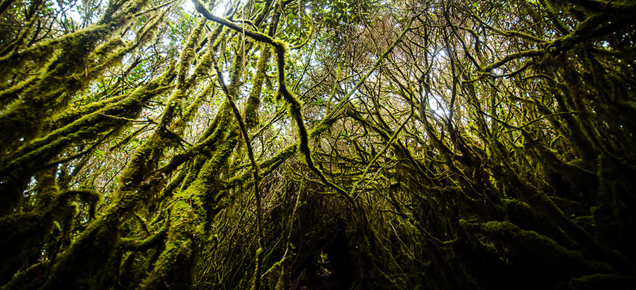
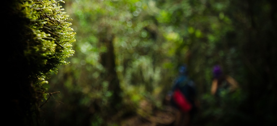
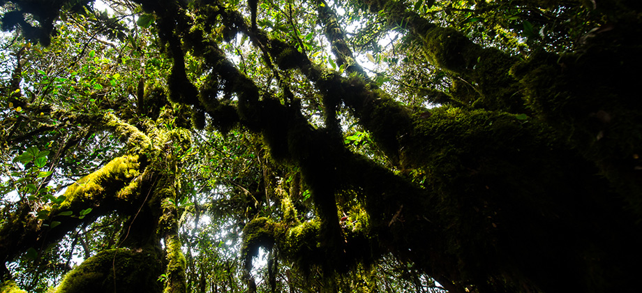
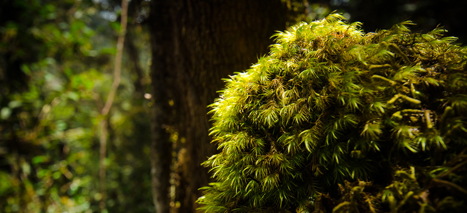
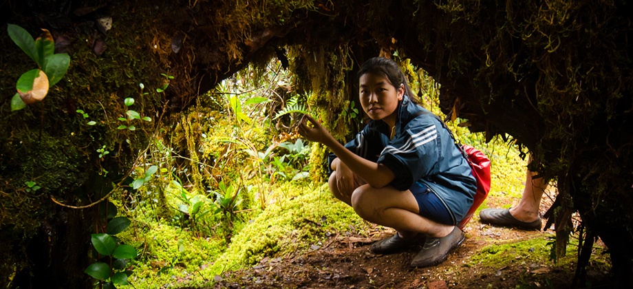
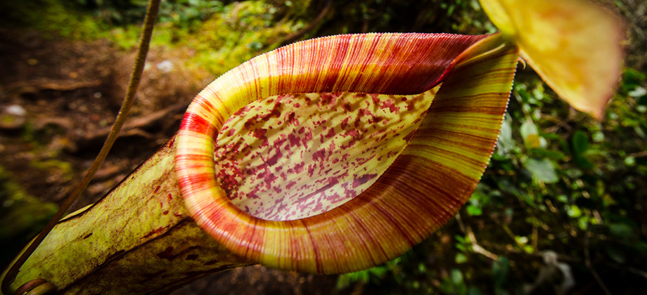
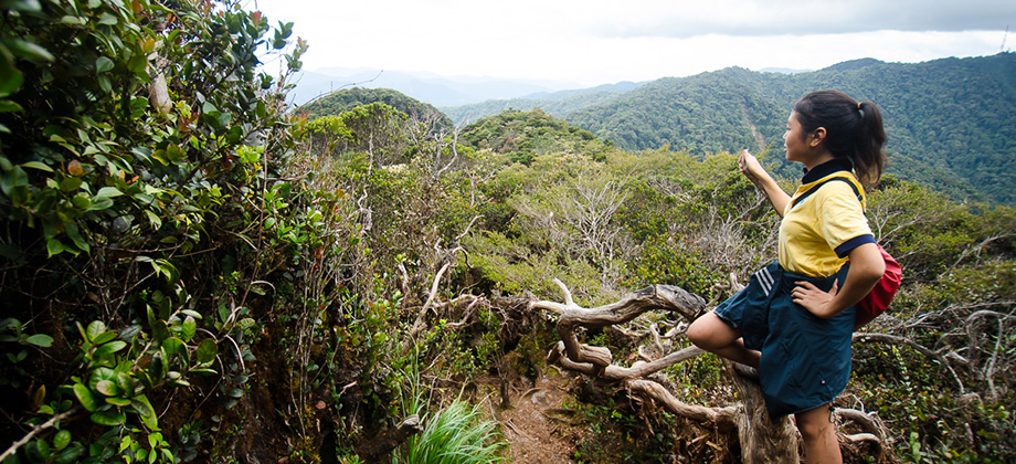
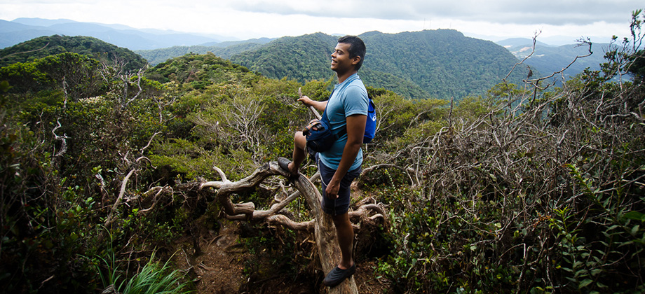
The epiphytic moss proved to be ubiquitous (as was expected) and seemed to coat the trees almost like a softer second skin. I always seem to find cloud forests to be somewhat intriguing as the combination of the soft, pleasant textures and the low temperatures are unlike the tropical forests that one would expect to find at lower elevations. They are also much more pleasant to trek as the usual stifling heat and humidity is absent. I also noticed an abundance of pitcher plants (Nepenthes spp.) along the trail as we made our way on the saddle between the two mountains.
Next : Mount Irau (Part 2)
Malaysia Overview


TEBING TINGGI BACKPACKER(fb)
Mount Guider Servicer Licenced
Will arrange:
-forestry permit
-police report
-nature guider
-emergency kit (basic)
-walkie talkie
-4×4 transport to trail head
ANDY
017-9997790
whataps/sms/call
Hi Ramon,
i plan to hike Mount Irau this week, just wondering whether i should apply hiking permit from Jabatan Perhutanan Pahang first before hiking as some say i need to apply and some say dont have to. Just want u to know that i using ur trail and save it into my Ambit for this trip. thanks bro.
Hi Joe,
I would have to say that if you have the time to spare, then let the relevant authorities know. The main reason why you would want to do this would be so that they are aware that you will be hiking in the area and will know where and when to look for you if you fail to check in after the estimated return date and time. Have fun with the hike! 😀
Hi Ramon,
We met at Yong Belar.Like yo blog and the G100 list. Have only done 7,the rest in my bucket list.
Hey Jit Kwang,
I’ve done a few of them before but haven’t marked them down as I wanted to start fresh to document all the hikes with my Ambit. So all of those that I have marked down on the list as completed were done after February 2013.
Do you have any hikes planned anytime soon?
Hey Ramon,
Enjoyed looking at your pics while taking a break in the office. There’s a mossy garden fondly known as the Secret Garden maybe an hour or less hike from Irau heading towards Yellow peak. Not many photos online of this place. Calm and serene place.
Hi Rachel, thanks for the suggestion! I plan to do a trans-Yellow, Pass, Suku, and Irau trek at some point so I’ll definitely have to look up that secret garden. Sounds very intriguing! 🙂