
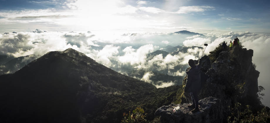
Mount Tok Nenek (Single)
Setting Off

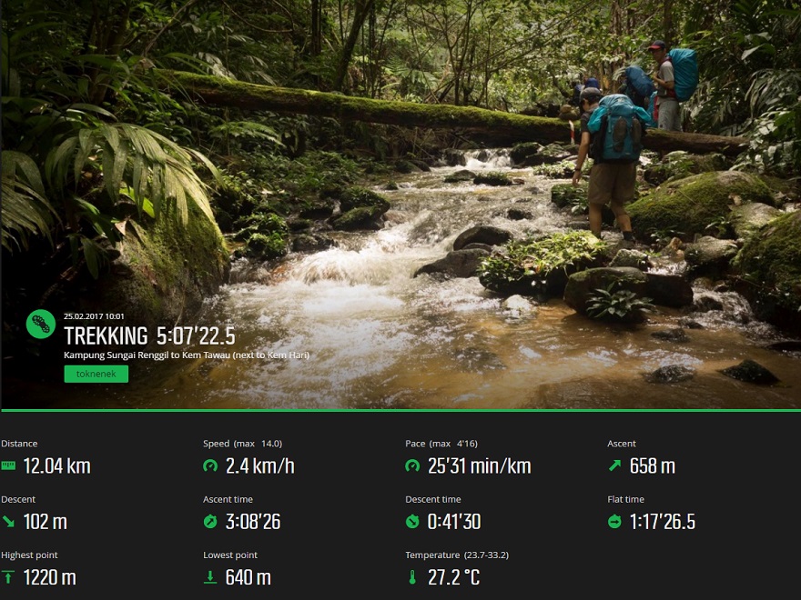
Before we set off, I made it a point to mentally divide the first day's hike into several sections: the first six kilometres consists of a fairly straightforward north-westerly hike to the large river where Simpang-Y (the junction to either Tok Nenek or Yong Yap) is located, kilometre six to nine swings westward and involves multiple river crossings as well as a fairly long traverse through a bamboo-covered area, and from kilometre nine to your chosen campsite also involves multiple (perhaps a dozen or so) river crossings.
We set off around 10:00 and crossed the new metal bridge, and found that the trail that made its way north-west had a slight incline. The late morning sun blazed right above us as water trickled down along the eroded channels that were scattered around the path. The high humidity made everything feel hot and sticky, so I sloshed through some pools of water for fun knowing that my Merrell hiking boots would keep my feet nice and dry. After having walked a kilometre, we passed a small bamboo hut and crossed the first stream a few hundred metres after that. Straight after that, however, we came upon 'Titian Abu Hassan', a large(r) river that is approximately 8-10 metres wide that was supposedly named after the first 'Tok Batin', or village leader, of one of the villages nearby. The group's pace slowed considerably as we slowly crossed the river one-by-one, before regrouping once again on the other side. The group set off again at 10:50, following the trail with the river running along to the left. There were also quite a few pipes here that channeled the river water down to the rivers below that also ran along the trail.

We encountered the next river crossing after 3.8 km, but instead of just crossing the river and continuing on, we decided to stop for a while here. The reason for this was two-fold: to give an opportunity to rest for those who were tired, and to go explore a small but fairly secluded waterfall that lay just upriver. The waterfall cut steeply down and into a fairly narrow chasm that was just wide enough for two or three people to tread-water abreast. The side of the chasm was composed of sheer, dark rock that had several veins of quartz running through them. This rock was also slick and very wet as trickles of water along almost the entire face flowed down from above. By then, the insides of my shoes were completely soaked but I was not too worried at the time as I was hoping that the shoes would be able to vent out most of the moisture once I started hiking again.

At 11:40, we set off once again and began an uphill slog, first on mud that gave way to rock, and then on grass that was lined with ferns. Examples of circinate vernation surrounded us as the dense canopy of trees melted away and the roar of the river faded off down on our left. Bursts of colour also lit up our surroundings every now and again when colourful wildflowers sprung up from the sides of the trail, from the bright yellows of Crotalaria to the vibrant pinks of Bamboo orchids (Arundina graminifolia). I always slowed down a little bit when glimpsing the latter, in the hopes that I would stumble upon one of the most stunning forms of mimicry in nature--the Malaysian orchid mantis (Hymenopus coronatus).
We reached a small marker that stated 'YY1 trail' approximately 4.5 km in. The marker was shortly followed by a small clearing which then abruptly narrowed down to a trail of mud. We slogged through this for a while making our way uphill again before the trail began to level off somewhat. Another river was reached just over a kilometre after the marker that was then followed by a much larger river that had an orange rope set up as a river handline. Most of the larger river crossings only went up to our knees but we took precautions nonetheless: unclipping our waist and sternum straps to be able to ditch our backpacks if we were bowled over, and shuffled along slowly always facing upstream. We reached Simpang-Y at 12:40, at the 6.25 kilometre mark, the noon sun almost directly overhead, decorating the sandy banks of the river by casting shadows of the canopy overhead. It had taken us just over two-and-a-half hours of hiking, swimming, and resting to get to this point... which was it for the first section!
On the other side of the river was a sandy clearing, and beyond that lay the trail that continued up to Mount Yong Yap. We, on the other hand, ended up turning left instead along the trail that made its way up to Mount Tok Nenek. It was 13:15 by then, so it was still fairly hot, but the sounds of the river that lay just to our right helped me feel better, somehow. The trail continued on into the forest for a bit where the dense canopy seemed to completely envelope us, and the heavy shadows that they cast cooled us down even more. The trail did this over and over again, swinging back out to the river, crossing the river to the other side (the exit points marked by cairns) and following the other side of the riverbank instead, before heading back into the forest once again.
The terrain seemed to change dramatically after that. Tall and imposing bamboo shoots (Tribe : Bambuseae) seemed to erupt out of the ground, and the jagged ends of those that had been cut away seemed to wait menacingly for the next clumsy hiker. The soft ground had been turned to veritable mush directly under sections where bamboo shoots lay low, and the further down the line you were the more care you had to take. The pace of the group slowed to a crawl (literally) as everyone grit their teeth and climbed over, crawled under, and slid by the bamboo obstacles that obstructed the path. The relief in the air was palpable as the bamboo section ended approximately 9 km in, just over an hour after leaving Simpang-Y.
We entered the forest once again, with the trail first heading up an incline and then tapering down to just a log that crossed a small chasm. From here, the sounds of the river grew to a roar once again as the trail swung back in towards it. As expected, the trail made its way back into the forest shortly after and the sounds of the river faded away once again. The trail dropped down to the river twice more before reaching the campsite known as 'Kem Lengkuas', which was basically a clearing that had an area of approximately 70 square metres, that was located at the 9.8 kilometre mark. We pressed on after a short rest, the exit that lead back to the trail lying just to the left of the entrance.
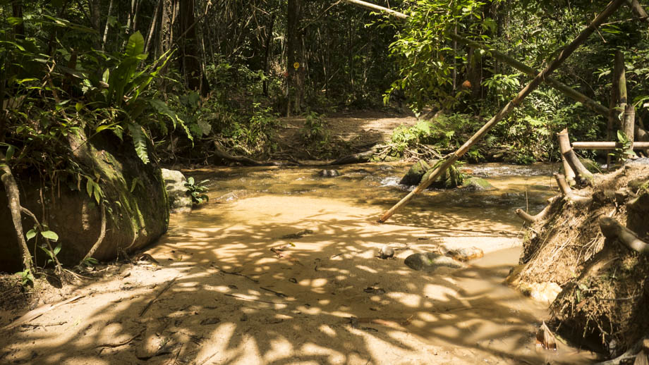
There were plenty of river crossings from this point onwards, with the cairns at the sides of the river indicating where the continuation of the forest trail was. The sunlight was not as harsh now that the sun was lower in the sky, and the angle that the light hit the water sent glints of sunlight shimmering across the surface. There was a soft glow that lingered in the air and it made the movements of the water quite mesmerising, almost as if the light itself was dancing. We arrived at 'Kem Kicap' (marked by the presence of a bottle) shortly after, and soon after that 'Kem Asadi' (marked by a slipper) at the 11.1 km mark. We trudged on just a little more to 'Kem Tawau' before setting up camp for the night.
Route Playback

")
 – Day 3")
 - Day 2")
 - Day 1")