ACT Day 11 - Tilicho Base Camp to Yak Kharka
Upper Khangsar
At the junction, we took the upper left branch that led to Yak Kharka

(
elevation : 4018 m) instead of turning right and down the slopes to Thare Gompa

, which was where we had come from
several days prior. Shortly after stopping for lunch, which was amongst pine trees and great mulleins
(Verbascum thapsus) that lined the sides of the trail, we spotted the hamlet of Upper Khangsar

(
elevation : 4120 m) in the distance.
 The northern lower slopes of Tare Kang (elevation : 7069 m), also knownas Glacier Dome. The treeline can be seen tracing its way across theslopes with alpine grass just above and pine forests just below
 Upper Khangsar (elevation : 4120 m) seen from a distance
Upper Khangsar appeared desolate and the only things that greeted us there were the long gazes of grazing horses
(Equus ferus caballus). The hamlet seemed camouflaged, with the stone walls that made up the houses being the same shade of brown as the surrounding stones and boulders. The houses themselves looked abandoned, with many of them having been reduced to just piles of rubble over the many years.
 Yaks (Bos grunniens) grazing below the hamlet of Upper Khangsar
A noisy chukar partridge
(Alectoris chukar) was heard long before it was seen. It made a loud continuous sound of "chukara-chukara-chukara-chukara", something between a cluck and a squawk, which drew us towards its direction. It was seen perched on the side of a stone wall, but shortly after it was spotted, it let out a loud "squawk" and flew off in a great hurry. Initially we thought that it had spotted us, but soon after, a pair of large Himalayan griffon vultures
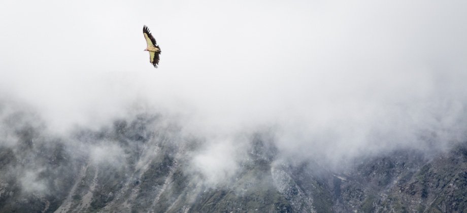
(Gyps himalayensis) swooped in from the direction that the partridge had been facing. The vultures must have seen something, as the pair circled the thermal currents above us for quite some time.
 The chukar partridge (Alectoris chukar) before it flew off in a panic
 One of the Himalayan griffon vultures (Gyps himalayensis) circling above
From there, the trail continued east and ran parallel to a wall that was uncannily similar to the one that I had followed on the
Galties hike in
Ireland just a year ago. Across the valley, the treeline that looked to be slightly higher than we were could be seen, but the trail eventually rose to meet it, just before reaching the edge of the spur

at the 8.6 km mark. This was where the march eastwards along the Marsyangdi Nadi ended and the walk north along the Thorong Khola was to begin.


