
March 21, 2018
Posted by Ramon Fadli in Astronomy, Class 2, Coniferous Forests, Peak Labels, Sunrise & Sunset
Recent Posts


0
0
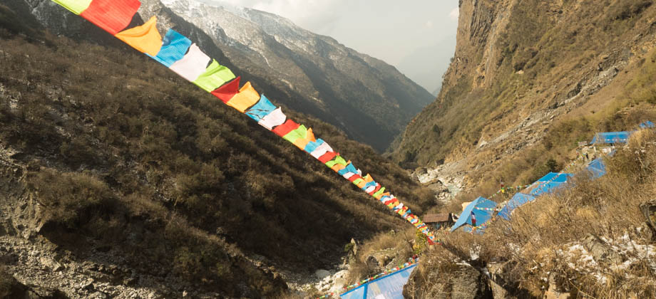
ABC Day 03 - Ulleri to Ghorepani
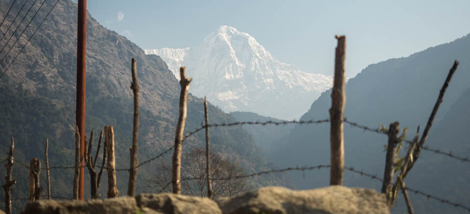
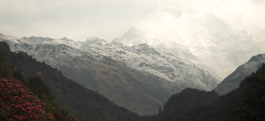
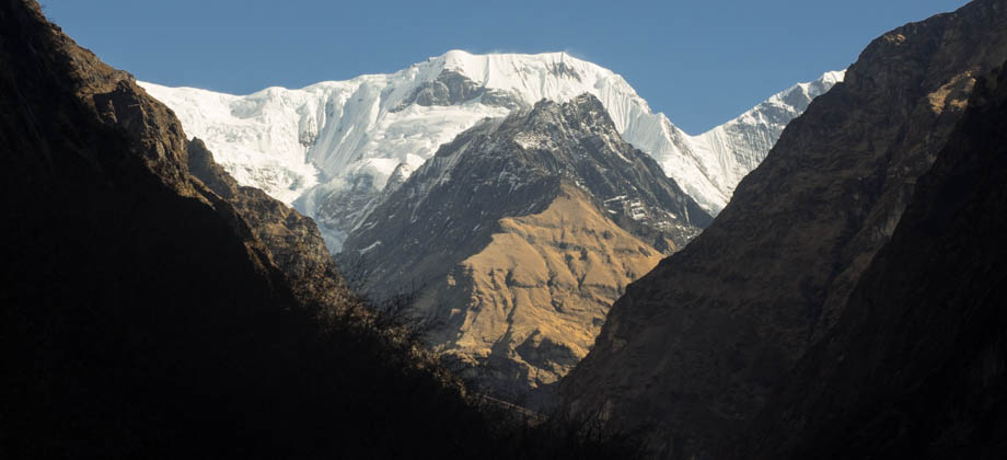
We had met up with Brandon's group (and children) the evening before, and had all set off from Ulleri (elevation : 1960 m) together that morning, just shortly after 08:00. The day had had a slow start as we had spent a fair amount of time marveling at the wonderful valley views of Annapurna South (elevation : 7219 m) and Hiunchuli (elevation : 6441m) that lay to the north-east, way before we had even left the Read more
0
ABC Day 02 - Nayapul to Ulleri
I woke up fairly fresh, after having recovered from a short bout of fever from the night before--a quick and 'gentle' reminder of the importance of good hygiene. After a quick discussion, we had decided that it might be better to just hire a taxi for the 2-hour journey to Nayapul, as my stomach was still feeling a little unsettled and a stomach-churning bus ride might not have been the best idea. The price of the tiny Read more
0
ABC Day 01 – Pokhara
After the 6 hour- and 200 kilometre-long near-death experience on the Prithvi Highway from Kathmandu to Pokhara the day before, I was very glad to still be able to walk around the roads of Pokhara. We had managed to secure a few empty seats in a friend's private coach before it had left Kathmandu, but doing so meant that we had to endure the crazy traffic that swerved in and out in order to overtake each other, Read more
0
March 17, 2018
Posted by Ramon Fadli in Alpine, Alpine, Arctic & Antarctic Tundra, Class 7, Coniferous Forests, Gandaki, Hiking, Humid Subtropical, IUCN Protected Category 6, Looped Hike, Mountains, Multiday Hike, Nepal, Peak Labels, Solo Hike
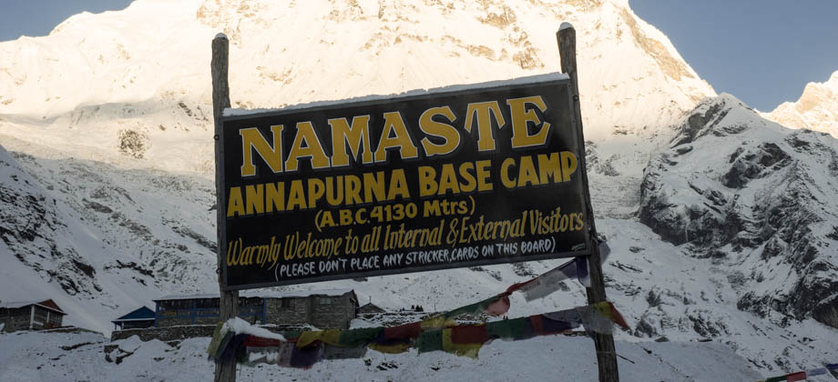
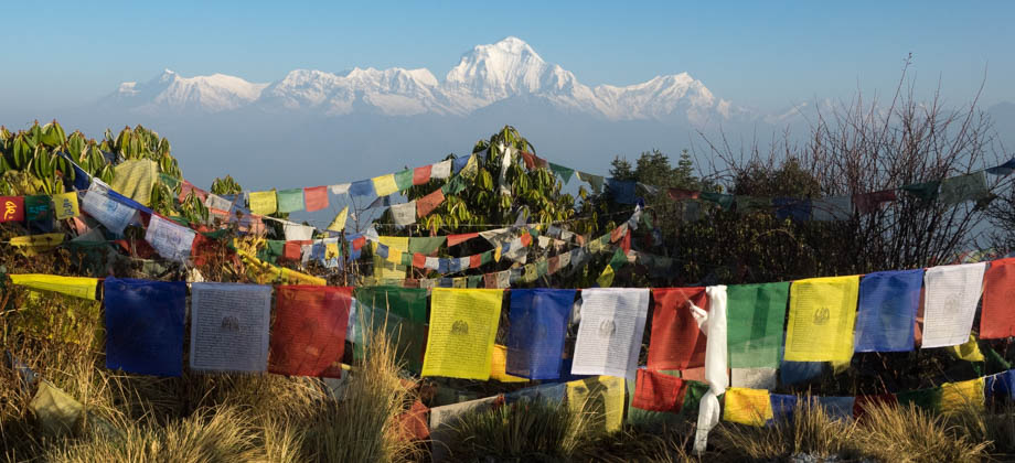
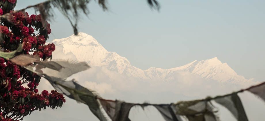
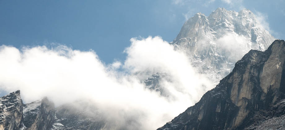
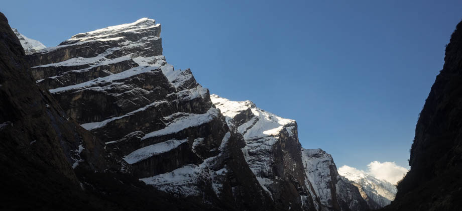
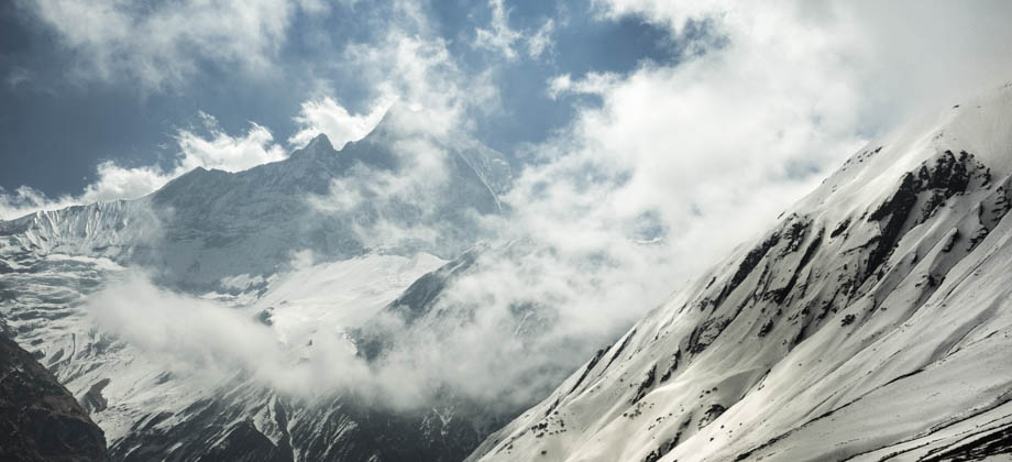
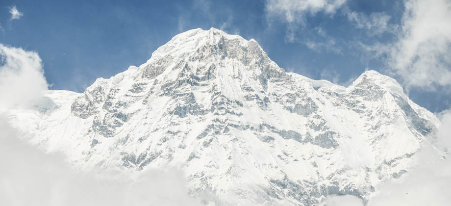
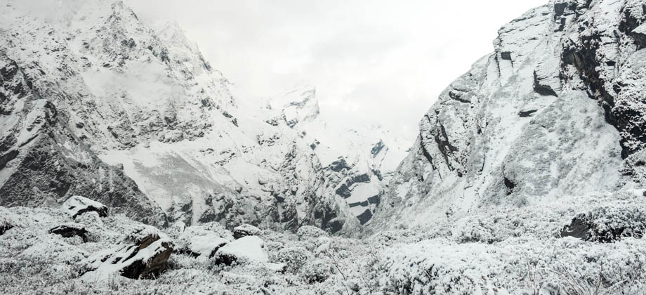
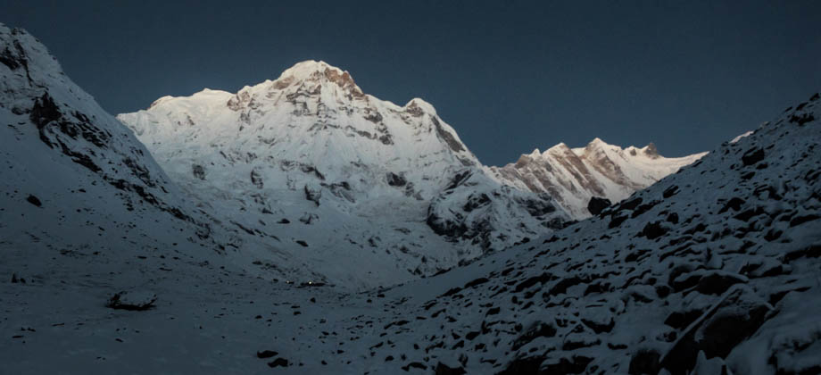
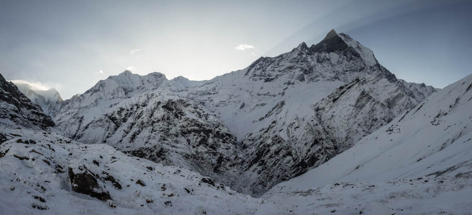
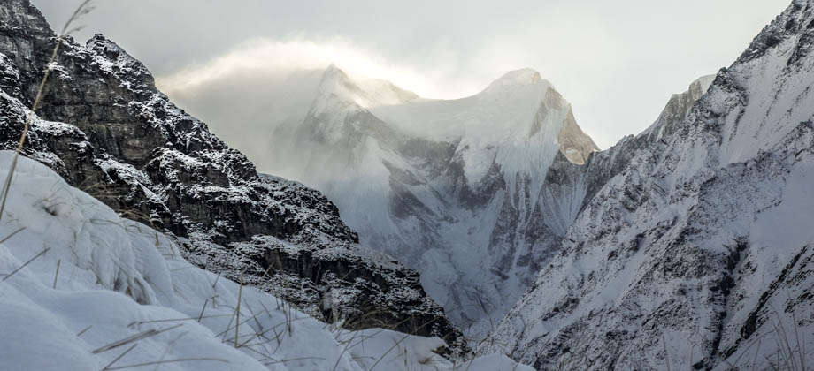
Annapurna Base Camp & Poon Hill
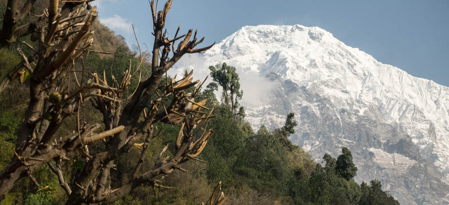
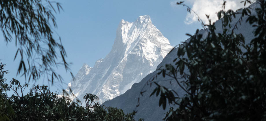
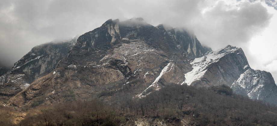
Annapurna (Sanskrit, Nepali, Newar: अन्नपूर्णा) is the name of a massif in the Himalayas that is known for its highest mountain--Annapurna I (elevation : 8091 m), the 10th highest mountain in the world and one of the 14 8000ers. Although Annapurna I was the first 8000er to be summited way back in 1950, it also, as of 2012, has the greatest fatality rate, with a ratio of 34 deaths for every 100 safe returns Read more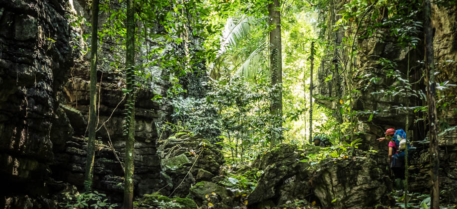
0
March 2, 2018
Posted by Ramon Fadli in Broadleaf Rainforests, Camping, Caves, Caving, IUCN Protected Category 5, Malaysia, Pahang, Tropical Rainforest
Jebak Puyuh Caves
The Jebak Puyuh (Malay: Quail Trap) Cave Complex is something of a hidden gem. The largest caves here may not be as big as those found in the Senyum Cave Complex, but they do take a bit more effort to get to and are thus left relatively untouched. Bear in mind that you will not find signs, well-trodden pathways, and metal stairwells that will help you gain access to the caves, and you will often-times have to push Read more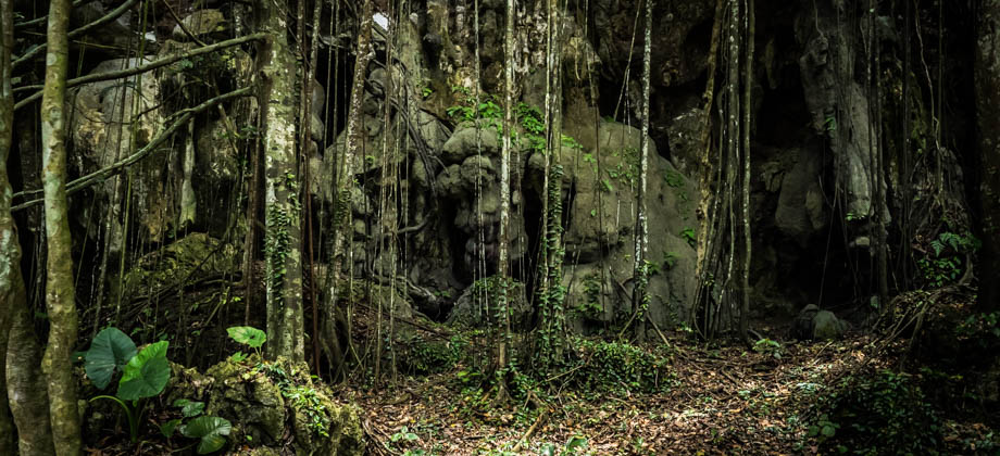
0
March 1, 2018
Posted by Ramon Fadli in Broadleaf Rainforests, Camping, Caves, Caving, IUCN Protected Category 5, Malaysia, Pahang, Tropical Rainforest
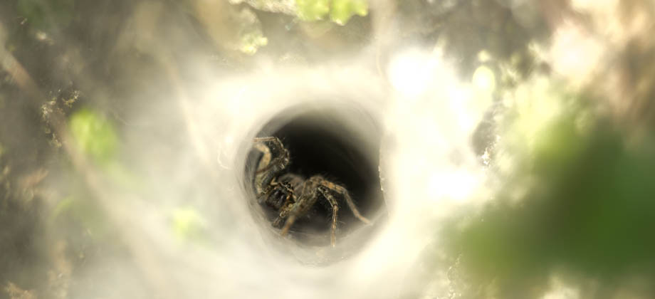
Cave Fauna
The Senyum Cave Complex is surrounded by an ecosystem that supports the greatest diversity of living organisms on Earth--the rainforest. These rainforests are lowland dipterocarp forests, which are just one type of many, and alone can have up to 2000 different species of plants and trees. There is one species that can be found next to the trail on the north-eastern sector of the Senyum cave complex, that Read more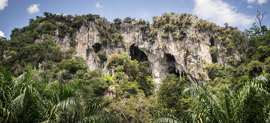
0
February 28, 2018
Posted by Ramon Fadli in Broadleaf Rainforests, Camping, Caves, Caving, IUCN Protected Category 5, Malaysia, Pahang, Tropical Rainforest
Senyum Caves
Senyum Caves (Malay: Gua Senyum) are a network of large chambers and caves that lie scattered around the periphery of a fairly large limestone complex. The complex is one of two, the other being the Jebak Puyuh cave complex, that lie within the north-western limits of the Jengka Forest Reserve. The two complexes are surrounded by palm oil plantations and have a swath of lowland forest separating Read more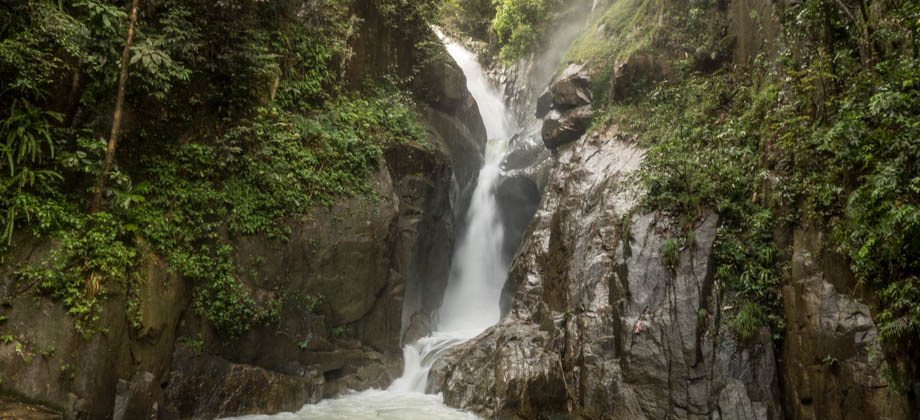
0
December 1, 2017
Posted by Ramon Fadli in Broadleaf Rainforests, Class 1, Day Hike, Hiking, IUCN Protected Category 6, Malaysia, Selangor, Waterfalls
Chiling Waterfall
Chiling Fish Sanctuary was established by the Selangor Fisheries Department in 2005 in order to create a protected area for several species of carps (family Cyprinidae), including the Malayan mahseer (Tor tambroides), known as 'Ikan Kelah' in Malay, and the near-threatened Copper mahseer (Neolissochilus hexagonolepis), or 'Ikan Tengas'. Both these fish fetch very high market prices (the 'Empurau' for instance Read more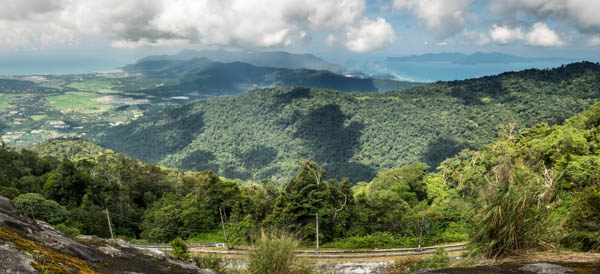
0
November 18, 2017
Posted by Ramon Fadli in Broadleaf Rainforests, Camping, Class 4, Day Hike, Forests, Hiking, Kedah, Malaysia, Mountains, Tropical Monsoon, UNESCO
Langkawi's Giants
Langkawi is occasionally referred to as 'Malaysia's Legendary Island' due to the many legends that surround its sights. The legends that visitors to the island are most likely to encounter are Mahsuri's seven-generation curse and the fairies of Telaga Tujuh waterfall. There are far more, however, one of which is the legend of Langkawi's ancient geological formations. Legend has it that the mountains of Langkawi used Read more
0
July 19, 2017
Posted by Ramon Fadli in Astronomy, Class 1, Coastlines, Day Hike, Diving, Hiking, Indonesia, Islands, IUCN Protected Category 2, Looped Hike, National Parks, Nusa Tenggara Timur, Reefs, Tropical Coral Reefs, Tropical Savanna, UNESCO
Komodo Island
The volcanic island of Komodo (along with Padar, Rinca and an archipelago of smaller islands) is a part of Komodo National Park, an area that was founded in 1980 and declared a UNESCO World Heritage Site in 1991. The national park was formed to protect, and is an eponym of, its most famous denizen--the mighty Komodo dragon (Varanus komodoensis), the world's largest and most dangerous lizard. The islands are Read more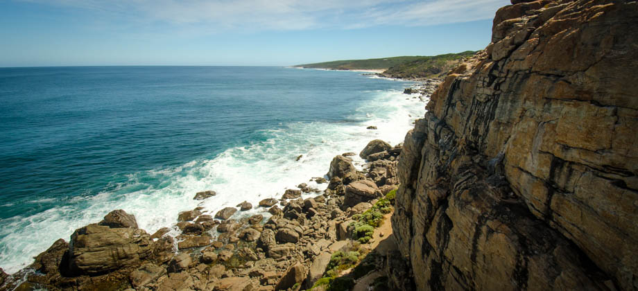
0
July 10, 2017
Posted by Ramon Fadli in Australia, Climbing, IUCN Protected Category 2, Mediterranean, Sclerophyll & Mediterranean Forests, Western Australia
Topo: Wilyabrup
Wilyabrup is by far the largest climbing crag in the Margaret River region. Most of the routes on this stretch of red granite are trad routes but there are also a fair amount of bolted routes scattered around. Although the crag lies three hours drive south from Perth, the majestic views of the coast and the fantastic roar of the crashing waves down below makes the long drive more than worthwhile. You can even head Read more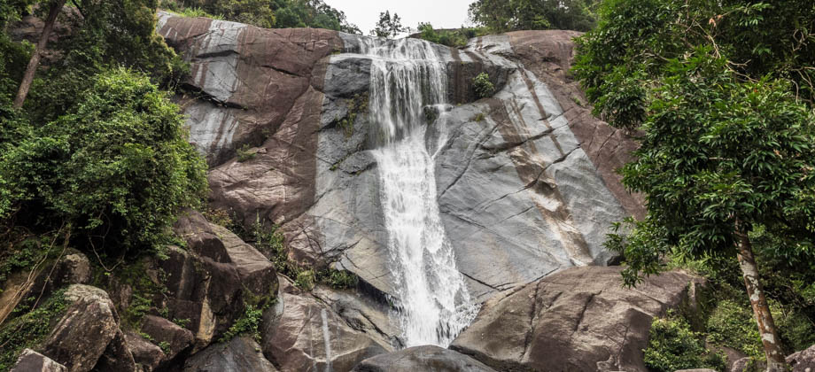
0
July 7, 2017
Posted by Ramon Fadli in Broadleaf Rainforests, Kedah, Malaysia, Tropical Monsoon, UNESCO, Waterfalls
Waterfalls of Langkawi
Telaga Tujuh Waterfall is Langkawi's most well-known waterfall. The waterfall's name means "Seven Wells" in English, and is derived from a series of seven interconnected pools that are located on its upper level. The waterfall is located on the slopes of Mount Mat Chinchang and lies along a demarcation area between the Machinchang Formation, which consists mainly of sandstone and shale, and Mount Raya Read more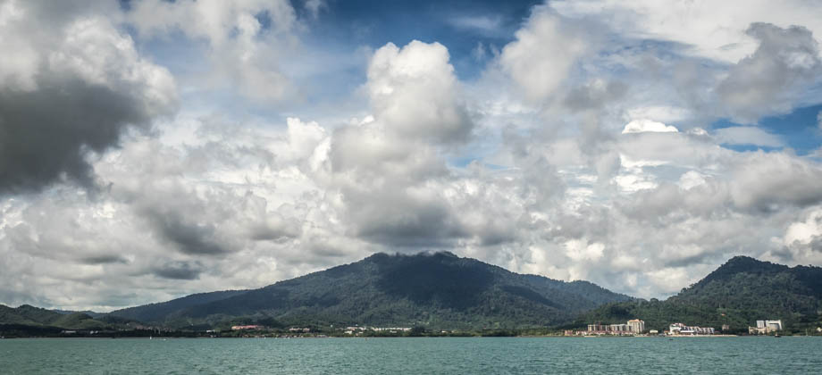
0
July 6, 2017
Posted by Ramon Fadli in Broadleaf Rainforests, Kedah, Malaysia, Tropical Monsoon, UNESCO
Langkawi
Langkawi is an archipelago in the Andaman Sea that consists of more than a hundred islands that are blanketed in 10-million-year-old rainforests and smatterings of barren rock that poke through the vast tree canopy. The rock formations that can be found here consist mainly of hard granite that make up the spine of the main island and give rise to both Mount Raya (elevation : 881 m) and Sawar Hill, as well as much older Read more
11
July 1, 2017
Posted by Ramon Fadli in Broadleaf Rainforests, Climbing, Malaysia, Selangor, Tropical Rainforest
Topo: Batu Caves
The limestone formations that make up the Batu Caves (Tamil: பத்து மலை) complex are said to be hundreds of millions of years old. The complex itself is mainly known for the Hindu temples (the main one dedicated to Lord Murugan), and the heavily publicised annual Hindu pilgrimage that takes place during Thaipusam (Tamil: தைப்பூசம்). Batu Caves derives its name from Sungai Batu (Stone River), the river that runs Read more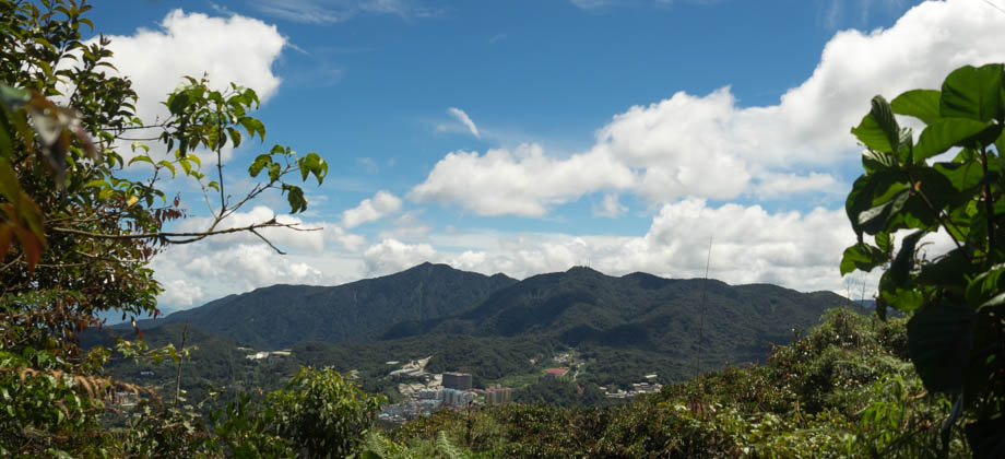
0
June 25, 2017
Posted by Ramon Fadli in Broadleaf Rainforests, Camping, Class 3, Day Hike, Forests, Hiking, IUCN Protected Category 1b, Looped Hike, Malaysia, Mountains, Pahang, Tropical Rainforest
Mount Berembun
Mount Berembun (elevation : 1840 m) is one of the more interesting mountains to climb in Cameron Highlands as there are plenty of trails (most of which are shown in the image below) to choose from that start at different points around town. The fact that it is also the closest summit to one of the only camping spots that is readily available in this area, Sungai Pauh Campsite (also known as the Forestry Department Read more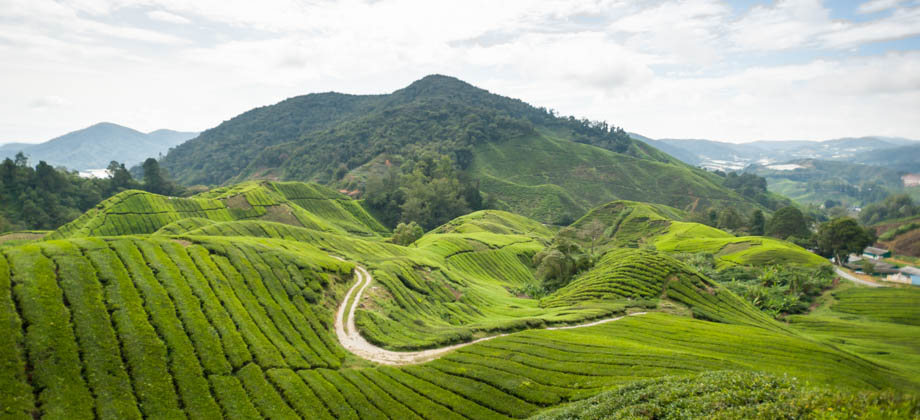
0
June 24, 2017
Posted by Ramon Fadli in Broadleaf Rainforests, Camping, Forests, Hiking, Malaysia, Mountains, Tropical Rainforest
Cameron Highlands
Cameron Highlands (Chinese: 金马崙高原, Tamil: கேமரன் மலை) is Malaysia's largest hill-station area, and with an elevation that ranges from 1300 m to 1800 m and a mean annual temperature of about 18 °C, is famous for its cool weather and huge tea plantations that decorate its rolling hills. The area was named after William Cameron, an explorer who mapped the area back in 1885. Before we go on, please jot Read more
0
May 8, 2017
Posted by Ramon Fadli in Camping, Class 1, Finland, Forests, Hiking, Humid Continental, IUCN Protected Category 2, Lakes, Looped Hike, Multiday Hike, National Parks, Solo Hike, Taiga & Boreal Forests, Uusimaa
Nuuksio National Park
The landscape of Nuuksio National Park is classically Finnish: numerous lakes dot the landscape, all of which are completely engulfed by conifer forests (Division: Pinophyta). These forests, which top the gentle glacier-carved hills, are cool and damp and are mostly made up of evergreen spruce (Picea sp.) and pine (Pinus sp.), both of which are well-adapted to the cold climate--they are more resistant to freezing than Read more
2
April 21, 2017
Posted by Ramon Fadli in Class 5, Day Hike, Hiking, Ireland, Lakes, Limerick, Looped Hike, Mountains, Oceanic, Solo Hike, Temperate Deciduous Forests, Tipperary
Galtee Loop
The Galtees are the highest inland mountain range in Ireland, and can be seen from afar as you travel between Cork and Dublin. The range seems to suddenly rise up from the surrounding plains, from almost sea level to just over 900-metres high. The highest mountain is Galtymore (elevation : 919 m), which is Ireland's 14th highest, and just manages to make the list of 'furths'. The hike up to the Galtees will Read more
0
February 25, 2017
Posted by Ramon Fadli in Broadleaf Rainforests, Class 6, Forests, Guided Hike, Hiking, IUCN Protected Category 6, Kelantan, Malaysia, Mountains, Multiday Hike, Tropical Rainforest