
Recent Posts


0
0
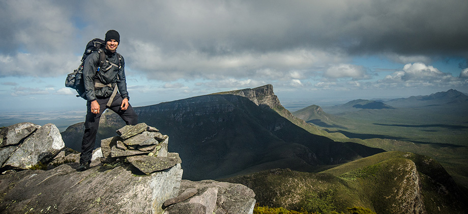
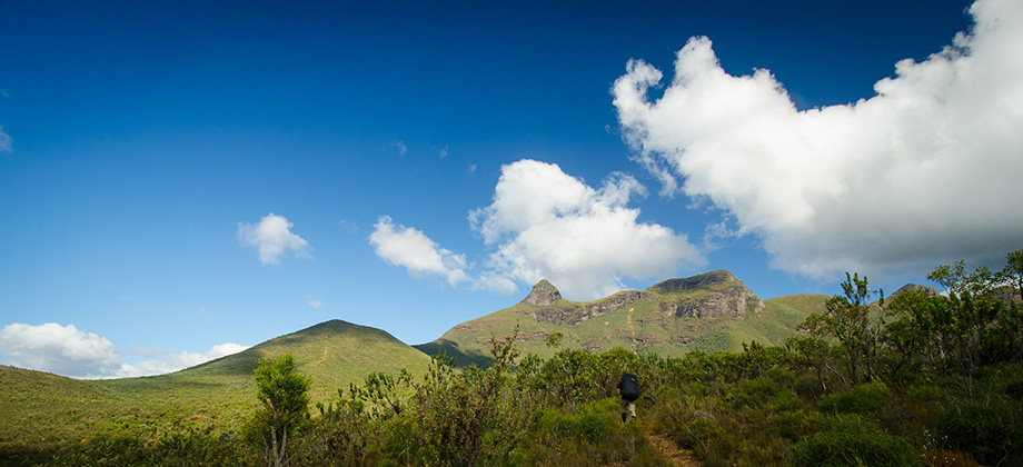
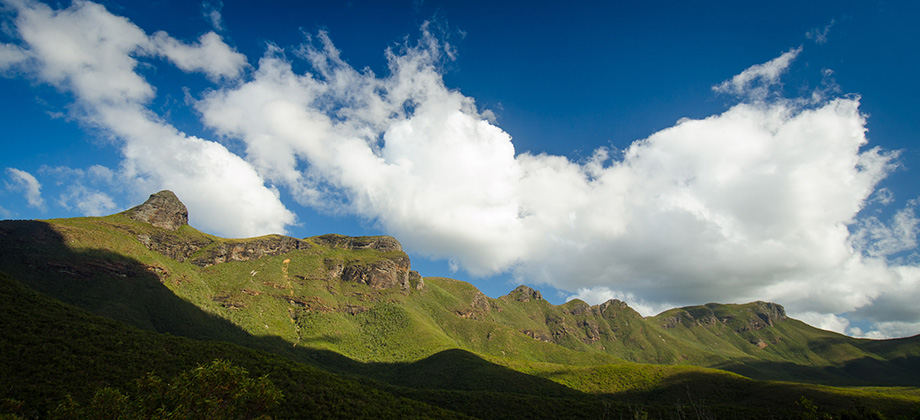
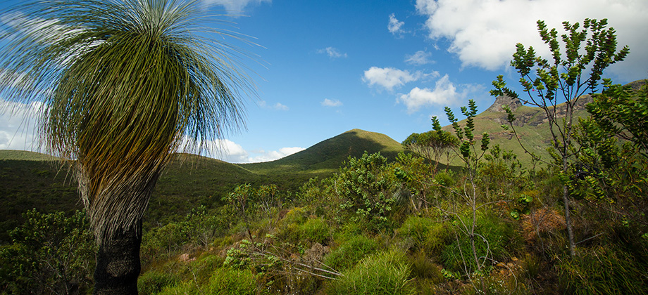
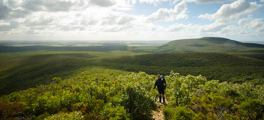
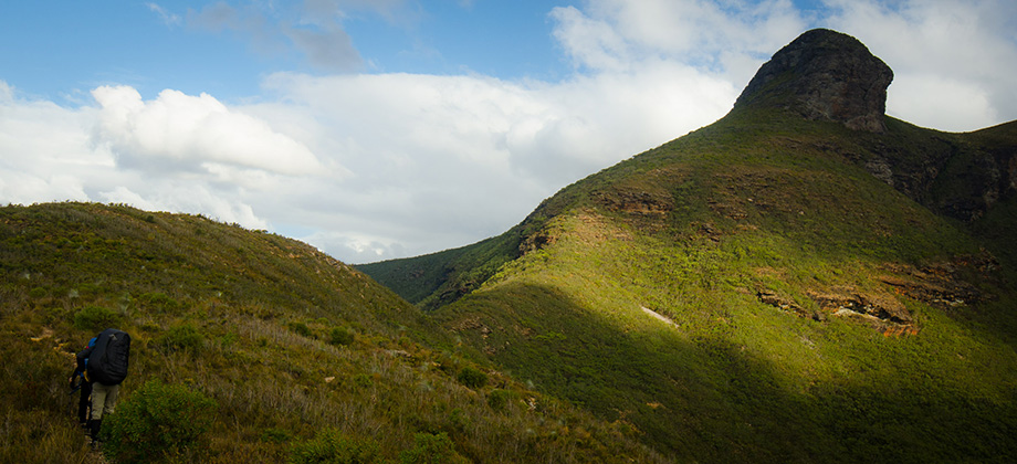
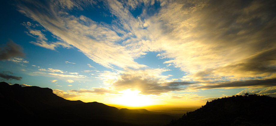
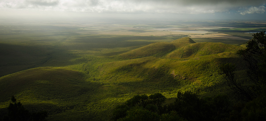
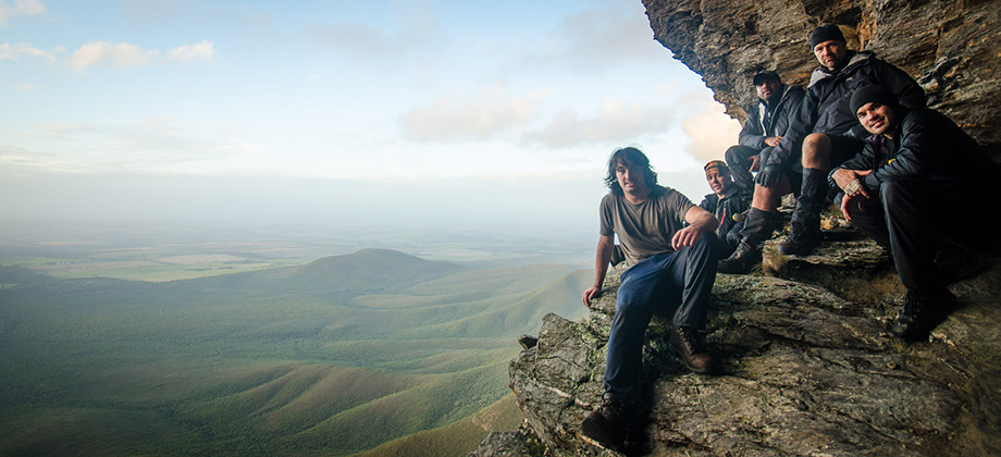
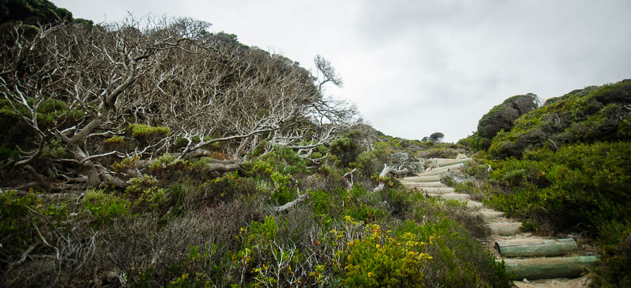
Stirling Ridge Walk - Day 1
Despite taking almost two hours, the six-kilometre-long walk along the Boundary Fence Track from the (Phytophthora cinnamomi) dieback control barrier (just after the Gnowellen Road junction) to the entrance of the Stirling Range National Park was rather uneventful. Everyone seemed to be in an intrepid mood despite having ended up with soggy boots early on after foolishly attempting to cross a flooded section with Read more
3
May 22, 2014
Posted by Ramon Fadli in Australia, Camping, Class 7, Hiking, IUCN Protected Category 2, Mediterranean, Multiday Hike, National Parks, Ridges, Sclerophyll & Mediterranean Forests, Sunrise & Sunset, Western Australia
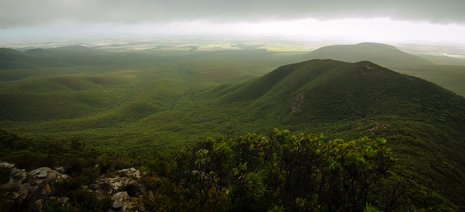
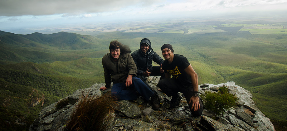
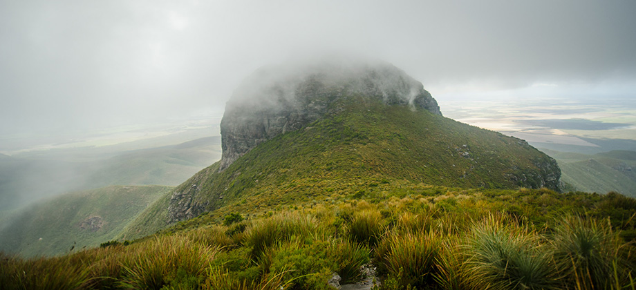
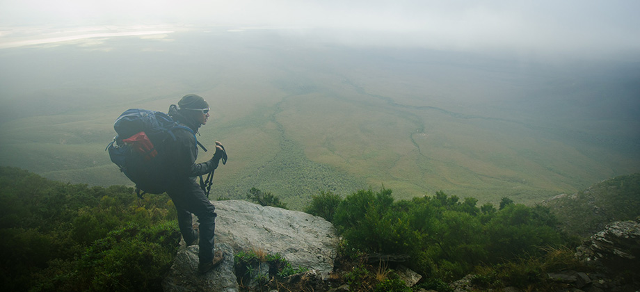
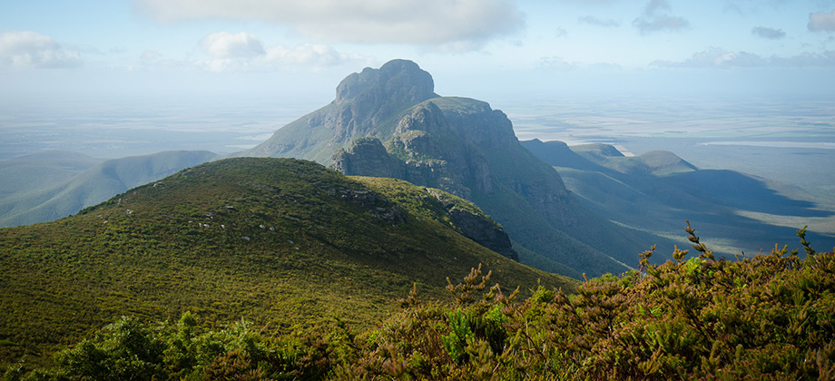
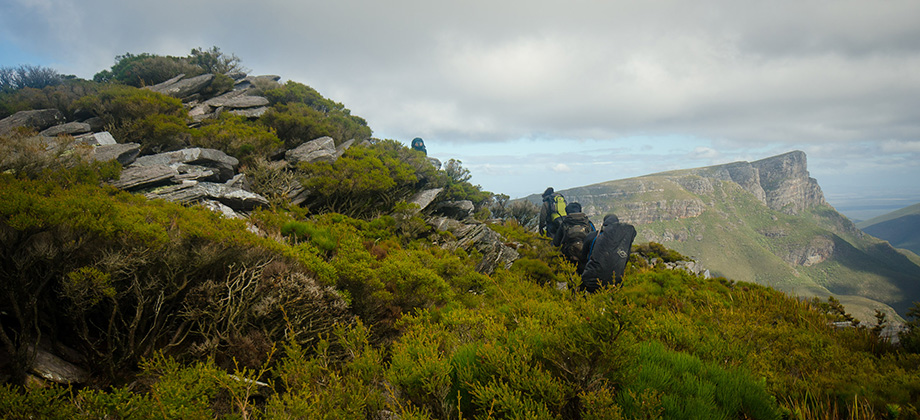
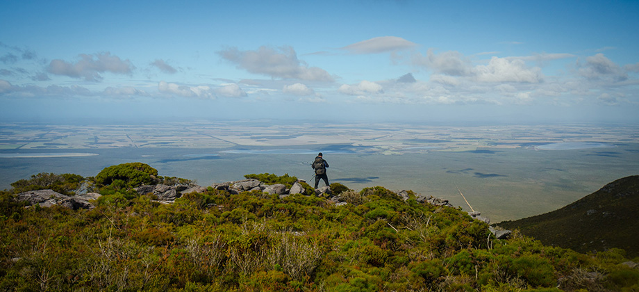
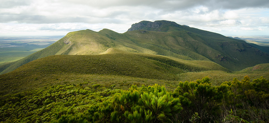
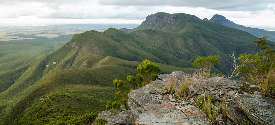
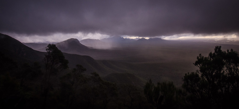
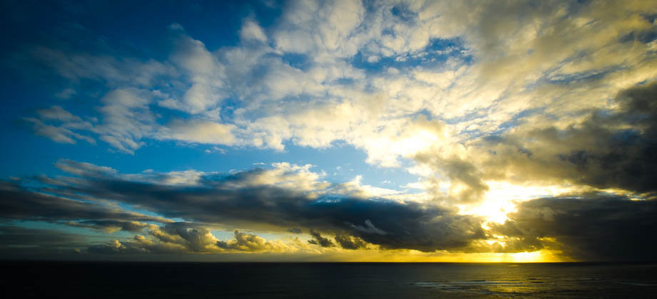
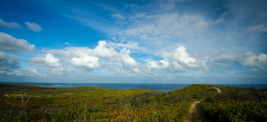
Stirling Ridge Walk
The Stirling Range is unique in many, many ways. Suddenly and abruptly rising from very flat, nondescript lowlands, the range is a prominent feature in the landscape and can be seen clearly from vast distances. Spectacular cloud formations are frequently seen here, which explains the Aboriginal (the Wagyl Kaip people being the traditional custodians) name for the range, 'Koi Kyenunu-ruff', which means ‘mist rolling Read more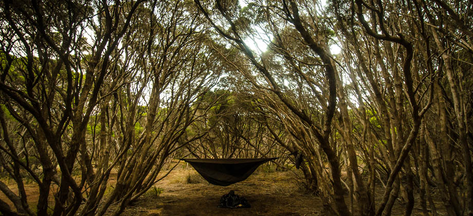
1
April 20, 2014
Posted by Ramon Fadli in Australia, Camping, Sclerophyll & Mediterranean Forests, Western Australia
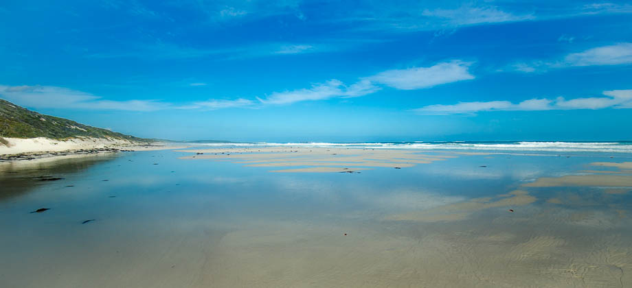
Cape to Cape Campsites
Most of the campsites that you will find along the Cape to Cape track are equipped with a shed that functions as a toilet that is next to two large rain water tanks - I would always recommend treating the water from the tanks prior to consumption (either by using water-purification tablets, a steripen, or by just boiling the water). The campsites also have picnic tables with benches for your perusal. You can use the links Read more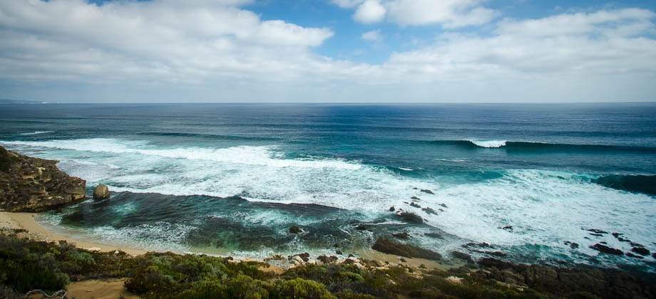


0
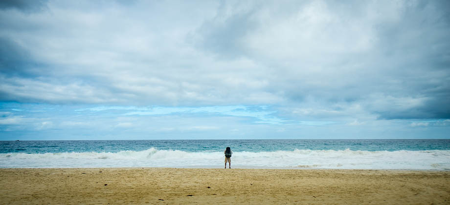
Cape to Cape Day 06 – Deepdene to Cape Leeuwin
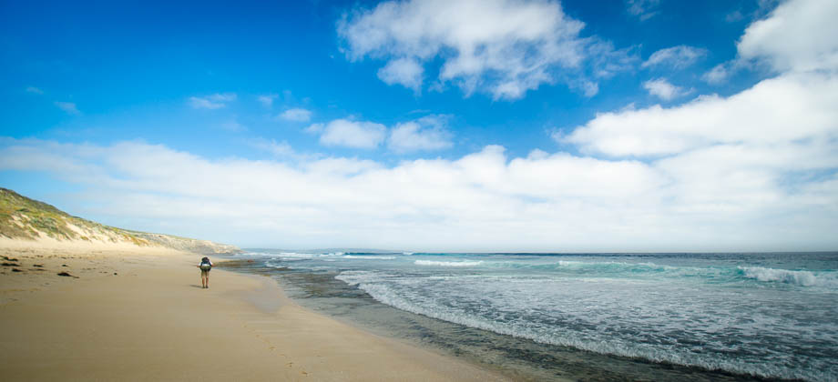
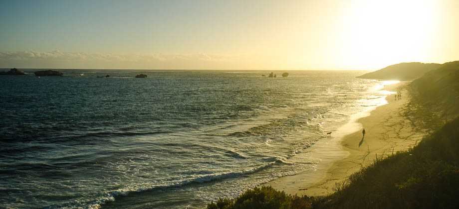
I broke camp at 08:10 that morning and made my way from Deepdene Campsite down the 390 metre trail to the dune blowout. I was greeted by dark, ominous clouds, a sure sign of impending drama. I had had enough of the blistering sun by then and welcomed the brisk sea breeze as I pushed my way onwards with my sights transfixed on the tiny lighthouse in the distance.I found that stepping in the footsteps of Read more
0
Cape to Cape Day 05 – Conto's to Deepdene
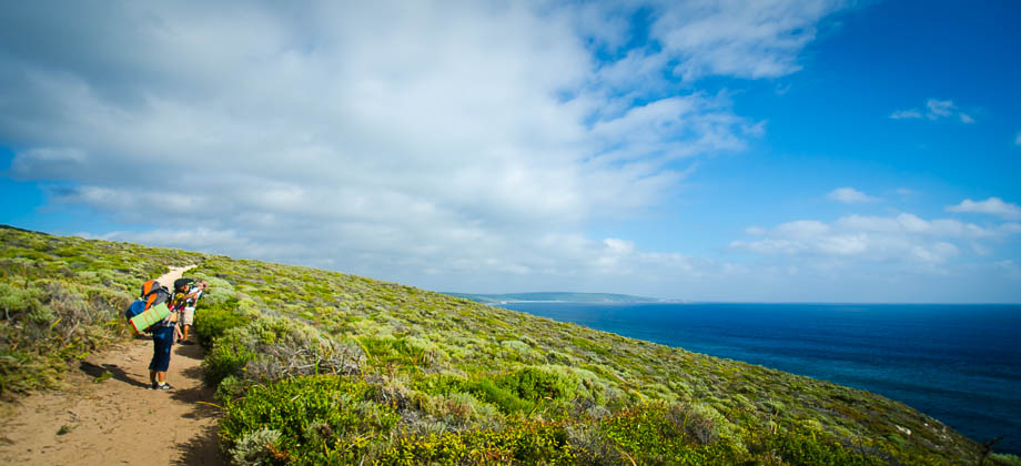
I was very eager to get away from the crowds of Canto's Campsite that morning, so I packed up my hammock quickly and skirted the hoards of camper vans and oversized (and excessive) tents in order to make my way out of the campgrounds. I arrived at the sign outside the entrance and turned left down the trail, circumventing the boundaries of the massive campsite. The trail was refreshingly thin here and Read more
0
Cape to Cape Day 04 – Ellensbrook to Conto's
I left Ellensbrook campsite a little later than I had hoped, just after 08:00. Realising that I had over 30 kilometres of hiking to do that day, I would need to hike at an average speed of approximately 4 km/h to reach the next campsite before the sun set - a speed that was definitely achievable especially considering that I was now hiking alone. The clouds didn't look too promising though and I caught myself hoping Read more
0
Cape to Cape Day 03 – Moses Rock to Ellensbrook
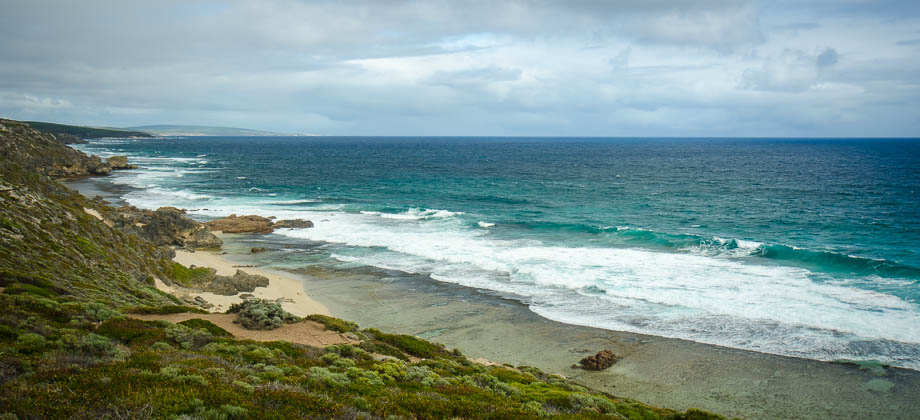
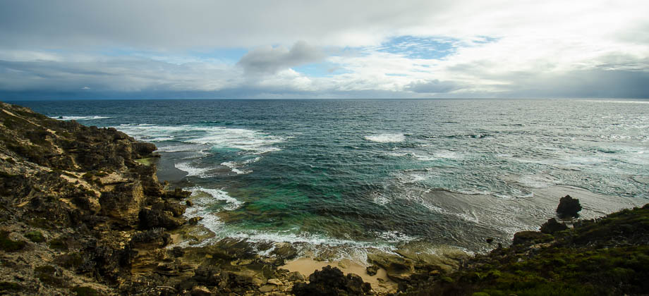
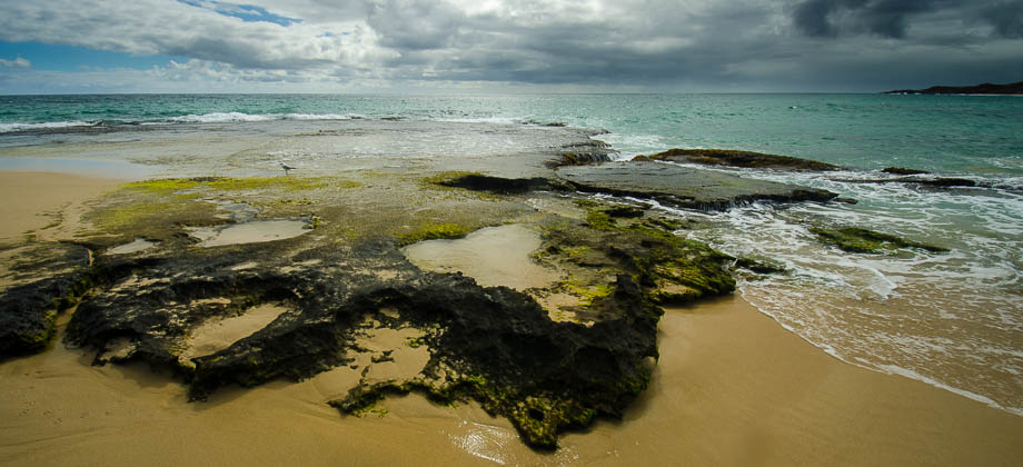
The three of us left Moses Rock campsite just after 09:00 and turned left at the crossroads in order to continue heading southward. As the views of the coast opened up, the overwhelming power of the ocean immediately became apparent - the initial reverberating smash of the waves against the rocks, the water being powerfully sucked back out to the ocean in the surge that would always follow, and the soft Read more
0
Cape to Cape Day 02 – Yallingup to Moses Rock
The sky was bleak and overcast as we left Camp Duckworth that morning, with squalls occasionally whipping through the area. As the three of us carried on walking south, I couldn't help but stare at the huge ominous clouds that seemed to be looming in across the ocean from the west. We passed a junction in the trail about a kilometre in and right after that, we stumbled upon 'The Rabbits' carpark that was located on Read more
0
Cape to Cape Day 01 – Cape Naturaliste to Yallingup
The three of us set off along the Cape to Cape track as soon as we reached the Cape Naturaliste lighthouse. In hindsight, I regret not taking some time to explore the lighthouse itself considering that it is a landmark and an integral part, as a start or end point, of the Cape to Cape track.The beginning of the trail was very easy to locate as the sign posts were very clear and very prominent. We set off down the Read more
0
April 13, 2014
Posted by Ramon Fadli in Australia, Camping, Class 6, Coastlines, Hiking, IUCN Protected Category 2, Mediterranean, Multiday Hike, National Parks, Sclerophyll & Mediterranean Forests, Solo Hike, Western Australia
Cape to Cape Track
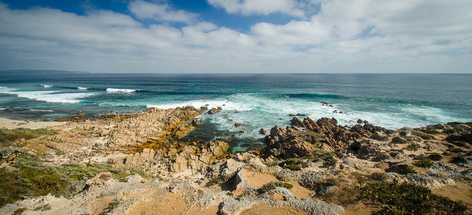
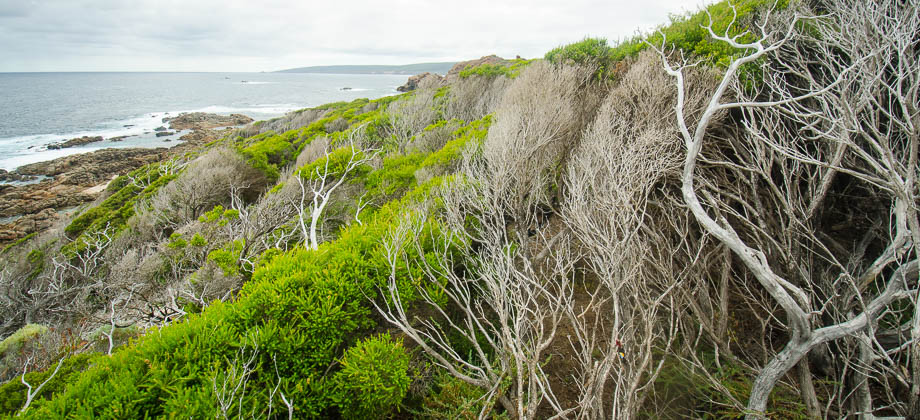
The Cape to Cape Track is a 135-km-long trail that runs north-south along the west coast of the peninsula between Cape Naturaliste in the north, and Cape Leeuwin in the south. The trail itself mostly follows sweeping, windswept limestone ridges and long stretches of seemingly untouched, pristine beaches. It does, however, occasionally mix it up by looping inland through woodland and gorgeous karri forests Read more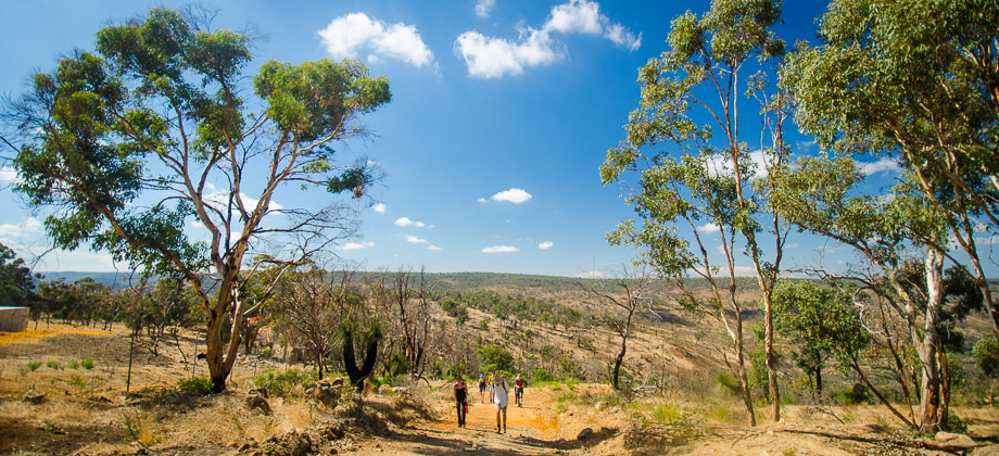
0
April 6, 2014
Posted by Ramon Fadli in Australia, Class 2, Day Hike, Hiking, IUCN Protected Category 2, Looped Hike, Mediterranean, National Parks, Outback, Sclerophyll & Mediterranean Forests, Western Australia
Echidna Trail
Walyunga National Park is located just next to the Darling Scarp, an escarpment that lies to the east of the Swan Coastal Plain. The park itself is known to contain one of the largest known Aboriginal campsites that can be found in and around Perth, a campsite that has apparently been used for more than six thousand years. The carpark that lies just next to the start of the trail can be reached by following Walyunga Read more
2
March 22, 2014
Posted by Ramon Fadli in Australia, Class 2, Day Hike, Hiking, IUCN Protected Category 2, Looped Hike, Mediterranean, National Parks, Outback, Sclerophyll & Mediterranean Forests, Western Australia
Ghost House Walk
Yanchep National Park lies on the Swan Coastal Plain, an area that was traditionally under the care of the Yued, Whadjuk, Binjareb and Wardandi Noongar peoples. The tribal name for the park is 'Nyanyi-Yandjip'; 'Yanchep' having been derived from 'Yandjip', which is the aboriginal name for the reeds that fringe the lakes in the area that are thought to resemble the mane of the Waugul (a snakelike dream-time creature Read more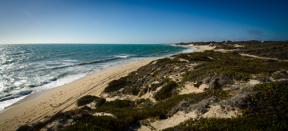
1
February 1, 2014
Posted by Ramon Fadli in Australia, Camping, Coastlines, Mediterranean, Sclerophyll & Mediterranean Forests, Western Australia
Wilbinga 4WD
Wilbinga is one of those hidden gems that not many people seem to have heard about. It is a place that is filled with sandy tracks that lead up to sand dunes that fringe the coastline - a perfect place for 4WD driving! The area is a Quindalup dune area and is part of the Gnangara Park. It lies to the north of Perth just after the town of Two Rocks, just after Yanchep National Park, which is roughly an hours drive away from Read more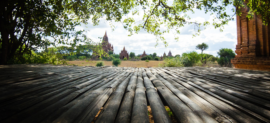


0
July 20, 2013
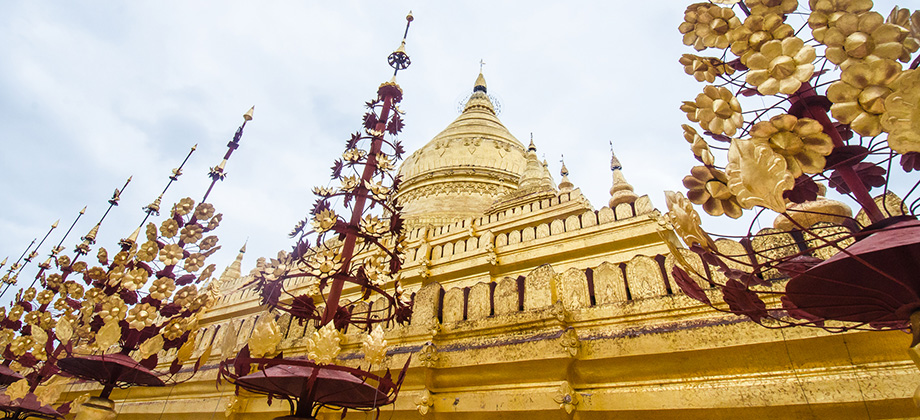
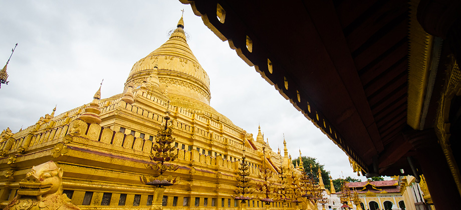
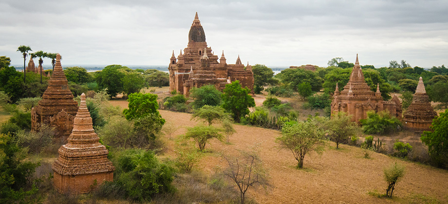
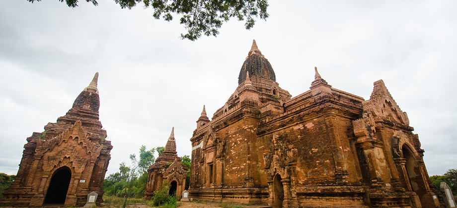
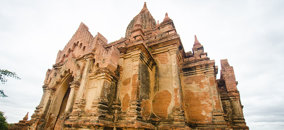
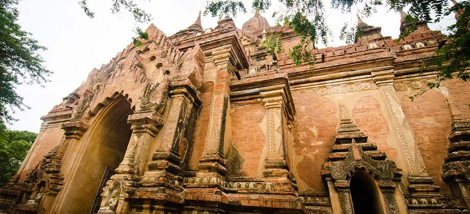
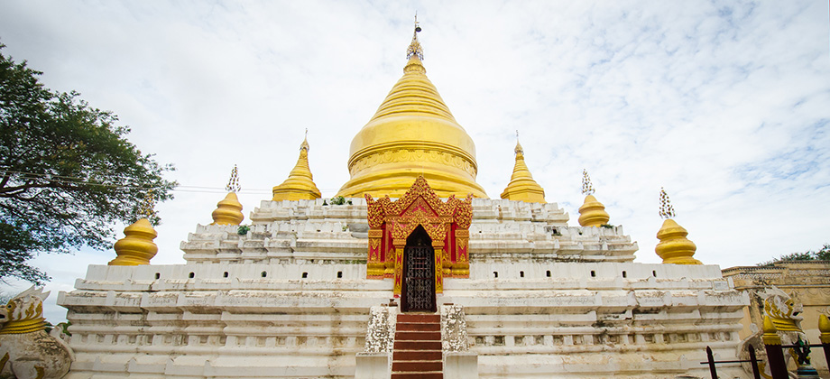
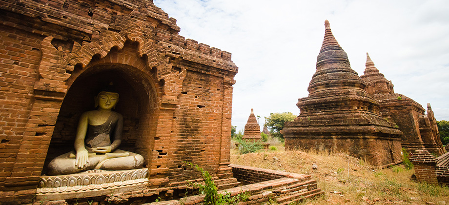
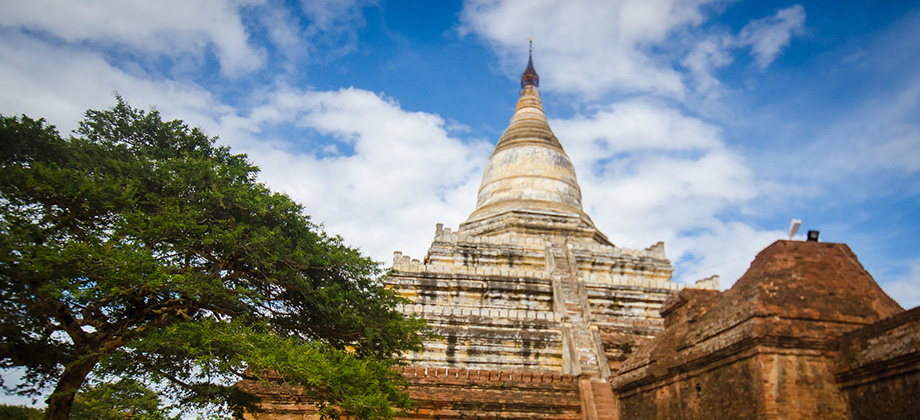
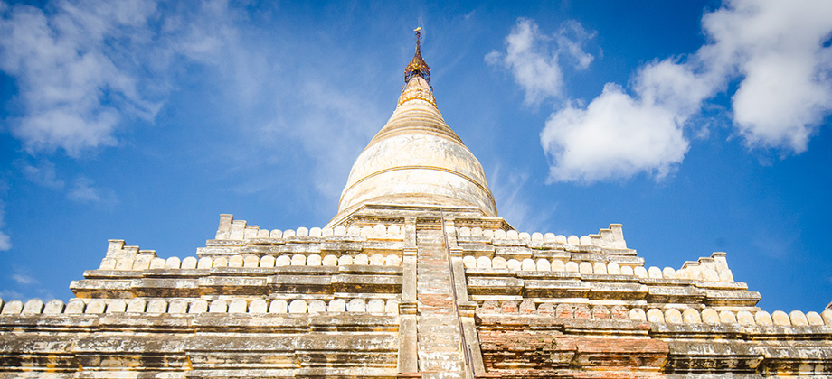
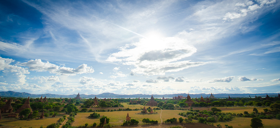
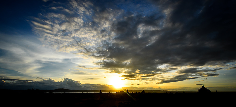
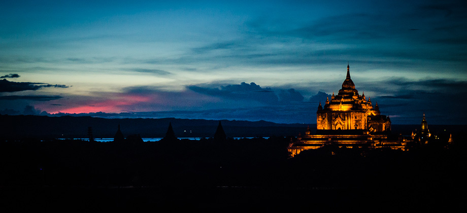
Posted by Ramon Fadli in Budget, Cycling, Dry Broadleaf Forests, Mandalay, Myanmar, Semi-arid Steppe, Solo Hike, Sunrise & Sunset
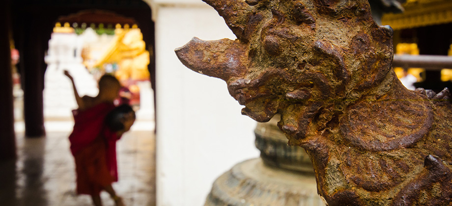
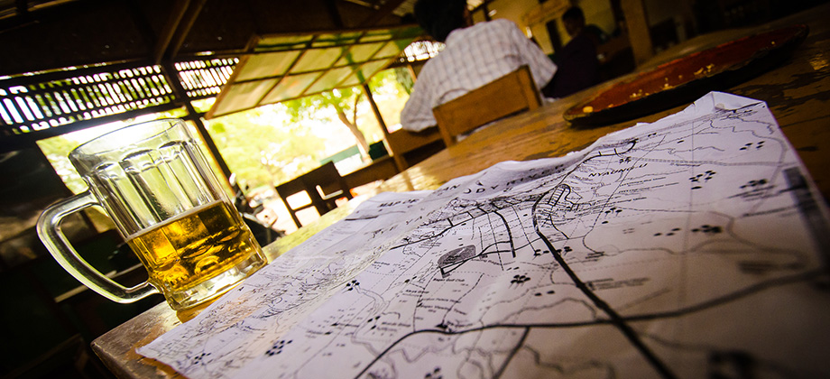
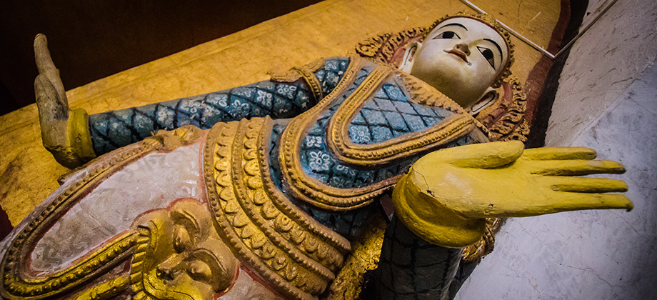
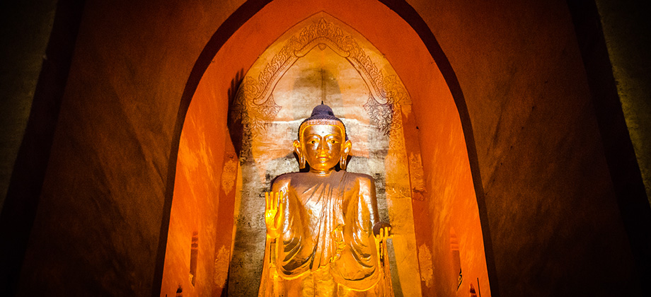
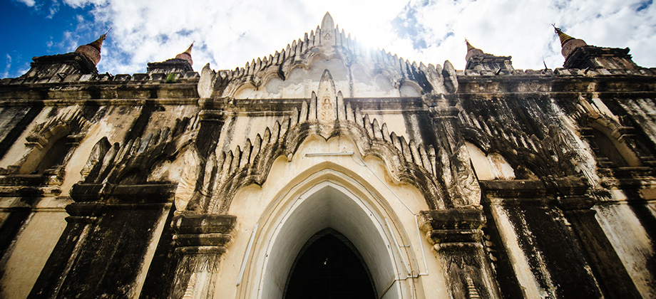
Bagan
I climbed out of the Shwe Mandalar express bus groggily and somewhat curmudgeonly after being rudely awoken by the strident cry of the bus driver just as the bus squeakily rolled to a stop. Despite the lack of sleep, I found to my surprise that the bus ride had been far more comfortable than I had anticipated. For some reason I had expected the eight and a half hour ride to be on a cramped and very crowded bus that Read more
2
May 30, 2013
Posted by Ramon Fadli in Broadleaf Rainforests, Camping, Forests, Hiking, IUCN Protected Category 2, Kelantan, Malaysia, National Parks, Tropical Rainforest, Waterfalls
Stong Waterfall
The 270-metre-high, seven-tiered Stong Waterfall is reputed to be the tallest waterfall in Peninsular Malaysia. It is located in the 21,950 hectare 'Gunung Stong State Park' that was formerly known as 'Jelawang Forest'. The directions to the park can be found in the post about Baha's Camp, a camp that is located on one of the higher tiers of this waterfall. Before we proceed any further however, I have to take a moment Read more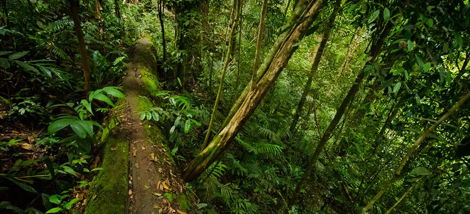
0
May 29, 2013
Posted by Ramon Fadli in Broadleaf Rainforests, Camping, Class 5, Day Hike, Forests, Hiking, IUCN Protected Category 2, Kelantan, Looped Hike, Malaysia, Mountains, National Parks, Tropical Rainforest
Mount Stong, Mount Ayam, and Mount Baha
The group had split with Taner, Jenna and I eager to hike to the three peaks whilst the others decided to stay behind and explore the waterfalls. By the time the three of us set off from Baha Camp it was already 10:26. We made our way to the crossroads that lay just outside the campsite quickly to avoid any guides that may still be lingering around the camp just in case they tried to prevent us from heading up to the Read more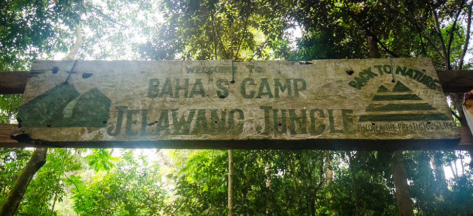
0
May 28, 2013
Posted by Ramon Fadli in Broadleaf Rainforests, Camping, Class 2, Day Hike, Hiking, IUCN Protected Category 2, Kelantan, Malaysia, Sunrise & Sunset, Tropical Rainforest, Waterfalls
Baha's Camp
Baha's Camp lies near the top of the (apparently) 270-metres-high seven-tiered Stong Waterfall, making it one of the tallest waterfalls in Peninsular Malaysia, that is located in the 21,950 hectare 'Gunung Stong State Park' (formerly known as Jelawang Forest). The camp serves as a launching point for trips up to the higher levels of the waterfall as well as for treks to the multitude of peaks that one can find in the Read more
0
May 18, 2013
Posted by Ramon Fadli in Broadleaf Rainforests, Class 4, Day Hike, Hiking, IUCN Protected Category 2, Malaysia, Ridges, Selangor, Tropical Rainforest
Tabur X (Extreme)
Tabur Extreme is the one of the higher points along the quartz dike known as Bukit Tabur. The nearly 14km long dike has a few sections that are accessible to trekkers that range from the easier and more popular Tabur West and Tabur East that lie closer to the Klang Gates Dam in Taman Melawati to the slightly tougher Tabur Far East and Tabur Extreme that lie closer to the National Zoo. Before we go on, please jot Read more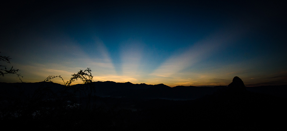
1
May 18, 2013
Posted by Ramon Fadli in Broadleaf Rainforests, Class 3, Day Hike, Hiking, IUCN Protected Category 2, Malaysia, Ridges, Selangor, Sunrise & Sunset, Tropical Rainforest